
Blog
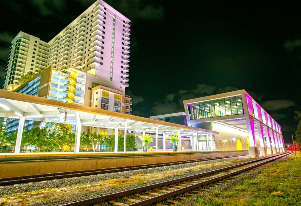
Project Spotlight: Flagler Station Groundbreaking Ceremony
On January 6, 2021, WGI participated in the groundbreaking ceremony for the highly anticipated Flagler Station project in Downtown West Palm Beach.
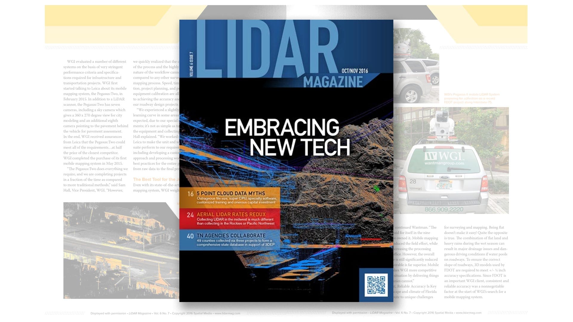
This article appeared in the Oct./Nov. 2016 issue of lidar Magazine. Click here to view the issue online.
by David Wantman and Sam Hall
The learning curve associated with adopting new technology can be a significant hurdle for many firms. Will the time and effort be worth it in the long term? If everything is going well, why introduce potential problems? These are fair questions to ask before purchasing a mobile mapping system. However, the alternative is continuing to do things the way they’ve always been done, and missing the chance to gain a competitive advantage by delivering more accurate, higher-quality data, faster than ever before.
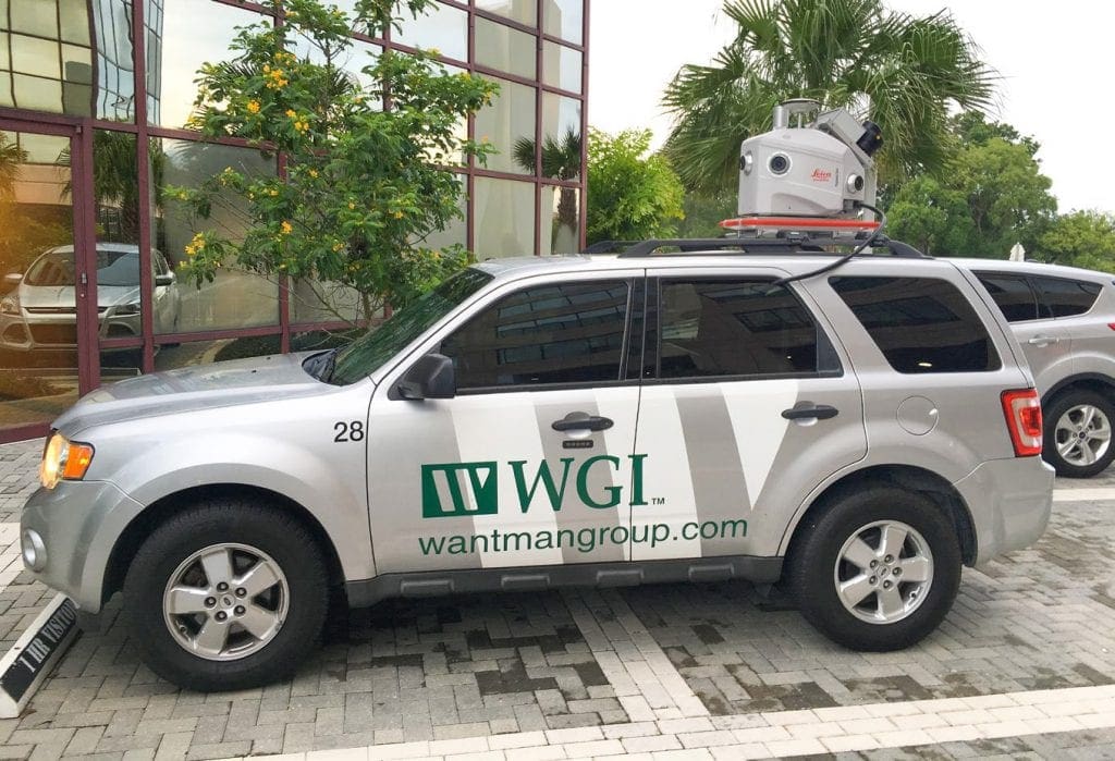
Wantman Group Inc. (WGI), one of the top three bid/design engineering firms in Florida with around 300 professionals on staff, started thinking about adding mobile mapping capabilities back in 2014. WGI has contributed to most of the major infrastructure and transportation projects in Florida in recent years. Founded in 1972 by Joel Wantman, the multi-generational organization continues to grow by emphasizing innovative solutions and excellent client service. Contributing to its success is a willingness to adopt new technology as it becomes available. Tools that enhance data quality and timeliness, such as a mobile mapping system, are integrated into existing processes to achieve the best results possible for clients.
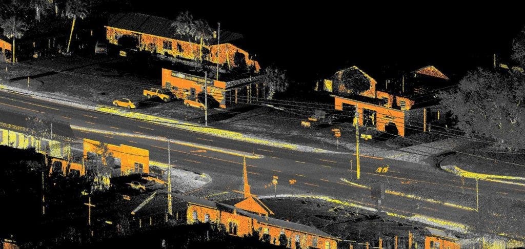
When the Florida Department of Transportation (FDOT) started to require deliverables that would support 3D design and 3D corridor modeling, the writing was on the wall. Terrestrial and mobile lidar are the best methods to collect data delivered in MicroStation for corridor modeling, 3D polylines, and 3D points. This motivated WGI to move forward with an investment in mobile mapping.
“Mobile mapping has only been around a few years, so we are just at the beginning of a significant transformation,” said David Wantman, President, WGI. “Owners and end users of a mobile lidar product haven’t yet completely realized the speed, accuracy, and totality of the deliverable. As they become educated, anything less than mobile mapping as the path to a final survey deliverable will not exist.”
“Our mobile mapping capability has attracted new clients and improved profitability,” continued Wantman. “The system has paid for itself in the nine months we’ve owned it. Mobile mapping has greatly reduced the field effort, while somewhat increasing the processing time in the office. However, the overall delivery time is still significantly reduced and the deliverable is far superior. Mobile mapping makes WGI more competitive in a bidding situation by delivering things other companies cannot.”
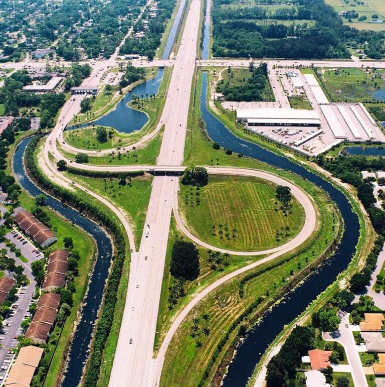
The landscape and climate of Florida both contribute to unique challenges for surveying and mapping. Being flat doesn’t make it easy! Quite the opposite is true. The combination of flat land and heavy rains during the wet season can result in major drainage issues and dangerous driving conditions if water pools on roadways. To ensure the correct slope of roadways, 3D models used by FDOT are required to meet +/- ¼ inch accuracy specifications. Since FDOT is an important WGI client, consistent and reliable accuracy was a non-negotiable factor at the start of WGI’s search for a mobile mapping system.
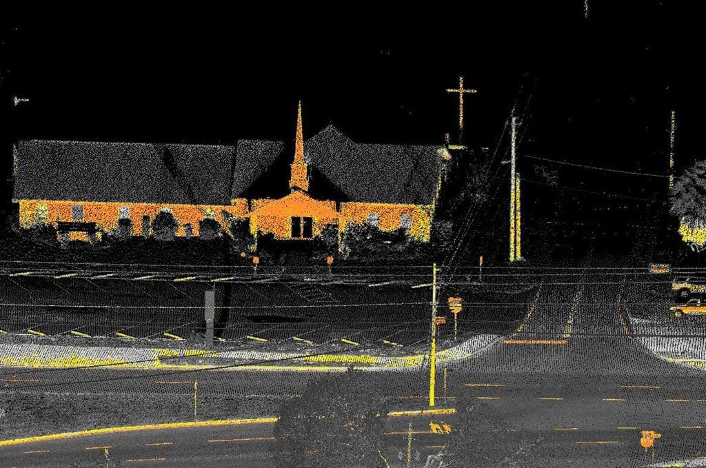
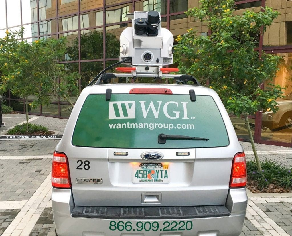
WGI evaluated a number of different systems on the basis of very stringent performance criteria and specifications required for infrastructure and transportation projects. WGI first started talking to Leica about its mobile mapping system, the Pegasus: Two, in February 2015. In addition to a lidar scanner, the Pegasus: Two has seven cameras, including a sky camera that gives a 360 x 270-degree view for city modeling and an additional eighth camera pointing to the pavement behind the vehicle for pavement assessment. In the end, WGI received assurances from Leica that the Pegasus: Two could meet all of the requirements…at half the price of the closest competitor. WGI completed the purchase of its first mobile mapping system in May 2015.
“The Pegasus: Two does everything we require, and we are completing projects in a fraction of the time as compared to more traditional methods,” said Sam Hall, Vice President, WGI. “However, we quickly realized that the complexity of the process and the highly technical nature of the workflow cannot be compared to any other surveying or mapping process. Speed, time, orientation, project planning, and proper equipment calibration are all essential to achieving the accuracy and precision our roadway design projects require.”
“We experienced a slightly steeper learning curve in some areas than expected, due to our special requirements; it’s not as simple as turning on the equipment and collecting positions,” Hall explained. “We worked closely with Leica to make the unit and software suite perform to our requirements, including developing a custom software approach and processing workflow with best practices for the entire process, from raw data to the final product.”
Even with its state-of-the-art mobile mapping system, WGI weighs its options for each project. Subcontracting for airborne lidar collections for large area projects, such as a recent survey of 110 square miles for South Florida Water Management, makes sense. General planning and analysis projects that do not require the highest accuracy are also suitable for airborne lidar, while any design or survey grade and linear project are most suitable for mobile mapping. WGI also operates two terrestrial Leica ScanStation laser scanners, used recently for a parking lot project at an airport.
In many other situations, however, mobile mapping is safer and less expensive than traditional methods of data collection. For example, low-altitude photogrammetry of a corridor conducted with a helicopter at 350 feet elevation isn’t feasible near airports or around tall buildings. This approach also requires appropriate weather windows, along with a helicopter and equipment costing over $1 million. In comparison, the equipment needed for terrestrial surveying on roadways is much less expensive but often requires traffic delays, puts people on the ground in a hazardous environment, and requires considerably more time in the field. When comparing cost, efficiency, and ease of use, mobile mapping is often the best choice, with the added benefits of enhanced safety, higher accuracy, and pavement imagery for the corridor included.

“We’ll use mobile mapping whenever possible because of the high accuracy and the time savings in the field,” said Hall. “Simultaneous collection of asset data contributes to our time savings. We currently are pursuing a complex multi-level interchange design/build project, and the downward-facing camera allowed us to inventory concrete pavement seams and provide a conditions assessment ahead of the bid. Having this information gives us an edge in that we’ll know exactly which segments of the project can be rehabilitated and which segments require replacement. The other teams will be guessing while we’ll have the exact cost going into selection.”
“In terms of asset management, we are required to provide an inventory of all newly constructed signs at the completion of our roadway projects,” Hall continued. “The Pegasus:Two allows us to automatically collect all sign locations in a matter of hours as opposed to days, and provide the required attribute data without physically visiting any of the signs. This capability reduces the effort associated with providing the GIS sign inventory by up to 80%.”
The biggest challenge WGI deals with is increasing pressure to reduce the time it takes to survey, map and design project areas. As the construction industry becomes more competitive and cost sensitive, contractors don’t want their equipment sitting idle. Delays cost money so the sooner they break ground, the better. However, if the design survey does not exactly match the actual landscape, the contractor can file a notice of delay and charge lost time back to FDOT. The accuracy of the Pegasus:Two system helps avoid delay claims based on design problems.
Another source of pressure to shorten the timelines of projects comes from the state itself. The governor is trying to generate jobs by committing large sums of money to transportation and major infrastructure projects. Preliminary project phases are being accelerated to get people working as quickly as possible.
Time saved in the field is a major selling point for mobile mapping. To put things in perspective, scanning a 5-mile corridor in Broward County required 60 days in the field and an additional 2 ½ months to receive the topo file using terrestrial surveying methods, while a 5-mile corridor in Miami-Dade County took six days to collect with the Pegasus:Two, with the topo file completed within two months, approximately a 50% time savings from project start to finish. The data collection effort is minimal and essentially free. With a full dataset in the office, if questions arise staff revisits the site virtually, without having to leave the office.
“Our experiences so far with high precision photogrammetric projects have been very positive,” Hall stated. “For the public sector, we’re producing 3D models for levee monitoring and maintenance, and deformation monitoring for plugs on Herbert Hoover Dike at Lake Okeechobee. With mobile mapping, we can map the dike in two hours as opposed to days manually.”
“Another interesting project involved designing a water main to replace wells in an affluent subdivision in West Palm Beach,” continued Hall. “It was important for us to scan quickly—because the plan was not popular with all of the homeowners—and we finished the survey in 45 minutes without anyone knowing we were there.”
As Florida’s population growth continues to rebound, capacity improvements have become a priority for maintaining safety and quality of life. According to the “Tom Tom Travel Index” published in 2015, three Florida cities—Miami, Tampa, and Orlando—rank in the top twenty US cities for traffic congestion. FDOT has recognized these issues and is pushing several significant capacity improvement projects forward, and requiring their design consultants to meet accelerated design delivery schedules. As a bid-design engineering firm, WGI works as a partner with building contractors, who are under increasing pressure to expedite projects.
In the past, it has typically taken two years from start to finish of the design phase, but mobile mapping can reduce the duration by as much as a year due to the fast data collection and processing times. Compressing a large-scale design survey from 250 field days to 70 field days allows the designer to achieve these incredibly aggressive schedules, which allows the owner to let the project for construction potentially years ahead of schedule and meet the demands of the traveling public.
In addition, being able to provide higher-quality data and very comprehensive information early in the proposal process allows more alternatives to be considered, which leads to smarter and more accurate designs and in many cases, proven cost savings. Design critical items like horizontal/vertical clearance can be provided within a week of data collection without sending anyone back to the site. Better designs and tighter quantities help keep the bid low and improve the chance of being selected.
Performance expectations for transportation and infrastructure projects are changing as the technology being used for surveying and mapping becomes increasingly sophisticated. There is no question that timelines are shorter and finer accuracy is required.
“Mobile mapping will cause as large a transformation in transportation and infrastructure mapping and surveying as GPS did 20 years ago,” said Wantman. “Those that embrace it will survive, while those that attempt to move forward without it will cease to exist. It will be impossible to be competitive without this technology.”
WGI is a national design and professional services firm leading in technology-based solutions for the construction of public infrastructure and real estate development. At WGI, we’re providing Tomorrow’s Infrastructure Solutions Today.
On January 6, 2021, WGI participated in the groundbreaking ceremony for the highly anticipated Flagler Station project in Downtown West Palm Beach.

This addition to the team solidifies WGI’s leadership in helping communities harness the benefits of emerging mobility options and smart/connected city technology.

Learn how WGI helped Pulte Homes convert an inactive portion of a golf course into a residential development, complete with a park and nature preserve.

Our rapidly changing communities face incredible pressures and challenges ranging from the environmental to the technological and beyond.
WGI’s CEO, David Wantman recently teamed up with the Acts 2 Worship Center Church and donated one of WGI’s geospatial trucks to help a family who was severely impacted by Hurricane Dorian start rebuilding their home.

WGI moves up 12 spots on the Engineering News-Record (ENR) 2021 Top 500 Design Firms List!
