WGI Icon_Green (1)
WGI Projects
Project Experience

Learn more about successful projects from some of our clients.

Plan Your Next Project!

Kick-start your next project with this quick step-by-step intake form.
About
WGI

WGI is a national design firm creatively transforming infrastructure and real estate through tech-driven services.

Our
Locations

You’ve seen our award-winning team, proven expertise, and industry authority. Now let’s make your next project a success.

Meet Our
Leadership Team

Our Executive Leadership Team and Practice Area Leaders bring decades of experience and client successes to your next project.

Our Practice Area Leadership

Our nationwide team of engineers, surveyors, planners, and architects offers
market-leading experience.

Firm Registrations

WGI holds nationwide registrations to perform engineering, surveying, architecture, and environmental science services.
WGI
Insights Blog

Our blog covers client interests like infrastructure, real estate, regulations, and smart, connected communities.

Whitepapers & Publications

Our whitepapers highlight our design experts' innovative insights and best practices for the AEC industry.

News &
Press Releases

Dedicated to your success, we invite you to subscribe to our newsletter for the latest news, case studies, and insights.

WGI
Media Room

Our passionate design professionals frequently share their expertise at webinars and virtual events.

Boyette Booster Station Survey

Client:
Tampa Bay Water
Market:
Water & Environment
Location:
Hillsborough County, Florida

Project Details

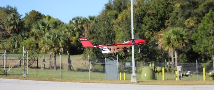
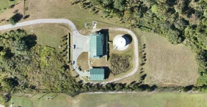
This Tampa Bay Water task order assignment is an 11.5-acre boundary and topographic as-built survey being completed utilizing a variety of modern survey technologies. RTK GPS was utilized for the site control and property documentation location. Digital leveling techniques were utilized for the vertical control and site benchmarks. For terrain modeling and planimetry, a combination of fixed-wing UAS (Unmanned Aerial Systems) and static LiDAR was employed in a data fusion process. Additionally, RTK techniques were being applied for any infill areas. This project was the first project for Tampa Bay Water utilizing an unmanned aerial system for mapping purposes, representing a shift in the way this agency will approach similar mapping projects in the future. As part of the QA/QC process for this project, comparisons were made between the static LiDAR-derived point cloud and the UAS-derived imagery-based point cloud. This enabled the technicians to use the best available data when creating the ground surface model and also allowed for QC of the 2D features for the developed portions of the project site. 

Project at a Glance

  • Boyette Booster Station Survey — image 1

Contact Our Team About Your Next Project.

At WGI, we creatively transform how our world is envisioned, designed, and experienced. Our expert team of professional engineers is ready to help.

Guided by Local Expertise