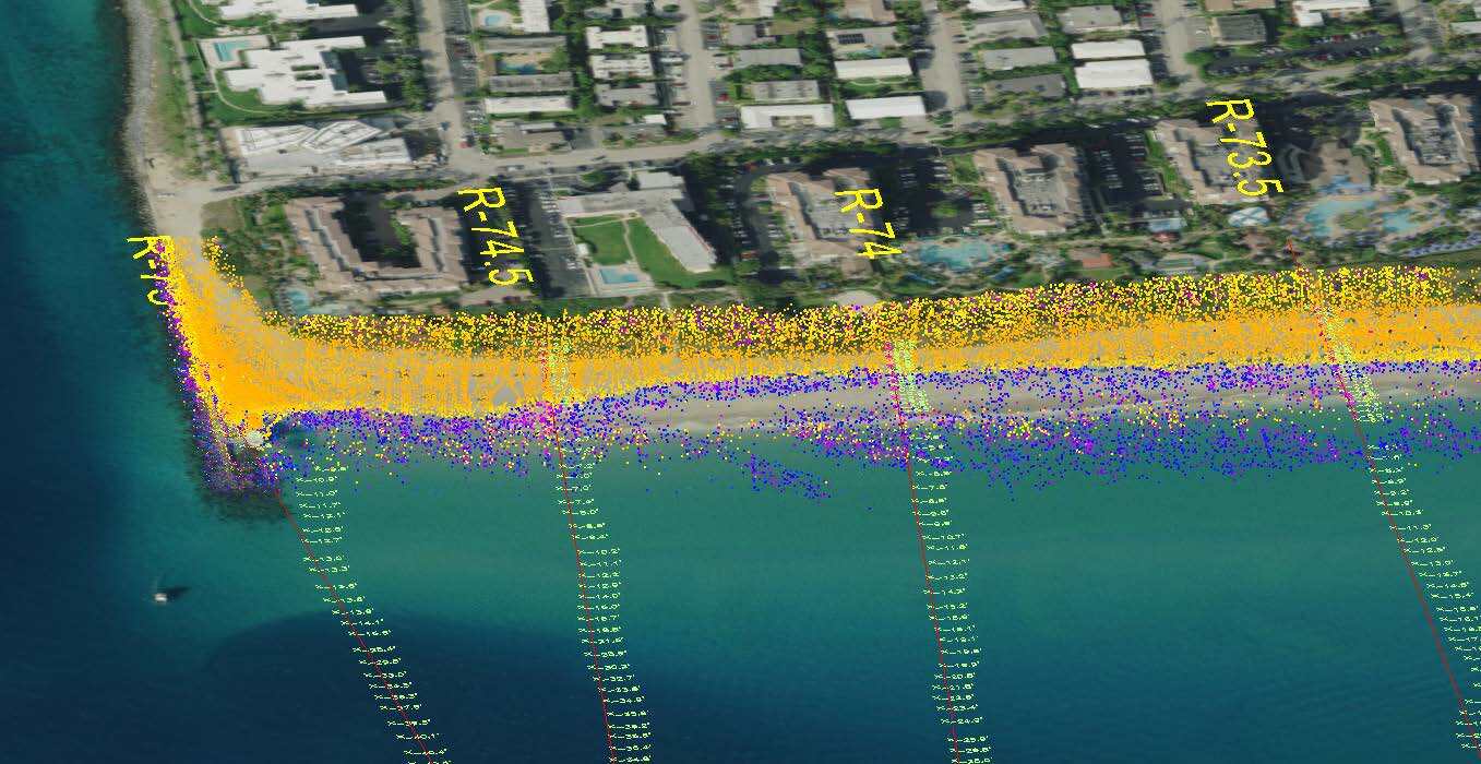
WGI provided annual topographic/hydrographic surveys for the Town of Palm Beach, of approximately 14 miles of beach shoreline. Surveys were performed from FDEP coastal range (R) monuments located in the upland dunes to approximately 3000 feet offshore. Upland data were collected utilizing RTK GPS survey methods. Offshore data was collected by a hydrographic survey vessel utilizing a single beam echo sounder coupled with RTK GPS and IMU for positioning. WGI also performed emergency pre and post topographic/hydrographic surveys before and after hurricane Dorian in 2019 to assess beach erosion and sand migration. In addition to the annual monitoring surveys, WGI provided semi-annual aerial imagery for beach and offshore reef monitoring. The imagery spans approximately 16 miles of shoreline to 4000 feet offshore, covering over 8000 acres, and is critical to the monitoring and analysis of the reef condition.
.png?width=185&height=175&name=WGI%20Icon_Green%20(1).png)


















 PORT ST. LUCIE