.png?width=185&height=175&name=WGI%20Icon_Green%20(1).png)



















Brooks Bridge was built in the mid-1960s to connect downtown Fort Walton Beach and Okaloosa Island. The bridge carries SR 30 (US 98) over Santa Rosa Sound which is part of the Gulf Coast Intracoastal Waterway. The bridge was built with a 50-year design life and no longer meets current design standards.
In 2015, the Florida Department of Transportation (FDOT) began a study to evaluate impacts for the replacement of the bridge. The study was completed in 2019, resulting in the determination that the replacement of the bridge would solve structural deficiencies, offer compliance with current Americans with Disabilities Act (ADA) requirements, and improve navigational clearance requirements.
[caption id="attachment_63806" align="aligncenter" width="1024"]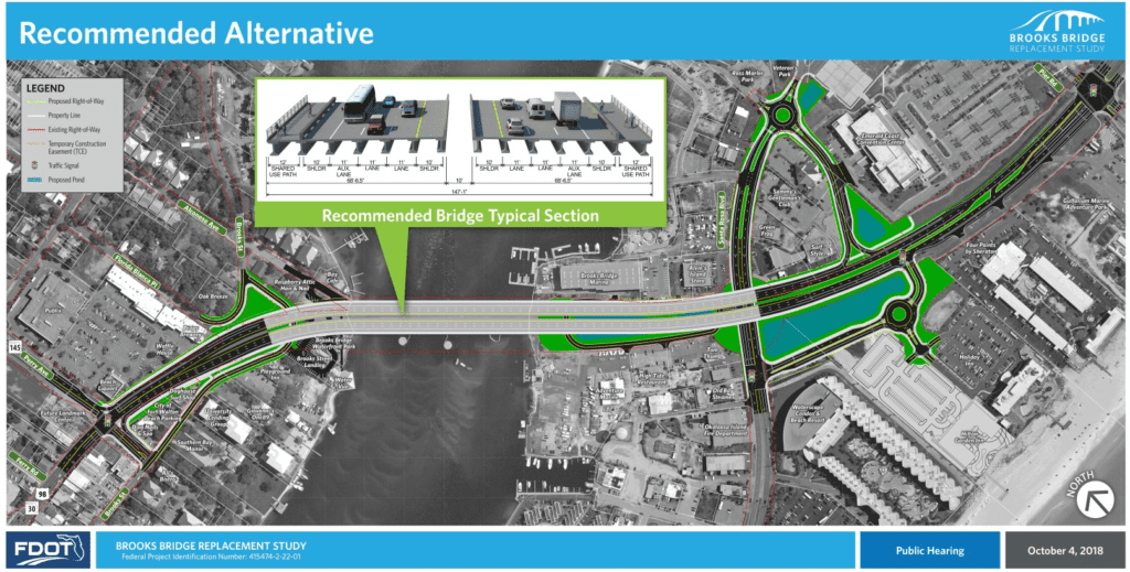 The new proposed Brooks Bridge across Santa Rosa Sound.[/caption]
 WGI Geospatial team member Shaun Herbert setting horizontal and vertical control for 3-D mapping.[/caption]
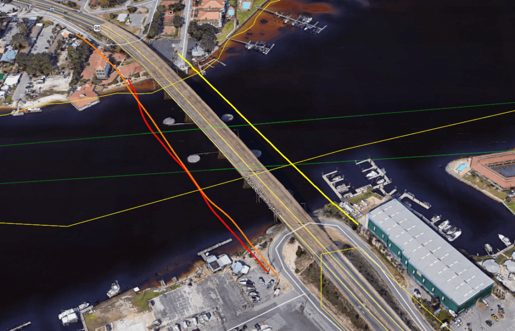 Red, yellow, and orange lines depict the WGI-detected positions of the utility lines under Santa Rosa Sound.[/caption]
 The new proposed Brooks Bridge across Santa Rosa Sound.[/caption]
A Team Effort
As part of a Continuing Services Contract with FDOT District 3, WGI was commissioned to detect and designate multiple submarine utility crossings under Santa Rosa Sound parallel to the existing Brooks Bridge. Subaqueous Subsurface Utility Engineering (SUE) projects are requested very infrequently. To accomplish this challenging assignment, our Tallahassee SUE/Geospatial team led by Rick Armond collaborated closely with Eddie Gaytan of our Chicago office to research, plan, coordinate, and execute the project. Extensive coordination with utility providers (including Okaloosa Gas District and Gulf Power Company) was required to gain access to conduit lines, and we teamed with CUES, Inc. (Community Utility Equipment Supply) for instrumentation and equipment rental and training. [caption id="attachment_63803" align="aligncenter" width="652"] WGI Geospatial team member Shaun Herbert setting horizontal and vertical control for 3-D mapping.[/caption]
A Successful Effort
WGI successfully mapped the submarine conduits by successive push-through observations. The team reviewed the position measurement data for repeatability and its observed spread (distance from average measurements). Using this methodology, WGI confidently generated individual plan profiles for each utility. [caption id="attachment_63807" align="aligncenter" width="1024"] Red, yellow, and orange lines depict the WGI-detected positions of the utility lines under Santa Rosa Sound.[/caption]