.png?width=185&height=175&name=WGI%20Icon_Green%20(1).png)



















The RIEGL VMX-2HA features a high-speed, high-performance dual scanner mobile lidar mapping system capable of producing 3.6 million measurements and 500 scan lines per second at highway speeds. This significant upgrade from our previous mobile lidar systems now allows WGI's Geospatial Team to collect and provide denser, more accurate, and feature-rich data for our clients.
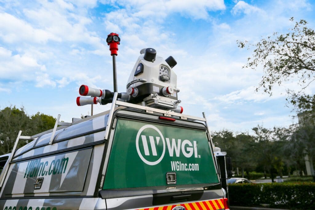 This powerful technology comprises two RIEGL VUX-1HA22 high accuracy lidar sensors and a high-performance INS/GNSS unit, housed in an aerodynamically shaped protective cover.
 The camera interface houses up to nine optional cameras and complements the lidar data with precisely geo-referenced images.
Camera System + Features
The VMX-2HA impresses with an extremely enhanced camera performance and a number of new features.
The camera interface houses up to nine optional cameras and complements the lidar data with precisely geo-referenced images.
Camera System + Features
The VMX-2HA impresses with an extremely enhanced camera performance and a number of new features.
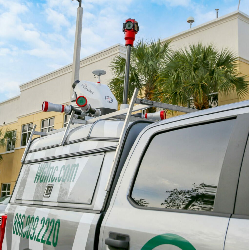 The camera interface and SYNC of up to nine external devices are included in the basic system configuration. Multiple high-resolution RIEGL cameras allow for unique capture angles and a high degree of detail in the images.
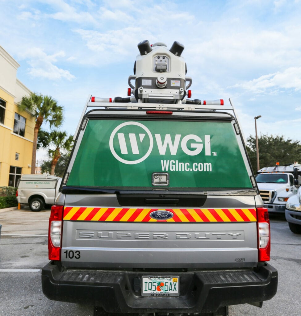 The VMX-CU (equipped with a high-performance 7th generation Intel Core i7 processor) precisely controls the management of power, data acquisition, and operation of the laser scanners, INS/GNSS sensors, and optional cameras.
The modular design of the system provides unique flexibility to meet a diversity of project requirements. Ready to be mounted to on-road and off-road vehicles, as well as on trains and boats, it provides our Geospatial Team with the technology and tools to ensure full data capturing for transportation infrastructure, facades, overhead structures, power lines, bridges, tunnels, etc.
Check out the video below for a glimpse of the vehicle-mounted RIEGL VMX-2HA:
[embed]https://youtu.be/ld3U98J-YC0[/embed]
WGI has been a consistent leader when it comes to utilizing the latest technology and did not hesitate when the opportunity arose to equip our Geospatial Experts with a new piece of tech as powerful as the RIEGL VMX-2HA.
If you are searching for higher-quality data, collected more safely, in less time, and often at a lower cost, then contact our experts today.
The VMX-CU (equipped with a high-performance 7th generation Intel Core i7 processor) precisely controls the management of power, data acquisition, and operation of the laser scanners, INS/GNSS sensors, and optional cameras.
The modular design of the system provides unique flexibility to meet a diversity of project requirements. Ready to be mounted to on-road and off-road vehicles, as well as on trains and boats, it provides our Geospatial Team with the technology and tools to ensure full data capturing for transportation infrastructure, facades, overhead structures, power lines, bridges, tunnels, etc.
Check out the video below for a glimpse of the vehicle-mounted RIEGL VMX-2HA:
[embed]https://youtu.be/ld3U98J-YC0[/embed]
WGI has been a consistent leader when it comes to utilizing the latest technology and did not hesitate when the opportunity arose to equip our Geospatial Experts with a new piece of tech as powerful as the RIEGL VMX-2HA.
If you are searching for higher-quality data, collected more safely, in less time, and often at a lower cost, then contact our experts today.
 This powerful technology comprises two RIEGL VUX-1HA22 high accuracy lidar sensors and a high-performance INS/GNSS unit, housed in an aerodynamically shaped protective cover.
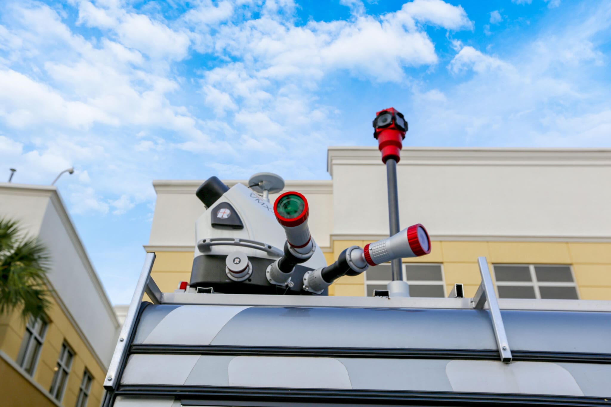 The camera interface houses up to nine optional cameras and complements the lidar data with precisely geo-referenced images.
Camera System + Features
The VMX-2HA impresses with an extremely enhanced camera performance and a number of new features.
The camera interface houses up to nine optional cameras and complements the lidar data with precisely geo-referenced images.
Camera System + Features
The VMX-2HA impresses with an extremely enhanced camera performance and a number of new features.
 The camera interface and SYNC of up to nine external devices are included in the basic system configuration. Multiple high-resolution RIEGL cameras allow for unique capture angles and a high degree of detail in the images.
 The VMX-CU (equipped with a high-performance 7th generation Intel Core i7 processor) precisely controls the management of power, data acquisition, and operation of the laser scanners, INS/GNSS sensors, and optional cameras.
The modular design of the system provides unique flexibility to meet a diversity of project requirements. Ready to be mounted to on-road and off-road vehicles, as well as on trains and boats, it provides our Geospatial Team with the technology and tools to ensure full data capturing for transportation infrastructure, facades, overhead structures, power lines, bridges, tunnels, etc.
Check out the video below for a glimpse of the vehicle-mounted RIEGL VMX-2HA:
[embed]https://youtu.be/ld3U98J-YC0[/embed]
WGI has been a consistent leader when it comes to utilizing the latest technology and did not hesitate when the opportunity arose to equip our Geospatial Experts with a new piece of tech as powerful as the RIEGL VMX-2HA.
If you are searching for higher-quality data, collected more safely, in less time, and often at a lower cost, then contact our experts today.
The VMX-CU (equipped with a high-performance 7th generation Intel Core i7 processor) precisely controls the management of power, data acquisition, and operation of the laser scanners, INS/GNSS sensors, and optional cameras.
The modular design of the system provides unique flexibility to meet a diversity of project requirements. Ready to be mounted to on-road and off-road vehicles, as well as on trains and boats, it provides our Geospatial Team with the technology and tools to ensure full data capturing for transportation infrastructure, facades, overhead structures, power lines, bridges, tunnels, etc.
Check out the video below for a glimpse of the vehicle-mounted RIEGL VMX-2HA:
[embed]https://youtu.be/ld3U98J-YC0[/embed]
WGI has been a consistent leader when it comes to utilizing the latest technology and did not hesitate when the opportunity arose to equip our Geospatial Experts with a new piece of tech as powerful as the RIEGL VMX-2HA.
If you are searching for higher-quality data, collected more safely, in less time, and often at a lower cost, then contact our experts today.