WGI Icon_Green (1)
WGI Projects
Project Experience

Learn more about successful projects from some of our clients.

Plan Your Next Project!

Kick-start your next project with this quick step-by-step intake form.
About
WGI

WGI is a national design firm creatively transforming infrastructure and real estate through tech-driven services.

Our
Locations

You’ve seen our award-winning team, proven expertise, and industry authority. Now let’s make your next project a success.

Meet Our
Leadership Team

Our Executive Leadership Team and Practice Area Leaders bring decades of experience and client successes to your next project.

Our Practice Area Leadership

Our nationwide team of engineers, surveyors, planners, and architects offers
market-leading experience.

Firm Registrations

WGI holds nationwide registrations to perform engineering, surveying, architecture, and environmental science services.
WGI
Insights Blog

Our blog covers client interests like infrastructure, real estate, regulations, and smart, connected communities.

Whitepapers & Publications

Our whitepapers highlight our design experts' innovative insights and best practices for the AEC industry.

News &
Press Releases

Dedicated to your success, we invite you to subscribe to our newsletter for the latest news, case studies, and insights.

WGI
Media Room

Our passionate design professionals frequently share their expertise at webinars and virtual events.

Valencia Pointe Clubhouse

Client:
Decorators Unlimited
Market:
Development, Residential
Location:
Palm Beach County, FL

Project Details

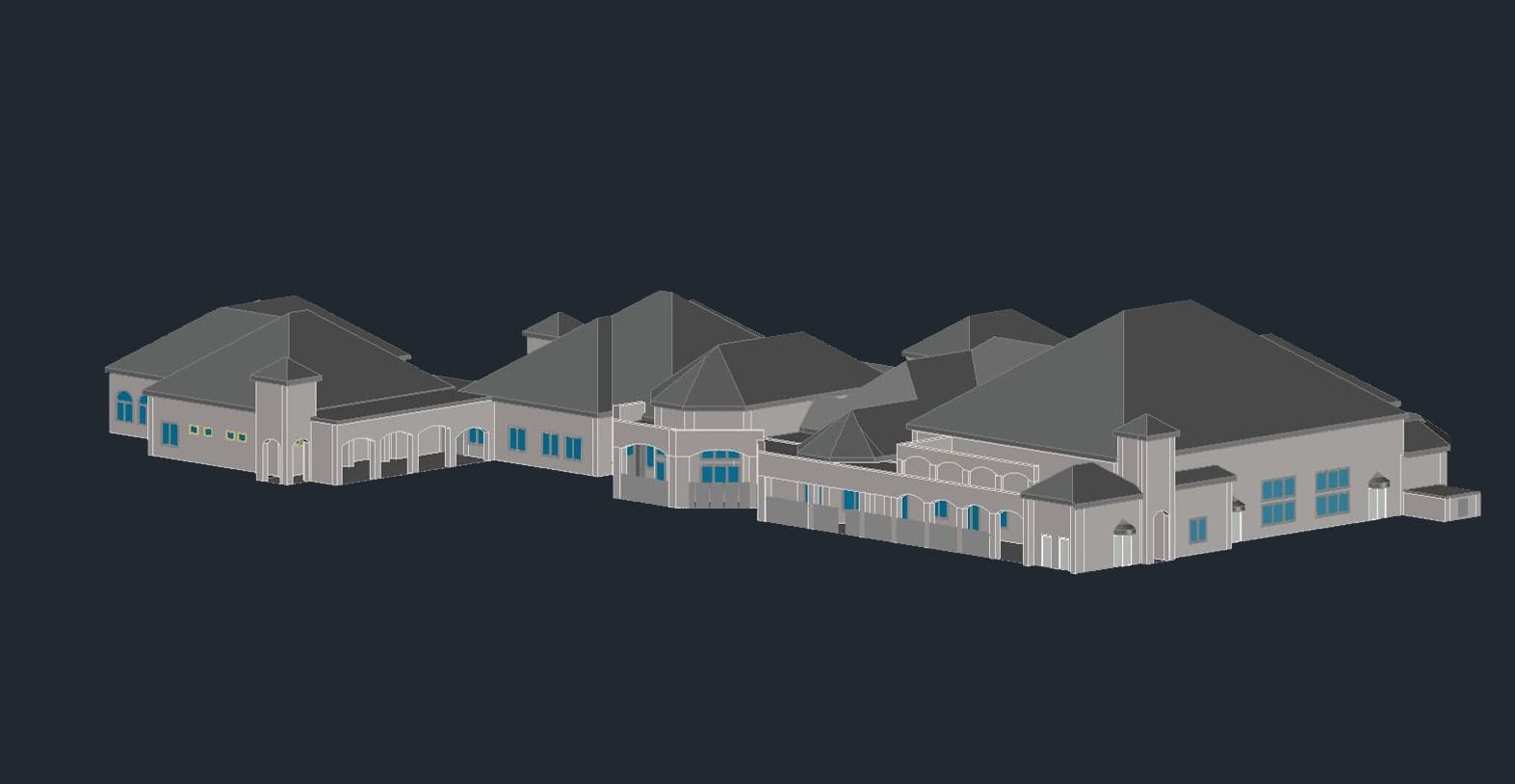
WGI provided an ALTA/NSPS Land Title Survey for 6.74 acres, including a floor plan and 3D model of the Clubhouse at Valencia Pointe in Boynton Beach, Florida. WGI’s Geospatial Division performed all fieldwork in a single day by locating and setting all 14 property corners, mapping all fixed improvements plus parking counts, and mapping the existing clubhouse’s interior. This was possible using technology by having one crew collect boundary evidence using GPS while another crew utilized mobile LiDAR to map the improvements.

WGI’s scanning division used the Leica Pegasus 2 mobile LiDAR unit to drive all accessible areas, such as roads and parking lots and switched to the Leica Pegasus Backpack to locate the remaining areas. The wearable backpack was walked through every outdoor space, including tennis courts, green spaces, obscured areas, pool deck, and the clubhouse’s interior. Each mobile LiDAR unit collected millions of points per second to capture these features in record time.

The survey data, improvements, features, and walls were then extracted in the office using multiple software platforms to meet the client’s needs. The improvements were shown on the ALTA survey as required. The building floorplan was shown as an AutoCAD ReCAP file. The Clubhouse model was shown as a REVIT deliverable for future designs and BIM integration.

Contact Our Team About Your Next Project.

At WGI, we creatively transform how our world is envisioned, designed, and experienced. Our expert team of professional engineers is ready to help.