.png?width=185&height=175&name=WGI%20Icon_Green%20(1).png)



















WGI’s commitment to transforming how our world is envisioned, designed, and experienced is on display yet again through our Geospatial Divisions' utilization of a combination of cutting-edge lidar and sonar detection technology, photogrammetry, modeling, visualization, and design tools!
WGI's Mobile Lidar Expert, Christian Stewart, recently conducted data-gathering expeditions for several projects, fusing lidar & multibeam sonar technologies. Working alongside Coty Granger, a Project Manager for Hydrographic Surveying, our team hit the ground running, gathering data with the use of combined sensors.
 Notoriously known for its inaccessibility, North Jetty of Sebastian Inlet, FL, required the use of a self-registering static lidar system. Leveraging that device to collect high-resolution lidar & well-defined imagery, our team produced scans in under 3 minutes. The speed and thoroughness of the device allowed WGI's Geospatial experts to effortlessly capture North Jetty's erosion areas during low tide, a feat which was previously near-impossible to reach.

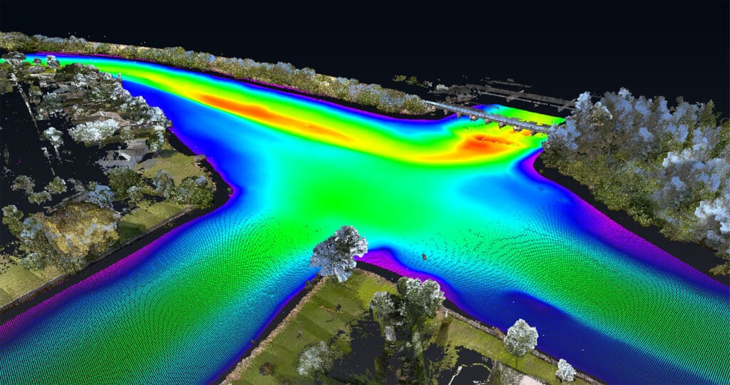 Meanwhile, at the C51 Canal Sediment Trap, Christian & Coty utilized multibeam and side-scan sonar in order to capture precision data sets. Alongside a mobile lidar system and a 72 MP Spherical Camera, the sensor combination enabled the capturing of exact topographic details both above & below the water, including high-resolution imagery of the project site.
Sebastian Inlet North Jetty

C51 Canal Sediment Trap

