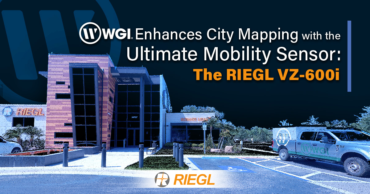
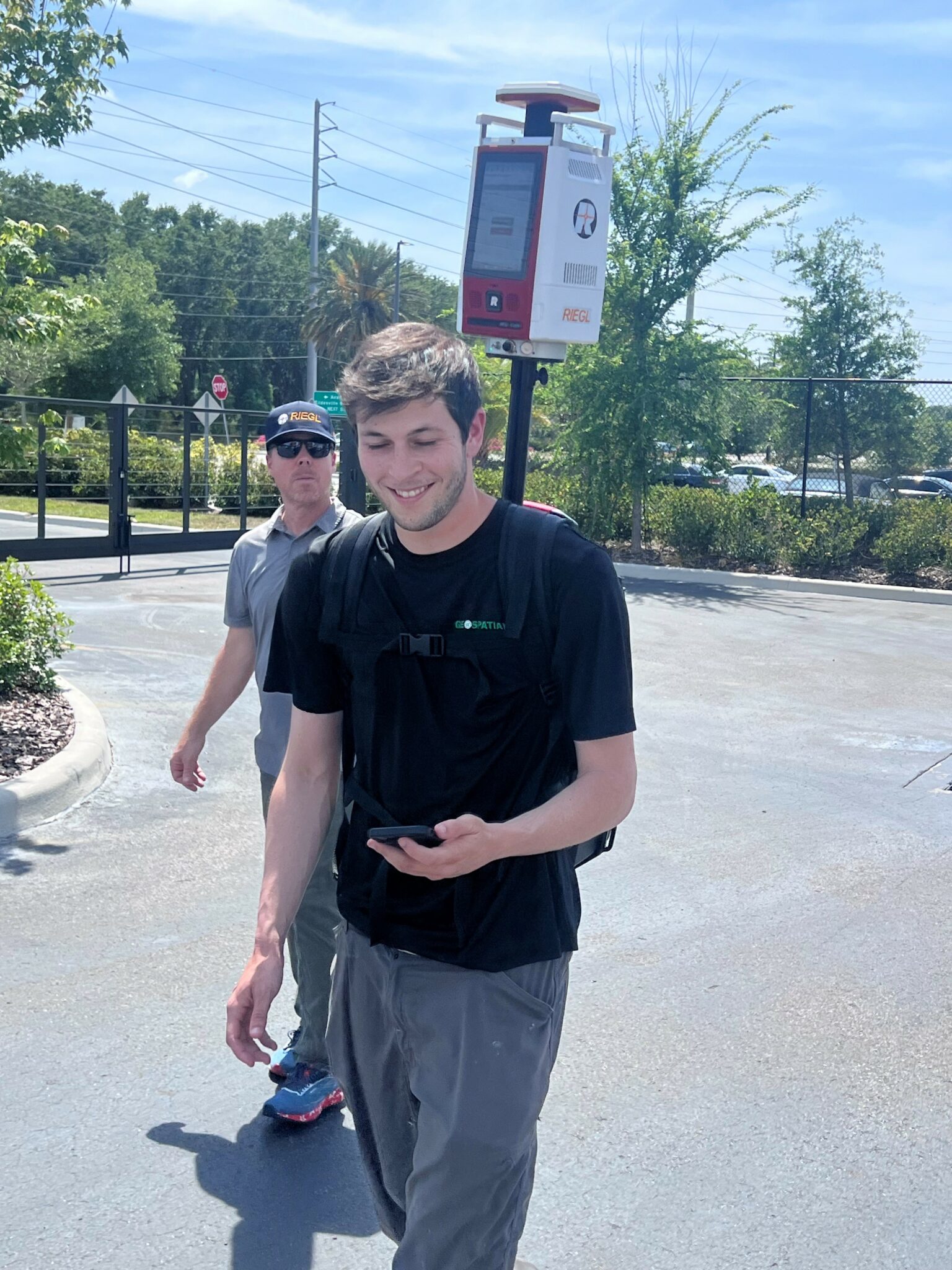
WGI captured data with the RIEGL VZ-600i and processed it with RiPANO during their training at the RIEGL USA Headquarters.
WGI, a leading national design and professional services firm headquartered in West Palm Beach, FL, finalized training at RIEGL USA and took delivery of the cutting-edge RIEGL VZ-600i. WGI plans to deploy the VZ-600i across several multi-platform collection projects, leveraging its advanced capabilities to map areas inaccessible by vehicle.
WGI has been closely monitoring the rollout of the VZ-600i since its launch, and the new kinematic mode for the VZ-i series scanners was a decisive factor in their acquisition. The alignment of quick delivery and an available training slot facilitated the seamless integration of the VZ-600i into WGI’s operations. The two-day training covered both static tripod scanning and kinematic mode collection, ensuring the team became proficient in utilizing the sensor’s full range of capabilities. The training concluded with an emphasis on post-processing and data publishing options. RIEGL’s RiPANO tool was highlighted as an excellent resource for sharing data with clients and internal teams.
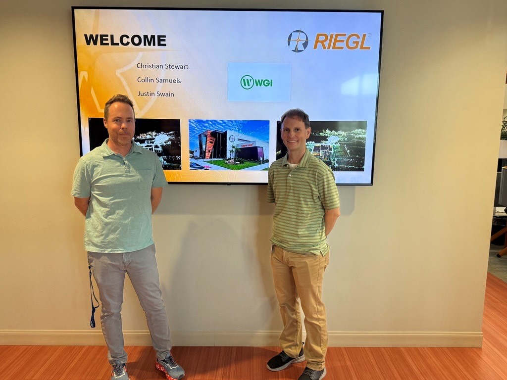
Christian Stewart, a lead in WGI’s Geospatial Technologies team, shared his experience:
“After attending the comprehensive two-day training program with Malcolm Greenlee and Josh France of RIEGL USA, I am truly excited about incorporating the RIEGL VZ-600i and its broad range capability, rapid data acquisition, and real-time on-board automatic registration into WGI’s many upcoming multi-platform lidar projects. Our team quickly became proficient with both static and kinematic data collection workflows. I am excited to have such a compact, accurate, and versatile sensor that can transition from static to mobile as quickly as one can unlock the mounting bracket. The ability to merge this data with any of our adjoining RIEGL VMX and VMY datasets gives me a lot of options to adapt collection workflows in challenging environments. I anticipate that this sensor will exceed expectations and provide an excellent return on investment.”
Continued investment and Looking Ahead
Since 2021, WGI has invested in a RIEGL VMX-2HA and two RIEGL VMY-2 systems. These systems have been deployed on a statewide collection in Florida, covering thousands of miles for telecoms and various Departments of Transportation across the country.
Josh France, RIEGL USA Division Manager of Mobile & Terrestrial Laser Scanning, commented on WGI’s ongoing investment in RIEGL sensors:
“I always look forward to helping our clients and working with them to find innovative uses for our systems and scanners. The real reward is when they keep returning to acquire additional systems because of their success. I am excited to help them realize their multi-platform data merging ambitions.”
With the addition of the RIEGL VZ-600i, WGI is poised to enhance its city mapping capabilities, delivering precise and comprehensive data collection even in challenging environments. This investment underscores WGI’s commitment to leveraging cutting-edge technology to meet the evolving needs of their clients. As WGI continues to integrate advanced RIEGL systems into their operations, they are set to achieve new heights in geospatial data accuracy and efficiency.
ABOUT WGI
As a multidisciplinary consulting firm, WGI has 25 offices in eight states and serves an active client base in over 49 states. WGI specializes in roadway engineering, structural engineering, environmental sciences, water resources, geospatial services, land surveying, subsurface utility engineering, land development, municipal engineering, mobility planning, parking solutions, building restoration, landscape architecture, architecture, land planning, and MEP engineering. In 2024, ENR ranked WGI #171 on its list of the Top 500 Design Firms in the United States. ENR Magazine also named WGI its 2021 Design Firm of the Year in the southeast United States. For more information, please visit www.wginc.com.
About RIEGL:
RIEGL is an international leading provider of cutting-edge technology in airborne, mobile, terrestrial, industrial and UAV-based laser scanning solutions for applications in surveying.
RIEGL has been producing LiDAR systems commercially for over 40 years and focuses on pulsed time-of-flight laser radar technology in multiple wavelengths.
RIEGL’s core smart-waveform technologies provide pure digital LiDAR signal processing, unique methodologies for resolving range ambiguities, multiple targets per laser shots, optimum distribution of measurements, calibrated amplitudes and reflectance estimates, as well as the seamless integration and calibration of systems.
RIEGL’s Ultimate LiDARTM 3D scanners offer a wide array of performance characteristics and serve as a platform for continuing Innovation in 3D for the LiDAR industry.
From the first inquiry, to purchase and integration of the system, as well as training and support, RIEGL maintains an outstanding history of reliability and support to their customers.
Worldwide sales, training, support and services are delivered from RIEGL’s headquarters in Austria and in the USA; main offices in Japan, China, Hong Kong, Australia, Canada, UK, South America, Germany, and France; and a worldwide network of representatives.
To access the original article, please click here