
A New Look for the New Year
We’re refreshing our brand to reflect the energy, inspiration, and excitement that we feel when we come to work every day.
Learn from award-winning professionals — explore our whitepapers, blogs, and the latest industry updates.
Join our dynamic organization of engineers, land surveyors, landscape architects, environmental scientists, and architects!
Talk to a market leader today! We’ll answer any questions you have about our professional services.
Many factors contributing to the design and analysis of stormwater infrastructure and detention have been updated this year to include: detention rates, drainage determination, and floodplain mitigation, which have been a result of new NOAA Atlas 14 Precipitation-Frequency Data (Link to NOAA Precipitation Frequency Data).
These changes are effective immediately and will result in an increased detention pond volume and underground storm infrastructure. A summary of these changes are illustrated below:
Detention Rates
Harris County
Outfall Location/Method*:
*Reference Section 6.03.1.2 of the Harris County Design Manual
City of Houston
Tract Size**:
**Reference Section 9.2.01.H of the City of Houston IDM
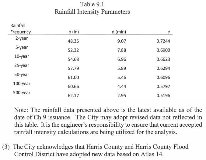
Storm Infrastructure Sizing – is based on the updated Atlas 14 rainfall data. Reference Table 9.1 in the City of Houston IDM.
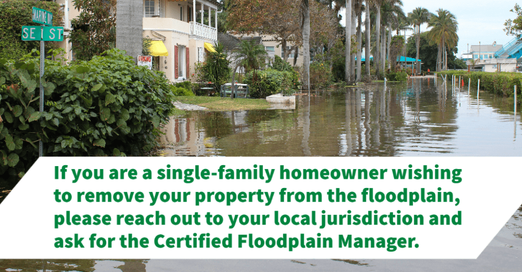
Floodplain Mitigation
Although Floodplain mitigation/regulations have not been updated since January 2018 (Harris County) and September 2018 (City of Houston), the impacts are significant and costly.
City of Houston
The effective areas include both the 100 and 500-year floodplain and yield zero net fill across the site. Zero net fill can result in structures being on an elevated foundation with crawl space or piers and additional detention volume or cut throughout the site. Foundations within the 500-year floodplain must be a minimum of two feet greater than the floodplain elevation.
Harris County
Fill may not be utilized in elevating structures, rather open foundations/piers are allowed in the 100 and 500-year floodplain. Minimum finished floor elevations (FFE) for the 100-year are 2’ about BFE and 1’ above BFE for the 500-year (Shaded Zone X only). Zones other than Shaded Zone X generally have greater restrictions for minimum FFE elevations. Like the City of Houston, Zero Net Fill is required within the 500-year floodplain.
WGI is a national design and professional services firm leading in technology-based solutions for the construction of public infrastructure and real estate development. At WGI, we’re providing Tomorrow’s Infrastructure Solutions Today.
We’re refreshing our brand to reflect the energy, inspiration, and excitement that we feel when we come to work every day.
There are new requirements for Houston, TX that will greatly impact detention rates for sites of all sizes. Learn how these changes could affect your upcoming projects.
Melissa’s addition to the team solidifies WGI’s leadership in helping communities harness the benefits of much-needed infrastructure projects throughout the nation.
Take a walk (and dive 🤿) with Amanda Montgomery as she gives us a glimpse into what a day in the life of an Environmental Scientist looks like at WGI.
ENR editors have recognized WGI as the 2021 Southeast Design Firm of the Year!
Fall 2017 was a devastatingly tragic period for many Texans as Hurricane Harvey produced record rainfalls and flooding throughout vast portions of south Texas.
You’ve been searching for a place like WGI. We look forward to meeting you soon.
Sign up to receive emails to hear our latest news and achievements in our monthly newsletter.
Enter your zip code, and we’ll personalize your experience with local projects, office locations, team members, and more.
WGI supports its associates with meaningful opportunities for growth, strong benefits and perks, while we work collaboratively with clients and co-consultants to shape and improve communities.
WGI is a dynamic organization with opportunities nationwide for engineers, land surveyors, landscape architects, environmental scientists, and architects.