Next Level Data Collection: WGI’s Geospatial Team Combines Technologies to Capture Data
WGI’s geospatial team recently utilized vehicle-mounted mobile lidar, boat-based lidar, and sonar to collect data for the partial rehabilitation of a bridge.
Learn from award-winning professionals — explore our whitepapers, blogs, and the latest industry updates.
Join our dynamic organization of engineers, land surveyors, landscape architects, environmental scientists, and architects!
Talk to a market leader today! We’ll answer any questions you have about our professional services.
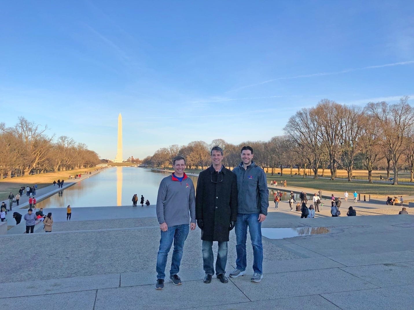
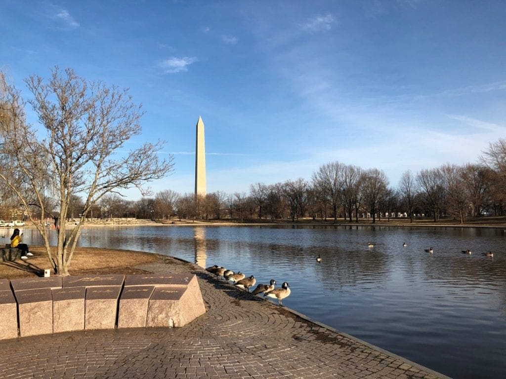
WGI Associates Bob Hanson, Eric Mathews, and Jim Sullivan attended the MAPPS 2019 Federal Programs Conference and Capitol Hill Day in Alexandria, VA. While attending the conference they had the opportunity to sightsee at some of Capitol Hill’s well-known monuments.
The MAPPS Federal Programs Conference features education sessions, briefings by federal agencies on programs, budgets and requirements for geospatial data, products and services, a day on Capitol Hill advocating before Congress on policies that serve the Nation and benefit geospatial firms, and more.
Bob, Eric, and Jim had the honor of meeting with staff from Senator Marco Rubio, Representative Brian Mast, Representative Vern Buchanan, and Senator Rick Scott’s offices for the specific support and funding for the 3D Elevation Program (3DEP), Digital Coast Act, and the National Agriculture Imagery Program (NAIP).
MAPPS is the only national mapping organization to hold an annual Washington, DC conference featuring specific information on legislation about policies and programs that impact federal contracting opportunities and make the voice of private practice surveying & mapping heard in the halls of Congress.
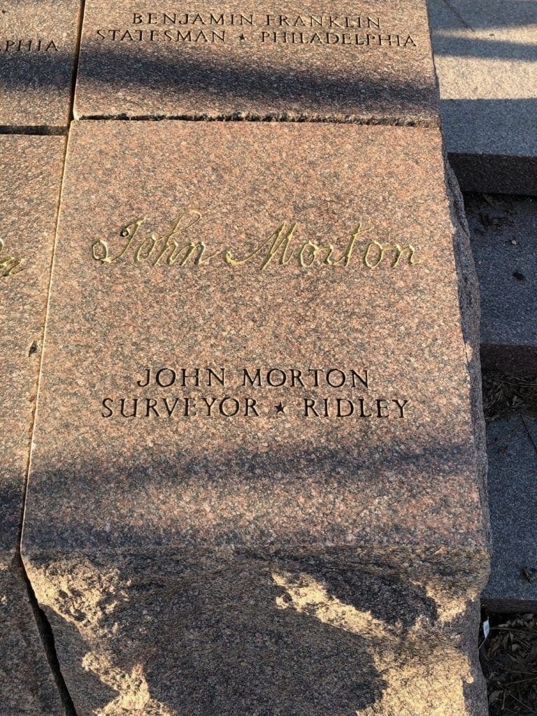
Many of the signatures shown on the Declaration of Independence were surveyors at one point in their lives, although John Morton is the only signature declaring himself as a surveyor. He provided the swing vote that allowed Pennsylvania to vote in favor of the United States Declaration of Independence.
WGI is a national design and professional services firm leading in technology-based solutions for the construction of public infrastructure and real estate development. At WGI, we’re providing Tomorrow’s Infrastructure Solutions Today.
WGI’s geospatial team recently utilized vehicle-mounted mobile lidar, boat-based lidar, and sonar to collect data for the partial rehabilitation of a bridge.
WGI associates participated in an internal contest to pitch innovative ideas to improve the company, their work product, and the built environment.
WGI moves up 37 spots on Engineering News-Record (ENR)’s 2020 Top 500 Design Firms List.
WGI makes a very significant 41-spot jump from last year’s Hot Firm ranking of #76.
Learn how to gain reliable underground utility location information and reduce costly delays due to conflicts or damages.
Melissa’s addition to the team solidifies WGI’s leadership in helping communities harness the benefits of much-needed infrastructure projects throughout the nation.
You’ve been searching for a place like WGI. We look forward to meeting you soon.
Sign up to receive emails to hear our latest news and achievements in our monthly newsletter.
Enter your zip code, and we’ll personalize your experience with local projects, office locations, team members, and more.
WGI supports its associates with meaningful opportunities for growth, strong benefits and perks, while we work collaboratively with clients and co-consultants to shape and improve communities.
WGI is a dynamic organization with opportunities nationwide for engineers, land surveyors, landscape architects, environmental scientists, and architects.