For WGI, a leading engineering and design firm in the United States, commitment to delivering precise data and reliable surveying – regardless of location or conditions – is paramount. Such dedication gives WGI the freedom to serve clients across both public and private sectors anywhere, anytime, and under any circumstances.
Expecting the unexpected in the field is a key part of a surveyor’s role. Confronting the difficult terrains, facing hardware failures, or experiencing connectivity issues on the job site can trigger a cascade of complications, potentially bringing an entire project to a grinding halt. This imperative – navigating potential obstacles – propelled WGI to equip itself with the appropriate GNSS tools and expertise to handle any task that arises. By ensuring its surveyors are prepared, WGI contributes to its customers’ ability to complete projects safely, efficiently, and on budget.
Capturing Reliable Survey Data in all Areas is Essential
As a leader in providing technology-based solutions for the construction of public infrastructure and real estate development, WGI dispatches its surveyors across the country on a wide range of projects, including vast geographical expanses, remote job sites, or areas that lack basic infrastructure. Surveyors face a wide range of challenges and different environments daily – it’s the job.
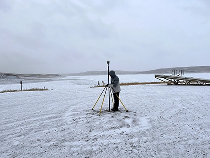
Operating in an area with limited to no cell coverage often leads to utilizing methods of data collection that take significantly more time, such as static GNSS missions or setting up a base station at an NGS control point that is inconveniently far from the site. Likewise, when traveling to locations outside of VRS coverage areas, one has to keep track of a myriad of local real-time networks. Many third-party RTNs also don’t offer full-constellation support, which impacts satellite availability and makes getting precise measurements more difficult.
Knowing that companies in the public and private sectors responsible for the design and construction of mega-projects – from infrastructure to real estate to industrial developments – rely on solid partners, WGI needs to deliver accurate land surveying data consistently and on every job. This led WGI to explore the opportunity to integrate Trimble® CenterPoint® RTX correction service into its arsenal of surveying tools.
With CenterPoint RTX, we were able to streamline our operations and in turn had greater efficiency in completing this particular survey.
The Importance of Having Access to the Right Tool for Every Job
While Trimble’s VRS Now™ correction service ensures consistent uptime and accurate measurements, unfortunately, it does not exist everywhere. WGI was exploring its options around how to complement its GNSS workflows and improve its surveying toolkit for greater productivity in the field. Following a recommendation from trusted partner Duncan Parnell and within a day of trialing the product, Roberto Mantecon, senior operations manager at WGI, realized that Trimble CenterPoint RTX could expand WGI’s operational reach beyond VRS-network footprints and enhance the efficiency of their land surveying capabilities.
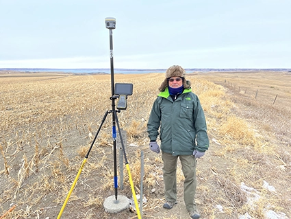
“I decided to try CenterPoint RTX and took it to areas without cell coverage. It lit up immediately and exceeded the precision we had been able to obtain previously. We checked 40-50 NGS benchmarks and had consistent 2 cm accuracy on the vertical,” he says. Because of how quickly CenterPoint RTX converged to a precise position, Mantecon was able to cover 200-300 miles in one day – a 30% increase in miles covered per day. “With CenterPoint RTX, we were able to streamline our operations and in turn had greater efficiency in completing
this particular survey.”“This Trimble RTX system rocks,” Mantecon says, adding that it can address any challenge so his teams in the field don’t have to worry about a local base, local datum or finding a local RTN. “Trimble RTX delivers highly consistent results.”
Power of Confidence When Having a Full Array of Tools to Get the Job Done
Mantecon and his team have been leveraging VRS workflows to capture location data using Trimble’s RTK network for 15 years, but the addition of real-time CenterPoint RTX service allowed WGI to have two corrections work in concert and deliver a true advantage in the field. “In the remote areas where we are working, it would take significantly longer to get accurate measurements. With CenterPoint RTX, we can capture the data within 3 minutes. Static operations would have taken at least 15 minutes per location.”
The expanded toolkit isn’t just making the customers happy, Mantecon adds. “The field guys love using CenterPoint RTX – it’s very versatile and with one receiver, they can multitask. This was the immediate answer to what they were looking for.” Not only are customers and field staff impressed, but the reliable accuracy and efficiency gains have paid for the cost of the subscription many times over.
To access the original article, please click here