WGI is continuing to grow its geospatial and land surveying capabilities, bringing licensed land surveying, LiDAR, photogrammetry, hydrographic surveying, and integrated geospatial solutions to clients wherever and whenever projects require. North Carolina is the latest milestone in this expansion, building on our presence in Charlotte and Raleigh while strengthening our ability to support transportation, utility, and infrastructure projects statewide.
Advanced Geospatial Technology
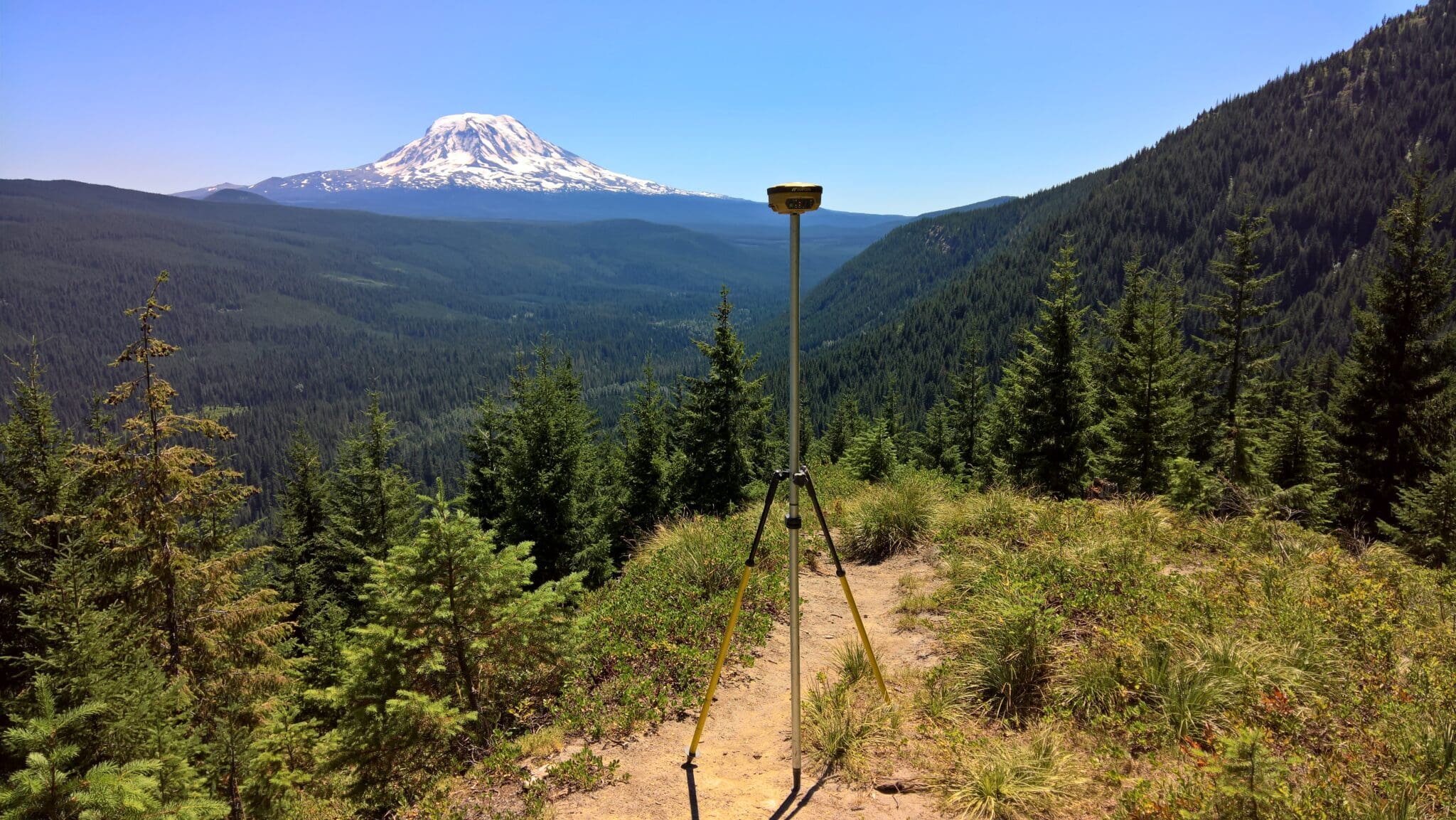
Accurate, reliable data is critical for infrastructure and development projects. WGI’s surveyors and engineers use advanced technologies to capture high-resolution site information across complex environments and large corridors, providing the insight teams need to reduce risk and make informed design decisions.
Key tools include:
-
LiDAR scanning for precise 3D terrain models
-
Photogrammetry and aerial mapping for overhead site documentation
-
Mobile LiDAR for efficient corridor and infrastructure mapping
-
Hydrographic surveying for waterways, bridges, and coastal projects
These tools allow WGI to deliver comprehensive geospatial intelligence that integrates seamlessly into planning, design, and construction workflows.
Comprehensive Geospatial and Surveying Services
Across every market we serve, WGI provides:
-
Boundary and right-of-way surveys
-
Topographic and corridor surveys
-
Control and geodetic surveys
-
Utility-focused surveying and subsurface utility engineering coordination
-
LiDAR, photogrammetry, and remote sensing data collection
-
Hydrographic surveying for waterway and infrastructure projects
Whether in North Carolina or any other state, these services give clients the data and insight needed to improve coordination, reduce risk, and support more predictable project outcomes.
Expanding Presence Across the Nation
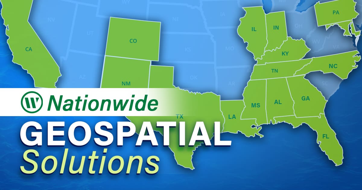
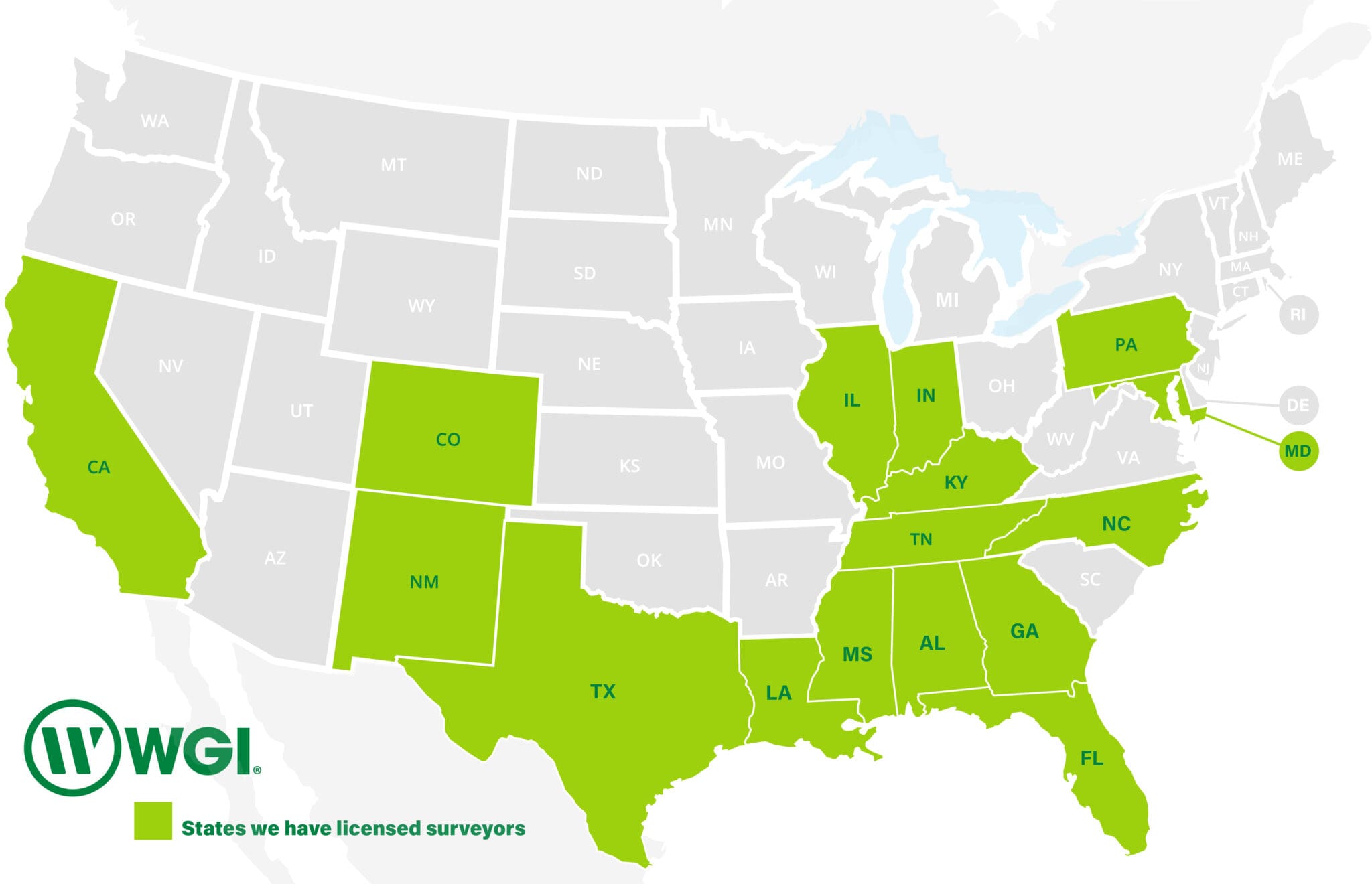
With licensed land surveyors and geospatial professionals in multiple states, WGI is building a nationwide footprint, ready to support projects wherever growth, complexity, and client demand require it. Our licensed states include:
-
California
-
Kentucky
-
Louisiana
-
Maryland
-
Mississippi
-
New Mexico
-
Pennsylvania
-
Tennessee
This expansion ensures WGI can deliver geospatial and land surveying solutions anywhere, anytime, providing consistent expertise, advanced technology, and local knowledge across the country.
Partner With WGI
From transportation corridors to utilities, waterways, and complex infrastructure environments, WGI delivers integrated geospatial and land surveying solutions nationwide. North Carolina is just a recent example of our expansion, so stay tuned for our next milestone!
Connect with WGI today and learn how our geospatial expertise and advanced technology can support your next project, wherever it takes place.