Markets
Services
Stay Connected
Sign up to receive emails to hear our latest news and achievements in our monthly newsletter.
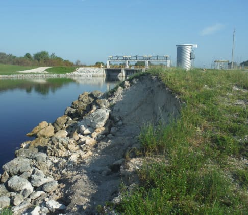
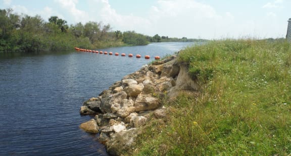
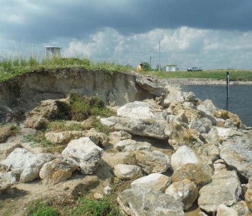
WGI performed this emergency post-Irma survey for the U.S. Army Corps of Engineers (USACE) around Lake Okeechobee. WGI acquired topographic data along the Herbert Hoover Dike at 24 separate locations depicting various debris lines, high water marks, and scour areas where the dike sustained damage from the storm event. Deliverables included point files and CAD file for USACE engineers to analyze.
Sign up to receive emails to hear our latest news and achievements in our monthly newsletter.
Enter your zip code, and we’ll personalize your experience with local projects, office locations, team members, and more.
WGI supports its associates with meaningful opportunities for growth, strong benefits and perks, while we work collaboratively with clients and co-consultants to shape and improve communities.
WGI is a dynamic organization with opportunities nationwide for engineers, land surveyors, landscape architects, environmental scientists, and architects.