At WGI, innovation and expertise converge through Solv3D – a robust and adaptable platform that is transforming how geospatial data is processed, analyzed, and applied to complex spatial challenges.
Deployed on WGI’s private cloud infrastructure, Solv3D supports custom machine learning models and leverages deep learning capabilities to extract meaningful insights from raw data sources such as point clouds, panoramic imagery, and other geospatial assets. This technology enables WGI to streamline decision-making, increase analytical accuracy, and automate workflows across a broad range of applications—from infrastructure assessments to long-term development monitoring.
Enhancing Outdoor Advertising Compliance Through AI
As part of WGI’s Outdoor Advertising (ODA) program, Solv3D has been effectively implemented to model billboard signage and detect potentially unauthorized structures captured via mobile lidar and spherical imagery.
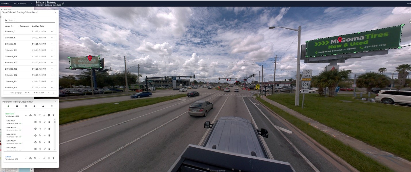
By deploying a highly accurate machine learning model, WGI can automatically identify signage across datasets and cross-reference these findings against historical records maintained with GIS datasets. This significantly reduces the labor-intensive nature of manual sign detection and compliance verification.
Tracking Development with Advanced Footprint Modeling
WGI has also developed a building footprint model currently in use under our contract with a county in Alabama. This tool enables year-over-year development tracking by comparing historical building records with newly acquired imagery.
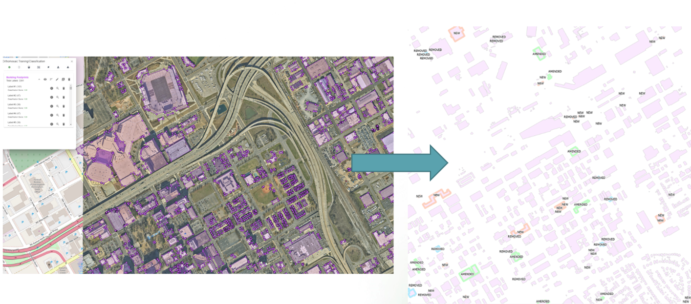
Automating this change detection process minimizes the need for manual data extraction and enhances the speed and reliability of development analysis.
Scalable ML Solutions for Multi-Source Point Cloud
WGI has developed advanced machine learning models tailored for high-volume point cloud classification across a variety of lidar sources, including mobile, static, and aerial platforms.
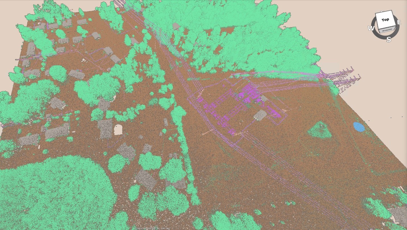
Our custom deep learning solutions incorporate cutting-edge techniques such as class frequency adaptation and adaptive algorithms designed specifically for multi-pass sensor data. These innovations significantly enhance classification accuracy and processing efficiency, enabling more reliable and scalable geospatial analysis.
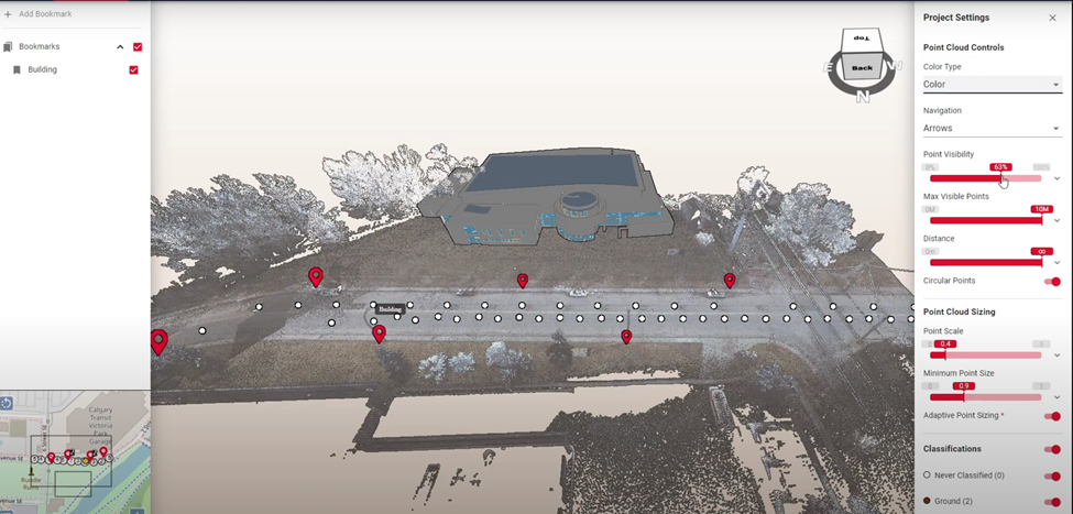
A Unified Platform for Comprehensive Data Visualization
Solv3D also serves as a powerful integrated viewer that consolidates GIS data, point clouds, imagery, and 3D models within a single, user-friendly interface. WGI is preparing to launch this secure, client-facing solution for several municipal clients, eliminating the need for multiple software platforms and enabling more intuitive access to geospatial project data.
Driving the Future of Geospatial Solutions
From outdoor advertising audits to countywide construction tracking and immersive 3D visualizations, Solv3D continues to play a central role in WGI’s commitment to technological advancement and data-driven project delivery, while being securely deployed on our own infrastructure.
By combining artificial intelligence with a streamlined visualization platform, WGI is redefining how clients engage with geospatial information—delivering faster, smarter, and more precise outcomes. Solv3D is not only helping solve today’s challenges—it is laying the foundation for the next generation of spatial solutions.
To learn more about our innovative technology offerings and how they can support your organization’s objectives, contact the WGI team today!