Project Spotlight: Lower Withlacoochee River
WGI completed a bathymetric survey of the Withlacoochee River to collect data for the Withlacoochee River Watershed Digital Elevation Model.
Learn from award-winning professionals — explore our whitepapers, blogs, and the latest industry updates.
Join our dynamic organization of engineers, land surveyors, landscape architects, environmental scientists, and architects!
Talk to a market leader today! We’ll answer any questions you have about our professional services.
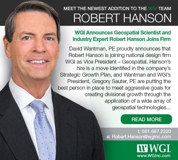
David Wantman, PE proudly announces that Robert Hanson is joining national design firm WGI as Vice President – Geospatial. Hanson’s hire is a move identified in the company’s Strategic Growth Plan, and Wantman and WGI’s President, Gregory Sauter, PE are putting the best person in place to meet aggressive goals for creating divisional growth through the application of a wide array of geospatial technologies.
“Bob has spent his entire career leading the evolution of the geospatial profession, from US Army Topographic School in the 1970s and NOAA National Ocean Survey Bathymetric Compilation Training in 1980, through close to four decades of the application of every new technology, up to his last position as chief scientist and industry expert for a large, international firm,” says David Wantman, CEO.
As a chief scientist and industry expert, Hanson was largely charged with the examination of applications developed in-house for a specific purpose using geospatial technology. Working with teams of professionals and subject-matter experts, he assessed the business potential beyond the project-level for application/technology innovation, based on its uniqueness, applicability as a technical solution within the marketplace, feasibility of scaling the innovation to national markets, and the ROI analysis with development and investment stages.
It is this level of operative expertise and development of future revenue streams that attracted WGI. In addition, Hanson led the firm’s capital investment in sensor-based technologies and formed a LiDAR Center of Excellence for operation/delivery of projects using Mobile LiDAR, Laser Crack Measurement Systems (LCMS) for pavement distress, and Unmanned Aircraft Systems (UAS). He led work on notable large and complex transportation and infrastructure projects across the nation.
“WGI’s strategic goals for its Geospatial Division are ambitious, and its investment in leveraging ‘Tomorrow’s Technology Today’ is very exciting to me. The combination of my experience, and WGI’s similar commitment to efficiency and technology, will rapidly increase WGI’s presence as a national leader in geospatial services,” says Robert Hanson. “And I am ready to relocate back to Florida after so many years in Pennsylvania.”
Noted Gregory Sauter, “We’re absolutely committed to advancing the cutting-edge technologies that are transforming how we envision, design, and deliver infrastructure. That provides WGI with a special opportunity to follow the example and experience of someone highly qualified to assist in the execution of our 2025 vision of market leadership and revenue derived from innovation and technology. We welcome Bob and his commitment to evolutionary thinking.”
WGI is a national design and professional services firm leading in technology-based solutions for the construction of public infrastructure and real estate development. At WGI, we’re providing Tomorrow’s Infrastructure Solutions Today.
WGI completed a bathymetric survey of the Withlacoochee River to collect data for the Withlacoochee River Watershed Digital Elevation Model.
How Adding UV-C Lighting And Needlepoint Bipolar Ionization To Your Building’s HVAC System Can Help Your Tenants Breathe A Sigh Of Relief When Returning To The Workplace
WGI’s certified arborists are enhancing the state of urban forests for our clients and our communities every day.
Fall 2017 was a devastatingly tragic period for many Texans as Hurricane Harvey produced record rainfalls and flooding throughout vast portions of south Texas.
Two interns working in WGI‘s Transportation division share their experience as a WGI intern.
Together, WGI and Urban SDK offer clients the ability to enhance safety, improve mobility, and realize cost savings – using data analytics combined with WGI’s robust infrastructure capabilities.
You’ve been searching for a place like WGI. We look forward to meeting you soon.
Sign up to receive emails to hear our latest news and achievements in our monthly newsletter.
Enter your zip code, and we’ll personalize your experience with local projects, office locations, team members, and more.
WGI supports its associates with meaningful opportunities for growth, strong benefits and perks, while we work collaboratively with clients and co-consultants to shape and improve communities.
WGI is a dynamic organization with opportunities nationwide for engineers, land surveyors, landscape architects, environmental scientists, and architects.