People & Partnerships
In 2019 we made investments in our people, setting them up for continued innovative success in 2020 and beyond. We added new associates Sandor Laszlo and John Klier, both with talents and interests in leading innovation development activities. The operational involvement of Jason Alvarez, Christian Stewart, Radek Grabowski, Dean Cole, Amy Hunter, Emily Zeilberger, and several others has also attributed to our success in leading development activities. We are harvesting their many ideas for use in our recipes for success.
We are also partnering with Florida Atlantic University (FAU) to push the future of the geospatial profession. In addition to collaborating on research and development initiatives, WGI is helping to identify and develop the next generation of talent.
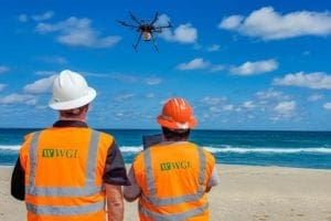
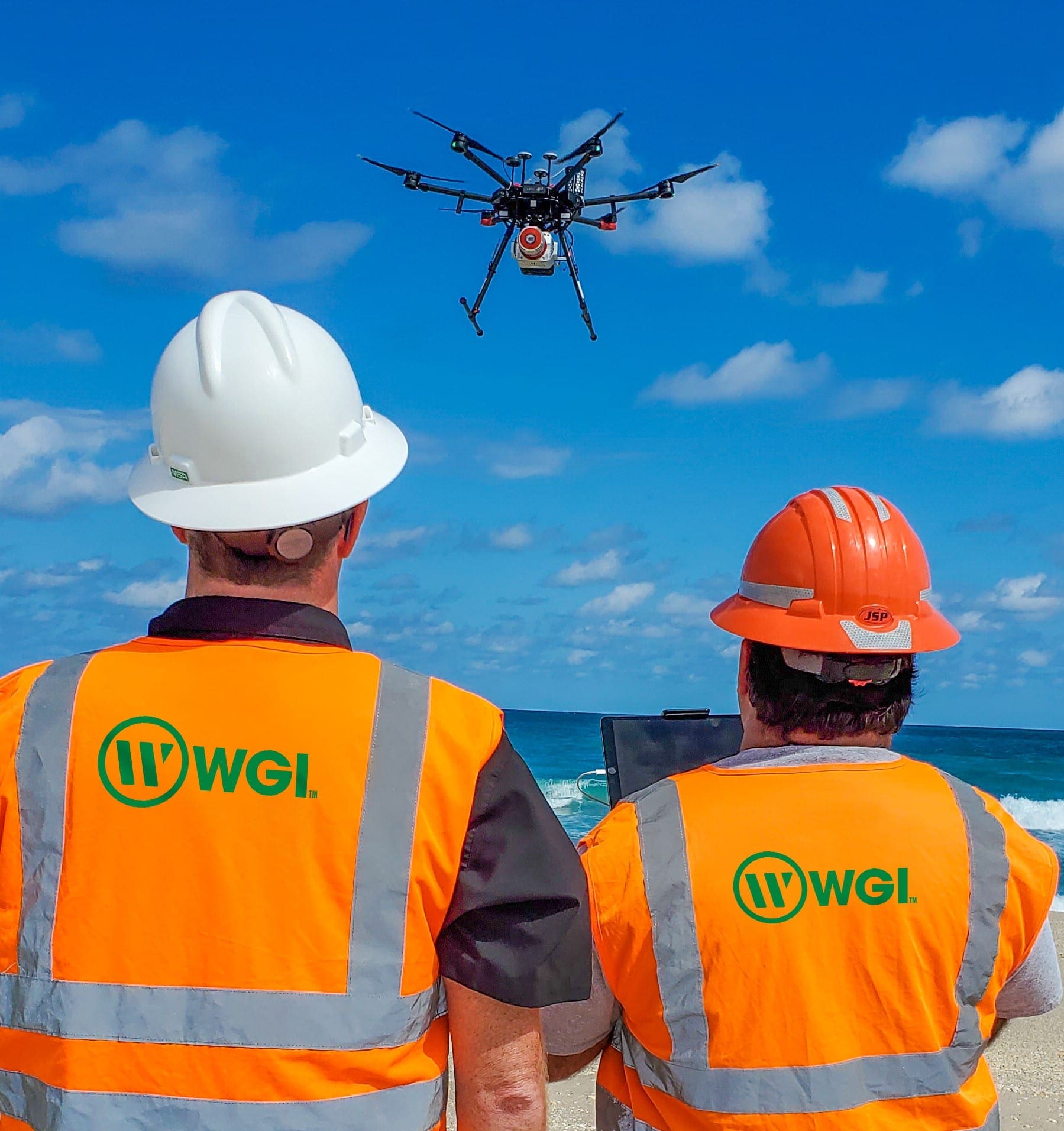
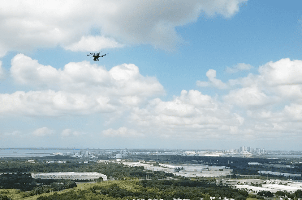
Unmanned Aircraft Systems (UAS)
We have acquired two additional UAS, both with heavy lift capabilities, for use with a high pulse rate and accurate lidar sensor. We will ferry the lidar system on and between these aircraft. We also will ferry the same lidar system on backpack and vehicle-mobile lidar mounted configurations.
The innovations we develop will be found in the cost-effective versatility and application of systems at project sites for optimal performance. Many efficiency constraints are currently encountered when using disparate sensors and ferrying platforms.
It will be easier to integrate enhanced workflows and post-processing of data known as “lidar fusion.” Having a singular mobilization on a project site for data collection will drastically increase efficiency. One of the systems is gas-powered for long flight durations (approximately 1.5 hr. in flight), which minimizes multiple launch missions for large area lidar data collections and imagery.
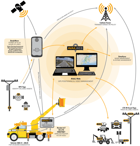
Terrestrial Mobile Video
WGI has recently signed an agreement to acquire ten vehicle systems and twenty integrated human-body cameras that will help increase the safety of our survey crews.
At the core of the systems is the ability to leverage positional data with the use of text messages and voice communications transmitted via the cellular network. We can also send limited video and collect, store, and transfer large amounts of video with the WiF the Rocket IoT hub. The hub comes with four configurable Power over Ethernet (PoE) ports and four Digital I/Os to configure cameras and eventually other remote sensors. Collected positional and temporal data is contained within an associated DataSyncTM database. Currently, the database is updated every fifteen seconds with all data associated with sensor positions and velocities. The actual sensor data (e.g., video) is stored on the Rock IoT’s internal storage and downloaded to the cloud on-demand or via dedicated wireless receivers at WGI facilities.
Using the Avail Web Portal for real-time situational viewing and awareness, we set parameters for emergency, safety, person-down or similar alerts, enable geofencing, and can automatically enable video recording.
Recordings are used with applications using artificial intelligence (AI) for asset identification and task confirmation. Using smartphone data collection and AI, the vehicle-mounted and human carried systems can be used for geolocated inspection using video, picture, voice, and collecting asset characteristics data.
Our application of these sophisticated systems, originally developed for police and emergency responders, will move us into a robust WGI asset management application that goes beyond the purely GIS-based data collectors used in the current geospatial industry.
Software Development:
In addition to the new hardware investments, we are also working on software-specific developments:
- Leveling Adjustment Software — Development of a stand-alone desktop software application for use with output from level data collectors.
- SUE Field Collector Software — Development of a mobile application with a web-based back end to facilitate the scheduling, collection, and report generation of SUE data.
- CAD to RCI/ARNOLD Software — Development GIS-based system to parse CAD files and generate RCI/ARNOLD ready data for all detectable features. The system will use the Linear Reference Dataset to locate the data in accordance with ARNOLD requirements.
- Imagery and lidar Extraction — Development of a software system that utilizes computer vision to detect and geographically locate features through imagery with verification using lidar point cloud analysis.
Let’s talk!
As you can see, 2020 will be an exciting year for the Geospatial Team at WGI and we want you to be a part of it! Contact us today if you are ready to get started on your next project or join our team!