As WGI’s Digital Services Spotlight series continues, we’re highlighting the transformative potential of combining geospatial intelligence, digital twins, and immersive visualization to reshape the future of mobility. SunTrax, Florida’s first dedicated testing site for autonomous vehicles and autonomous aerial vehicles, represents one of the state’s boldest steps toward transportation innovation, and WGI played a key role in building the digital foundation that makes it possible.
From lidar scanning and precision control networks to AR/VR visualization and baseline BIM modeling, SunTrax showcases what happens when multidisciplinary expertise comes together to create a smarter, more connected transportation ecosystem…
Building Florida’s Groundbreaking Mobility Testbed
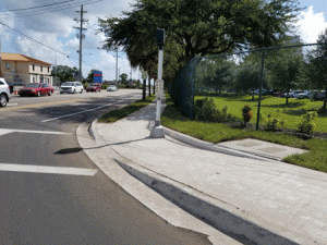
The SunTrax project marks a major milestone in advancing autonomous technologies in Florida. As the first facility in the state designed specifically for both autonomous vehicles and autonomous aerial vehicles, with integrated vertiports, SunTrax is positioned to support the next generation of mobility on land and in the air.
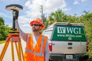
WGI supported this vision by deploying advanced geospatial technologies across the entire site. Through a comprehensive approach that combined terrestrial, mobile, and aerial lidar; high-resolution photogrammetry; and precision control networks, our geospatial experts mapped every detail of the facility and surrounding environment. This rich digital foundation not only supports traditional infrastructure design but enables seamless integration of emerging technologies that depend on precision data.
Powering Innovation With Digital Twins and Immersive Visualization
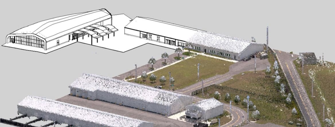
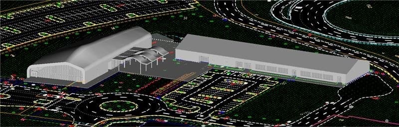
Central to SunTrax’s groundbreaking capabilities is its use of digital twin technology, turning detailed geospatial data into a living, interactive model of the facility.
Working closely with Akular, our Geospatial and Buildings teams delivered a fully integrated design survey that included terrain models, infrastructure models, and FDOT’s first baseline 3D building information model (BIM). Exportable in industry-standard formats and ready for live data integration, this digital framework allows SunTrax to scale and adapt as technology evolves.
The digital twin opens the door to next-generation smart infrastructure features such as:
- Programmable traffic signals
- Sensor-driven pavement diagnostics
- Real-time dashboards for autonomous vehicle testing
- Integrated vertiport operations for autonomous aerial systems
With AR/VR enhancements layered on top, stakeholders can explore, plan, and test within a fully immersive environment, long before vehicles ever touch the track or launch from a vertiport.
The Power of Multidisciplinary Collaboration
What truly sets SunTrax apart is the integrated expertise behind it. WGI’s full-service team, spanning geospatial survey, remote sensing, transportation engineering, building modeling, and digital visualization, worked collaboratively to build a scalable digital platform that anticipates future mobility needs.
This holistic approach ensures SunTrax can support:
- Autonomous EVs navigating complex environments
- Aerial autonomous vehicles utilizing vertiport infrastructure
- Infrastructure systems that respond to real-time data
- Stakeholder engagement through immersive and interactive tools
By blending deep technical knowledge with forward-thinking digital strategy, WGI helped transform SunTrax into a model for smart, connected transportation facilities.
Contact Us
SunTrax demonstrates what’s possible when advanced geospatial technology, digital twins, and multidisciplinary expertise come together to shape the future of mobility. By building a precise digital foundation and integrating immersive, real-time tools, WGI helped create a platform that will support innovation for years to come…on the ground and in the air.
At WGI, we combine cutting-edge digital capabilities with deep transportation insight to help clients plan, test, and deliver next-generation mobility solutions with confidence.
Whether you’re exploring autonomous vehicle testing, smart infrastructure integration, or digital-twin–driven design, our Digital Services team is ready to help bring your vision to life. Connect with us to start shaping the future of connected mobility.