Neighborhoods in the City of Austin represent one of the three pillars of development stakeholders in the City of Austin, with the other two being our environmental protections and our business/economic interests.
Projects that go awry in the City of Austin often do so because they fail to successfully appeal to the needs and fabric of their host neighborhoods. If your project is located inside the City of Austin, neighborhood plan or not, outreach efforts are critical to a projects success.
The map below shows of the extents of the various Neighborhood Planning Areas in the City of Austin:
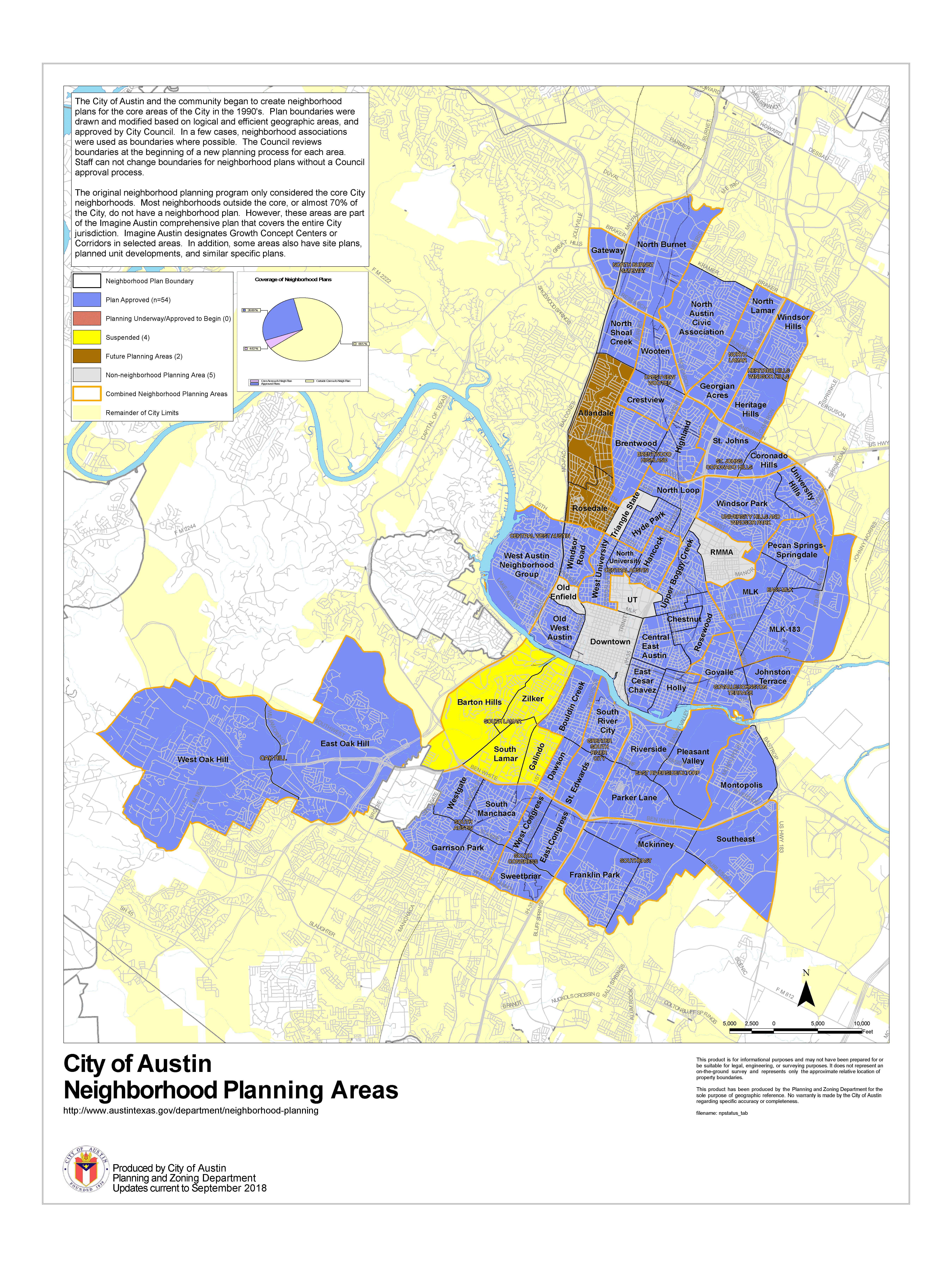
Below is a list of the current neighborhood plans, all of which have future land use maps (FLUMs), contact team information, and related plan amendments available for public viewing online at the City’s Planning and Development Review Department website:
- Bouldin Creek
- Brentwood/Highland Combined
- Central Austin Combined (Hancock, North University, West University)
- Central East Austin (OCEAN)
- Central West Austin Combined (West Austin Neighborhood Group (WANG), Windsor Road)
- Chestnut
- Crestview/Wooten Combined
- Dawson
- East Cesar Chavez
- East MLK Combined (MLK, MLK-183, Pecan Springs/Springdale)
- East Riverside/Oltorf Combined (Parker Lane, Pleasant Valley, Riverside) (EROC)
- Govalle/Johnston Terrace
- Greater South River City (South River City, St. Edwards)
- Heritage Hills/Windsor Hills
- Holly
- Hyde Park
- Montopolis
- North Austin Civic Association (NACA)
- North Burnet/Gateway(Master Plan)
- North Lamar Combined (Georgian Acres, North Lamar)
- North Loop
- Oak Hill Combined (East Oak Hill, West Oak Hill)
- Old West Austin
- Rosewood
- South Congress Combined (East Congress, Sweetbriar, West Congress
- St. John/Coronado Hills Combined
- Southeast Combined (Franklin Park, McKinney, Southeast)
- University Hills/Windsor Park
- Upper Boggy Creek
According to the City of Austin, Neighborhood planning provides an opportunity for citizens to take an active role in the planning process and decide how their neighborhoods will move into the future while addressing land use, zoning, transportation and urban design issues. The individual neighborhood planning teams work with City of Austin staff to implement their plan’s recommendations.
Visit the City of Austin’s Neighborhood Planning website to find more information and to download specific neighborhood plans.
Have questions about the entitlement process in the City of Austin – we can help!
Do you wonder when you should reach out to the neighborhood about your project? It’s not an easy answer – at WGI, we’ve got a track record of experience in successful neighborhood outreach efforts. Contact our Austin office today at (512) 669-5560 to learn how we can help you navigate the neighborhood outreach process.