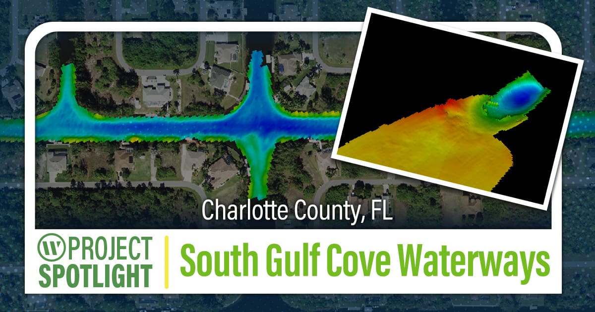
With over 55 miles of navigable canals, South Gulf Cove is a Charlotte County community consisting of over 4,700 waterfront homes and homesites with access to the Gulf of Mexico and Charlotte Harbor on Florida’s Southwest Coast. A lock controls boating access to the community’s waterway system, protecting it from high water levels and tidal influence.
Navigating the Depths: WGI’s Bathymetric Survey Unveils South Gulf Cove Canals
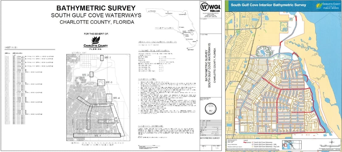
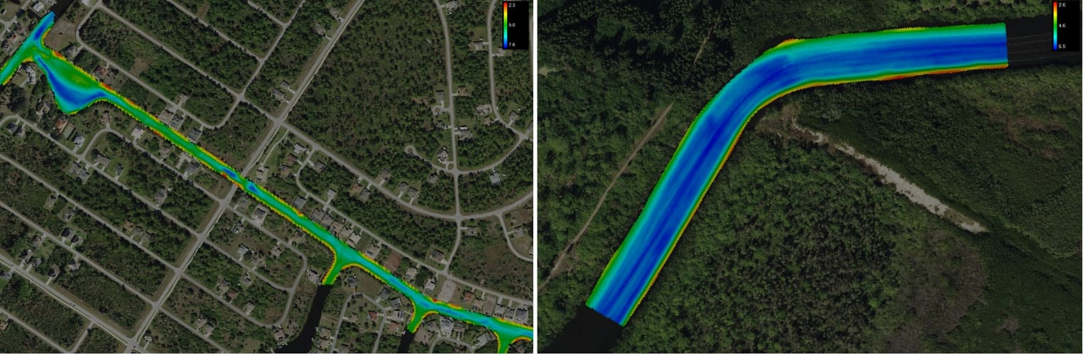
WGI conducted a bathymetric survey within the South Gulf Cove waterway system for Charlotte County. With no previous hydrographic survey data available, the County wanted to obtain accurate and up-to-date information regarding the depths, contours, and navigability of the canals to effectively manage and maintain the waterway system in the future. Areas of interest included approximately 10.4 miles of navigable channels along portions of the main canals.
Our experienced and nationally recognized hydrographic team was led by hydrographic survey project manager Coty Granger, who was equipped with WGI’s innovative and industry-leading arsenal of equipment that yielded accurate, quality results for Charlotte County.
The following systems were used to obtain International Hydrographic Organization-compliant multibeam bathymetry within the canals:
- Vessel: WGI’s Hydrographic Surveyor is a 25-foot enclosed cabin secure all-around SAFE boat. The vessel was designed for use by the US Coast Guard with an emphasis on safety, maneuverability, and performance. These characteristics also make it the perfect platform for survey operations.
- Multibeam Sonar: R2Sonic‘s Sonic 2022 multibeam echosounder was used to collect bathymetric data. The Sonic 2022 uses state-of-the-art beam-forming technology to capture ultra-high-resolution soundings with unprecedented accuracy and efficiency. This system can produce 1,024 soundings per ping at a ping rate of 60hz and cover a swath of 160 degrees (almost 3.5 times the water depth)!
- Inertial Navigation System: The Sonic 2022 is fully integrated with an Applanix POS MV Wavemaster II. This robust inertial navigation system provides positioning, heave, pitch, roll, and velocity data in real-time. The Wavemaster II’s unrivaled accuracy and performance aided WGI in efficiently collecting, processing, and delivering a high-quality product.
The Results
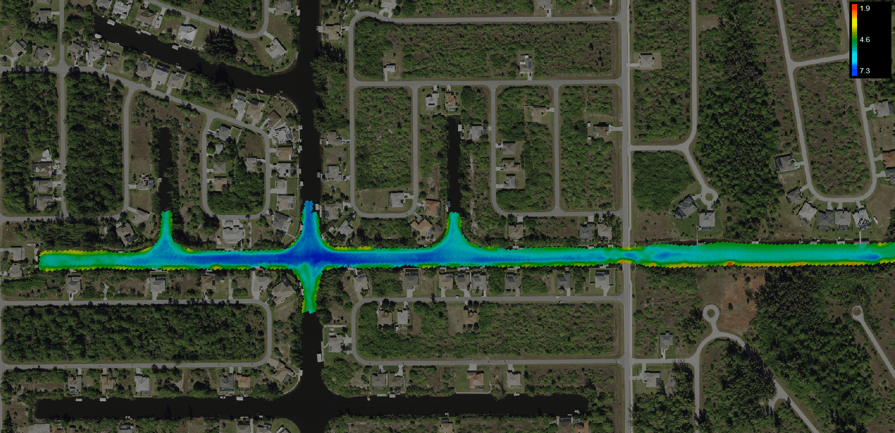
WGI provided a contoured, bathymetric survey map with the most up-to-date GIS imagery identifying existing channels within the canals. Using this map, channel centerline and project stationing/alignment were defined. Charlotte County’s pre-designed dredge template was used to derive the dredging volumes necessary to meet a desired channel depth of -4.0 feet at mean low water elevation. This depth will ensure canal access for larger vessels and make the waterway more navigable for all.
WGI’s deliverables will improve the safety and usability of the South Gulf Cove waterway system and assist Charlotte County in future design, dredging, and maintenance of the canals.
Contact Our Team
For those seeking top-tier geospatial expertise, we invite you to contact our Geospatial Experts at WGI for data that exceeds even the highest expectations – And be sure to check out our recent publications for exclusive insights on the innovative geospatial technology and strategies that are reshaping the geospatial and land surveying landscape as we know it:
- Topographic Mapping at a Grand Scale
- Discover how WGI’s Geospatial experts were instrumental in crafting the highest-resolution aerial lidar dataset for the majestic and untouched terrain of the Grand Canyon. From high-resolution lidar scans to precise topographic models, our exclusive whitepaper unveils the innovative techniques used to capture over 800mi² of this natural wonder. Plus, delve into the advanced geospatial technologies that made it all possible, including state-of-the-art aerial sensors and cutting-edge data processing.
- Innovations in Lidar Mapping
- Since its inception in the 1960s, lidar has been a staple in surveying. Yet, like any technology, lidar systems have evolved, leaving industry professionals to wonder what’s next… Download our whitepaper to uncover the innovations that are reshaping the industry & giving mapping professionals a new toolset for achieving high-accuracy, high-density point clouds using FWAL.
- Inertial Surveying & Mapping of Subaqueous Pipelines – Unveiling the Future of Pipeline Mapping
- In this comprehensive guide, we’ll unravel the complexities of accurate 3D mapping as we give you a behind-the-scenes look into the Florida Department of Transportation’s (FDOT) ambitious replacement of two critical bridges spanning the Florida Gulf Intercoastal Waterway. With real-world examples and meticulous detail, this is your opportunity to discover how WGI leveraged ground-breaking inertial navigation technology and innovative solutions to seamlessly map subaqueous utilities in the replacement of both the John T. Brooks and Theo Baars bridges.