

Podcast
WGI Unleashed Episode 89: Lyndsey Duty, Environmental Scientist
On the latest episode of the WGI Unleashed podcast, we sit down with Lyndsey Duty, one of WGI’s Environmental Scientists based out of our Tampa, FL office!
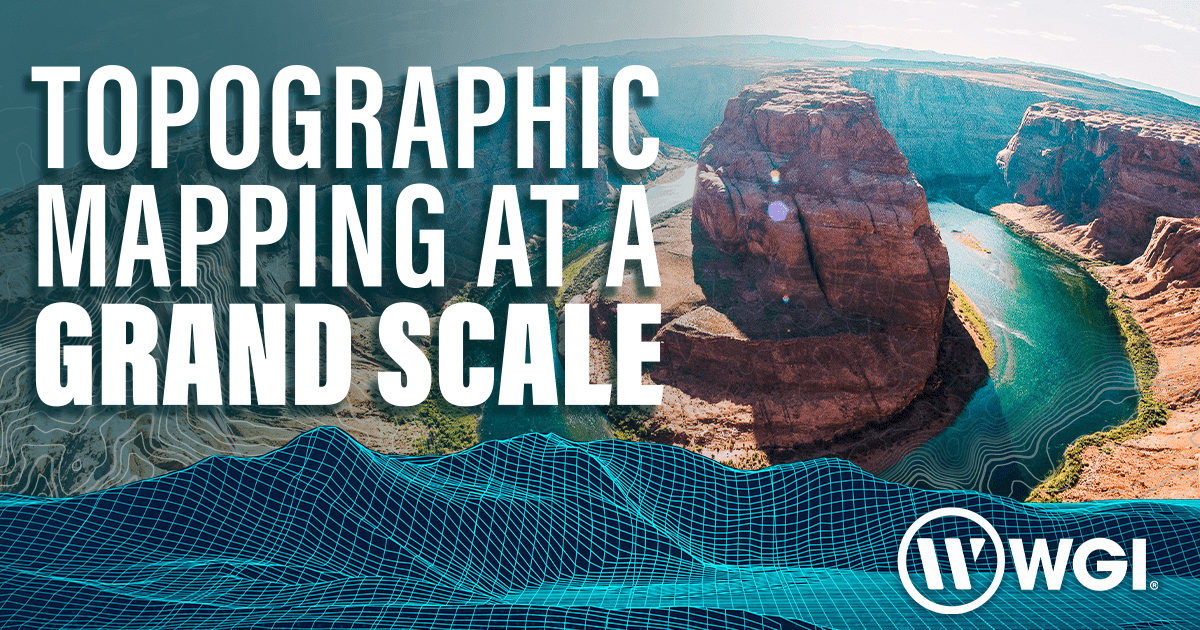
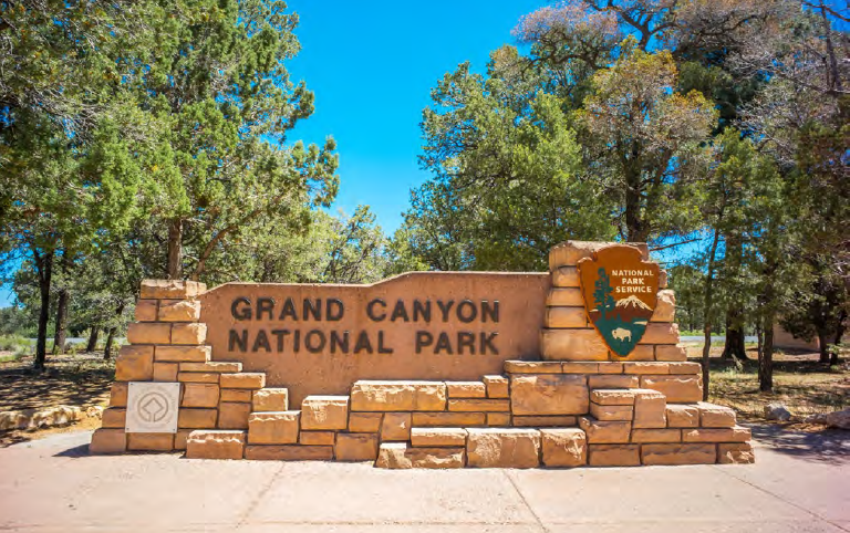
WGI played a vital role in one of the most challenging national lidar projects: Mapping the Grand Canyon. First protected in 1893 as a reserve and later a National Monument thanks to the influence of figures like Teddy Roosevelt, it was not until 1919 that the Grand Canyon became a National Park. The first survey expedition of the Grand Canyon was in 1869, led by John Wesley Powell, the second director of the United States Geological Survey (USGS). A complete, level survey line was later provided through the Birdseye Expedition of 1923. Today, the Grand Canyon National Park plays host to an estimated 5.9 million visitors annually.
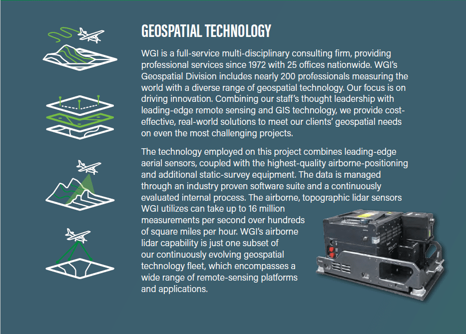
A century after obtaining National Park status, multiple federal, state, and tribal agencies collaborated to acquire high-quality elevation data for large portions of Grand Canyon National Park (GCNP). This would be the first multiagency, geospatial collaboration project for the GCNP, resulting in the highest-resolution aerial lidar dataset available to date for this stunning landscape.
The multi-purpose spatial data collected for this project supports dam safety assessment and engineering design review, conservation research and planning, habitat analysis and modeling, floodplain mapping, hydrologic modeling, and fire and fuel modeling. Additionally, the data supports federal initiatives of producing seamless maps of the region.
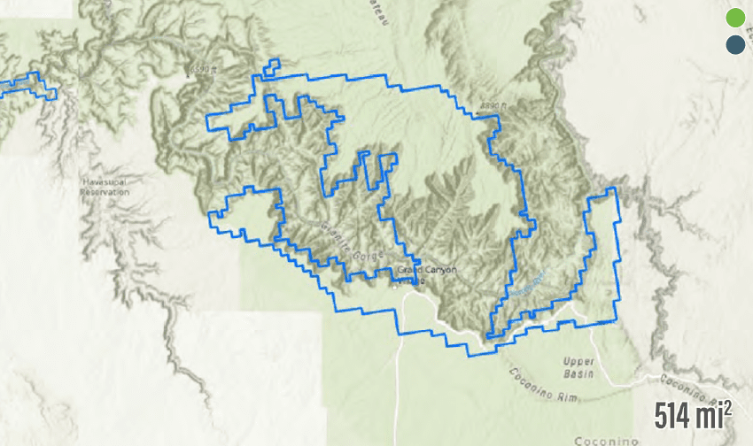
In 2019, WGI was contracted to collect and process airborne lidar data for two key portions of the GCNP. These areas include 319mi² of the “Grand Canyon West” and 514mi² of the well-known “Grand Canyon Central,” which includes the Grand Canyon Village, the North Rim, and the Kaibab Plateau. WGI is a prequalified provider of geospatial products and services. We hold several federal mapping contracts, which allows state and federal agencies to ensure that prequalified and experienced organizations are performing the work to a predefined standard.
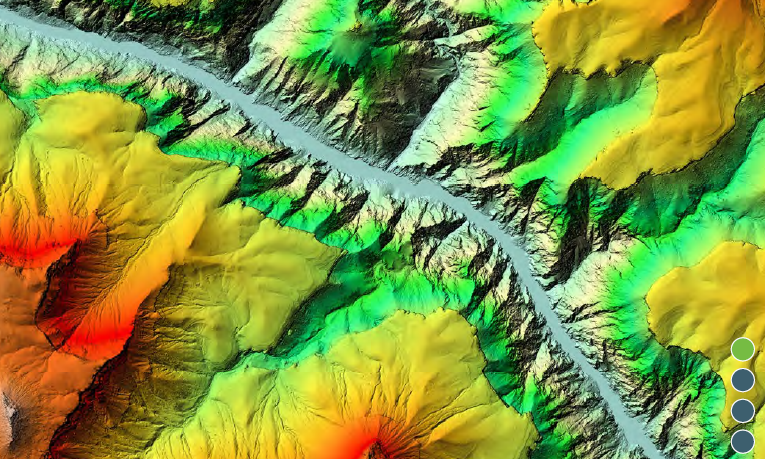
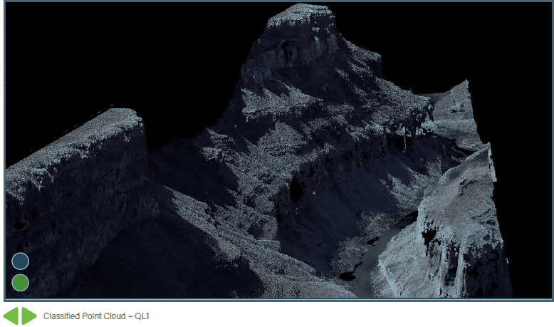
The GCNP project is unique because the data was specified at a high standard compared to much of the existing national baseline lidar datasets. This higher-quality product is defined by the USGS Lidar Base Specification (LBS) as Quality Level One (QL1), which calls for eight lidar pulse measurements within a square meter (8pls/m²) rather than two pulse measurements that is typical of QL2 data covering much of the U.S. QL1 data also meant a higher-resolution Digital Elevation Model (DEM) pixel size for the GCNP at 0.5m rather than 1m for improved models and higher-resolution analysis.
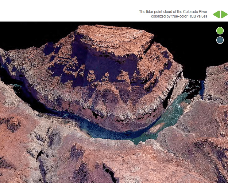
This project’s geospatial products included a classified lidar point cloud which identified ground, sensor noise, water, bridge decks, snow, and exclusions. From that classified lidar point cloud, several raster products were generated at 0.5m resolution. A first-return Digital Surface Model (DSM) was created representing the topography, including the tops of above-ground features like rooftops and the vegetation canopy heights.
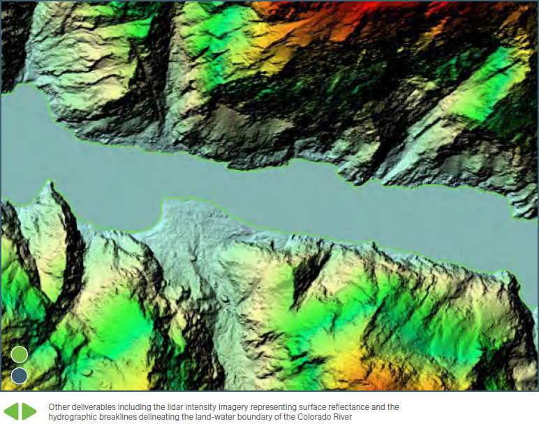
A bare-earth DEM was also created, excluding vegetation and other above-ground features, to contrast the DSM and obtain an accurate model of the vegetated canopy heights — among other purposes. WGI performed a process known as hydro-flattening in preparation of the DEM, which corrects elevation-related water surface errors resulting from data voids on the Colorado River surface. This error on water surfaces is typical of a topographic lidar survey as laser wavelengths in the near-infrared region of the light spectrum do not capture continuous measurements on water bodies. The hydro-flattened DEMs are delivered to the public with smooth and accurate water elevations that do not flow uphill and do not flow over the defined shoreline. Additionally, a 0.5m resolution intensity image, showing the reflectivity of the topographic features, is provided with breaklines delineating the Colorado River shoreline. Per the LBS standards, which apply to almost all national airborne lidar projects, WGI provided ground control, metadata, and QA/QC reports to easily utilize and assess specific regions of the project areas in a defined tile index.
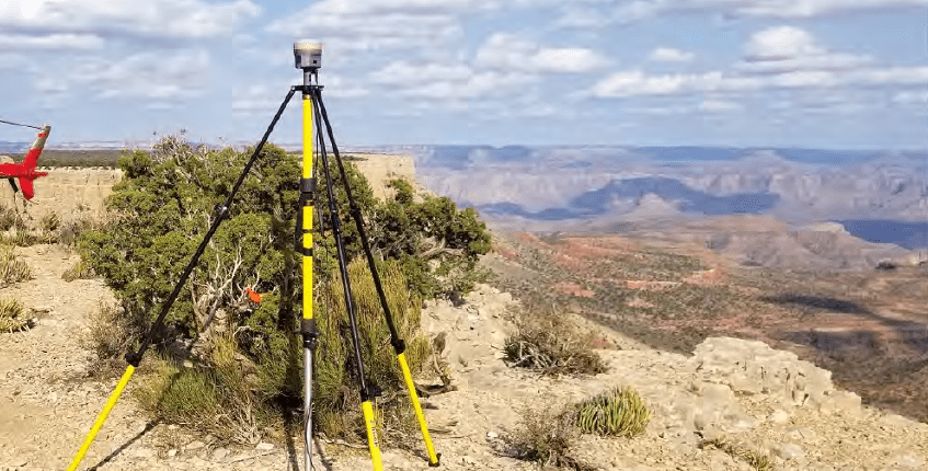
Federal lidar projects require a ground-survey component in addition to the aerial data-acquisition missions. Using the ground control, aerial lidar data is adjusted to a known ground truth, which is also used to assess the spatial accuracy of the point cloud and resultant products. In the case of the GCNP project, WGI’s field crews identified existing survey monuments and surveyed 33 independent ground control points and 80 independent lidar check points, both in vegetated and non-vegetated regions. These surveyed locations were documented, photographed, and reported on to allow a valid third-party quality check. The survey used both real-time kinematic (RTK) and static Global Navigation Satellite System (GNSS) observations exceeding the project’s requirements.
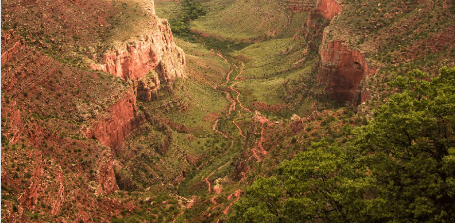
Mapping the Grand Canyon with lidar was more complicated than most geospatial mapping projects. There are no cookie-cutter approaches that can be applied to encompass a wide diversity of physical environments and land use. Thus, this mapping project required early identification of its challenges, and tailored solutions to achieve consistent and timely results.
The first challenge was the terrain relief of northern Arizona and the canyon walls which can result in up to 6,000 ft of rapid terrain change. Therefore, it was crucial to understand the ranging capability of the lidar sensor itself, selecting appropriate altitudes and sensor parameters for capturing both the canyon’s valley and upper rim, simultaneously. Furthermore, the flight lines of survey were planned over the canyon in an orientation parallel to each segment of the canyon. Our approach, combined with additional flightline overlap greater than the average federal lidar project, allowed the scan lines of the sensor (orienting perpendicular to the direction of flight), to travel from the riverbanks, up the talus and cliffwall. This was important for the accurate scanning of vertical surfaces which may not otherwise be captured from an airborne, birds-eye perspective.
In addition to the airborne flight plan, a survey plan was also created to ensure that the control portion was delivered to the project standards which reference the American Society for Photogrammetry and Remote Sensing (ASPRS) and the National Geodetic Survey (NGS). The survey plans required control points evenly distributed throughout the project area and placed in an area with minimal slope. To solve the challenge of identifying level terrain points, WGI’s surveyors utilized existing topographical maps to create a survey plan which uncovered the need to place control not only on the upper rim but also inside the canyon itself.
The next major challenge in the project’s planning phase was accessing the lands and airspace of this diverse region. WGI worked closely with several state, federal, and tribal organizations to coordinate access to the survey project areas. Additionally, our team obtained a Waiver of Authorization from the Federal Aviation Administration (FAA) to enter the airspace, coordinating daily with Air Traffic Control (ATC) to fly over National Park Service (NPS), military, and tribal zones. For the ground control portion, multi-agency coordination was required for access to federal lands, but not all of the GCNP is situated on NPS lands. There are 11 Native American Tribes in the area, three bordering or directly in the project area. Coordination with these Tribes was also a key aspect of the project. Thanks to this upfront collaboration effort, WGI was able to proceed with the support of multiple stakeholders.
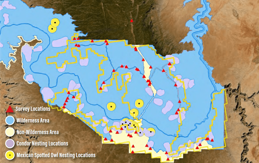
Once the permits and approvals were obtained, the team turned its attention to ecological considerations. The Grand Canyon is home to several endangered species and remains a key nesting site for the Mexican Spotted Owl and the California Condor. For this reason, the NPS requested an environmental impact study, which identified Wilderness Areas and any known nesting sites of protected animals. Upon its completion, Grand River Conservation Authority (GRCA) issued a Backcountry Permit for WGI’s surveyors, restricting any land access within one mile of the known nesting sites.
To summarize, the ground survey plan required an even distribution of accessible control points on level terrain, that did not disturb the identified nesting sites, and minimized the need to access Wilderness or Tribal lands. First, a known layer of existing roads, routes, and trails was imported to identify the planned survey locations accessible by ground.
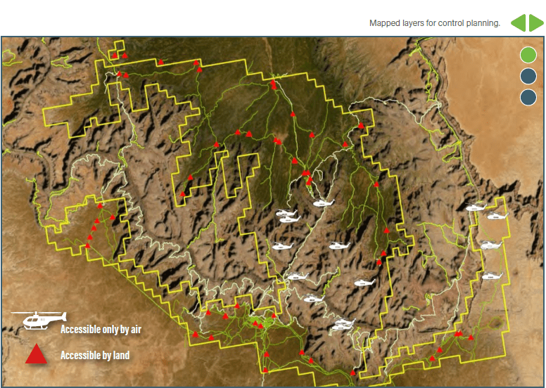
WGI utilized a helicopter provider to fly the survey team into the canyon for the collection of any remaining control points not accessible by ground. Map layers of the Wilderness Areas, Tribal lands, and nesting sites were also added in the finalization of the most-effective survey plan. The planning phase of this project was, in fact, the most time-consuming portion — but an early identification of all the challenges, coordination with the stakeholders, and robust action plans were essential for an effective data-acquisition phase.
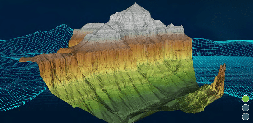
Lidar data collection began in the fall of 2019, completing in just 10 days. The primary advantage of aerial lidar technology is that large areas can be acquired in a fraction of the time traditional methods require. A fixed-wing aircraft, outfitted with a Galaxy lidar system, conducted 220 passes over nine flights. Luckily, the arid environment near GCNP is conducive for a clear atmosphere, necessary for topographic lidar acquisition. Conversely, nearby forest fires required careful monitoring of the wind direction so that each survey area could be acquired free of smoke in the atmosphere. The data is so precise that WGI Geospatial was able to map the elevations at a 0.5m resolution, producing extraordinarily detailed terrain models.
Upon completion, the lidar data was calibrated, adjusted to control, classified, and all the required deliverables were created to the LBS standards. In addition to providing the most detailed models and maps possible from the source data, the final elevation models included the breakline delineation and hydro-flattening of the water surfaces. This is a progressive step towards fully hydro-conditioned models and elevation-derived hydrology which represents the next era of nationwide lidar mapping.
The GCNP project was immensely successful. Projects like this require government quality assurance (QA) departments to review the data for nationwide consistency and quality in the publicly accessible data. In fact, the deliverable GCNP project data required no data corrections and only minimal metadata revisions, expediting the final acceptance. Lidar point statistics are better than the specification by 22% and 17% respective to pulse density and spacing. Point cloud accuracy, at the non-vegetated control check points, was also better than the accuracy requirement by approximately 22%. This data is already offering significant benefits, providing assessments of engineering issues related to state and public infrastructure; land-cover assessments; habitat assessments; evaluations of hydrological erosion and wildlife; assessments of fire risk in various parts of the National Park; and assessments of hydrologic flow in the Colorado River Basin.
Let the experts at WGI Geospatial help you with your mapping needs. Contact one of our professionals today!
WGI is a national design and professional services firm leading in technology-based solutions for the construction of public infrastructure and real estate development. At WGI, we’re providing Tomorrow’s Infrastructure Solutions Today.
On the latest episode of the WGI Unleashed podcast, we sit down with Lyndsey Duty, one of WGI’s Environmental Scientists based out of our Tampa, FL office!

WGI’s San Antonio team laced up their running shoes and braved the rain to take on the iconic Rock and Roll 5K – Discover how they turned challenges into triumphs in this memorable event recap!

With a legacy of supporting, empowering, & inspiring women in transportation, the WTS Central Florida’s Annual Awards & Scholarship Banquet was nothing short of a night to remember.

Discover how Austin is transforming urban development with proposed zoning changes, inclusive housing initiatives, and creative space preservation—all while embracing growth and sustainability.

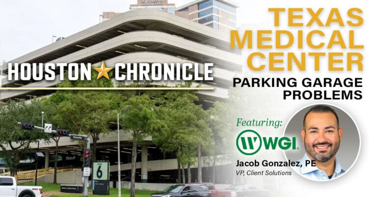
Texas Medical Center made $78M from parking last year. Why haven’t its busiest garages been upgraded in years?
Discover how WGI helped bring Lively Lane to life—a vibrant community in San Marcos that blends sustainable design, live/work townhomes, and natural beauty to create the perfect balance of urban convenience and serenity.
