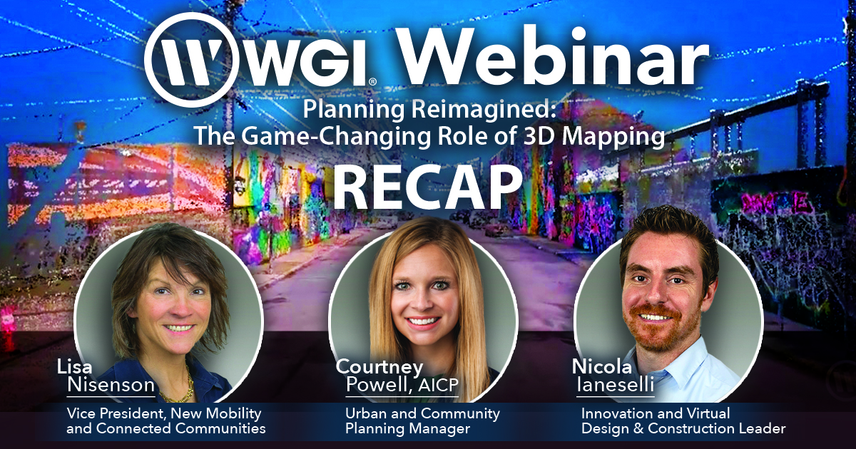
In our latest webinar, Planning Reimagined: The Game-Changing Role of 3D Mapping, WGI’s Lisa Nisenson, Nicola Ianeselli, and Courtney Powell, AICP, provided an in-depth look at how emerging geospatial technologies are revolutionizing urban planning, infrastructure development, and environmental management.
This session explored the transformative power of lidar, photogrammetry, and digital twins, demonstrating how these tools enhance decision-making and improve project outcomes. As cities and agencies seek innovative solutions to address rapid urbanization, climate resilience, and infrastructure maintenance, advanced mapping technology has become essential.
This webinar provided valuable insights into how planners can harness high-precision 3D data for applications ranging from urban growth management and infrastructure assessment to flood modeling and public engagement.
Key Takeaways from the Webinar:
- The Power of 3D & 4D Mapping – Advanced geospatial data collection methods provide deeper insights for transportation planning, land-use analysis, and environmental assessments.
- Digital Twins & Predictive Analytics – Digital twin technology allows for real-time monitoring, scenario modeling, and AI-driven decision-making, optimizing asset management and long-term planning.
- Infrastructure & Environmental Applications – From assessing road and sidewalk conditions to tracking urban tree canopies and watershed health, 3D mapping enhances data-driven planning efforts.
- Stakeholder Engagement with 3D Visualization – Interactive 3D models and simulations improve public communication, helping communities visualize planning decisions and future developments.
- Funding Opportunities for 3D Mapping Projects – Planners can leverage federal, state, and local funding sources to integrate advanced geospatial tools into their projects, increasing efficiency and reducing costs.
So, if you missed the live session, you don’t have to miss out on these expert insights – Watch the full webinar recap below to learn how WGI is harnessing the latest advancements in 3D mapping to drive smarter, more sustainable communities:
Contact Us!
Whether you’re planning for resilient infrastructure, environmental conservation, or smart city development, WGI’s geospatial experts are ready to help you integrate cutting-edge technology into your projects.
Contact our team today to learn how WGI can help streamline your planning efforts, enhance data accuracy, and bring your vision to life with 3D mapping solutions!