WGI’s strategic growth centers on expanding capability in markets where the firm is already engaged and where client demand continues to grow. North Carolina is a clear example. With established transportation engineering teams in Charlotte and Raleigh, WGI is now enhancing its presence by adding our full suite of Geospatial service offerings, providing additional resources to support complex transportation, utility, and infrastructure projects statewide.
WGI is now licensed to perform Land Surveying in North Carolina through its affiliate entity, WGINC Consulting Corp., providing additional technical resources that complement its existing operations and strengthen support for complex infrastructure projects.
This expansion allows WGI to deliver more integrated, data-driven solutions—particularly for projects involving utilities, corridors, waterways, and constrained environments—while continuing to serve clients through teams already embedded in the region.
Building upon an Established Presence in North Carolina
WGI’s presence in North Carolina is well established through its Charlotte and Raleigh offices, where transportation engineers and technical staff support roadway, railway, and multimodal infrastructure projects throughout the state. These teams bring deep familiarity with local conditions, agency requirements, and delivery expectations, including ongoing collaboration with the North Carolina Department of Transportation (NCDOT).
With land surveying licensure now in place, WGI can augment this local presence by providing direct access to surveying, subsurface utility engineering, and remote sensing professionals, supported by existing North Carolina staff and firmwide technical leadership. Clients benefit from expanded services without losing the continuity, responsiveness, or regional knowledge they already rely on.
This step reflects WGI’s long-term investment in North Carolina, expanding capability where growth, complexity, and demand continue to accelerate.
Geospatial and Utility-Focused Surveying for Infrastructure Projects
Many of today’s infrastructure challenges are driven by utility congestion, right-of-way constraints, and limited visibility into existing conditions. WGI’s expanded surveying and geospatial services are focused on providing early, reliable data that helps project teams manage these risks before design decisions are finalized.
Surveying and geospatial data are closely coordinated with utility information, subsurface utility engineering (SUE), and corridor constraints to support:
- Utility mapping and coordination
- Existing-conditions documentation for transportation and infrastructure corridors
- Early identification of conflicts and design constraints
- Improved planning for relocation, protection, and phasing
By integrating geospatial data with utility and transportation workflows, WGI helps clients reduce uncertainty, improve coordination, and make more informed decisions earlier in the project lifecycle.
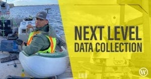
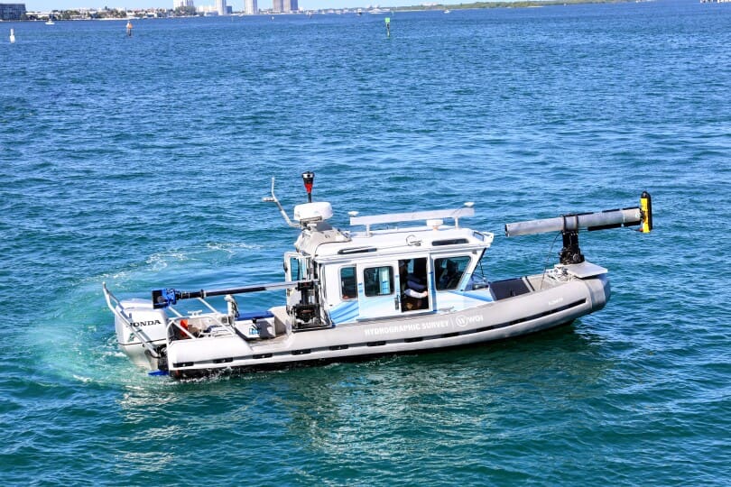
Hydrographic Surveying to Support Waterway and Infrastructure Projects
WGI’s expanded services in North Carolina also include hydrographic surveying, supporting projects that interact with rivers, streams, coastal waters, and inland waterways.
These capabilities are particularly valuable for transportation projects involving bridges, culverts, drainage systems, and water crossings, where conditions below the waterline are critical to design, permitting, and long-term performance.
By combining hydrographic data with topographic and geospatial information into a seamless format, WGI delivers a more complete understanding of site conditions, helping teams address hydraulic, environmental, and structural considerations with greater confidence.
Technology-Driven Geospatial Intelligence
WGI’s Geospatial teams leverage advanced technologies to efficiently capture complex environments across North Carolina. Mobile and aerial LiDAR, photogrammetry, and remote sensing allow large corridors and constrained sites to be documented safely and accurately, producing high-resolution surface models and detailed terrain data.
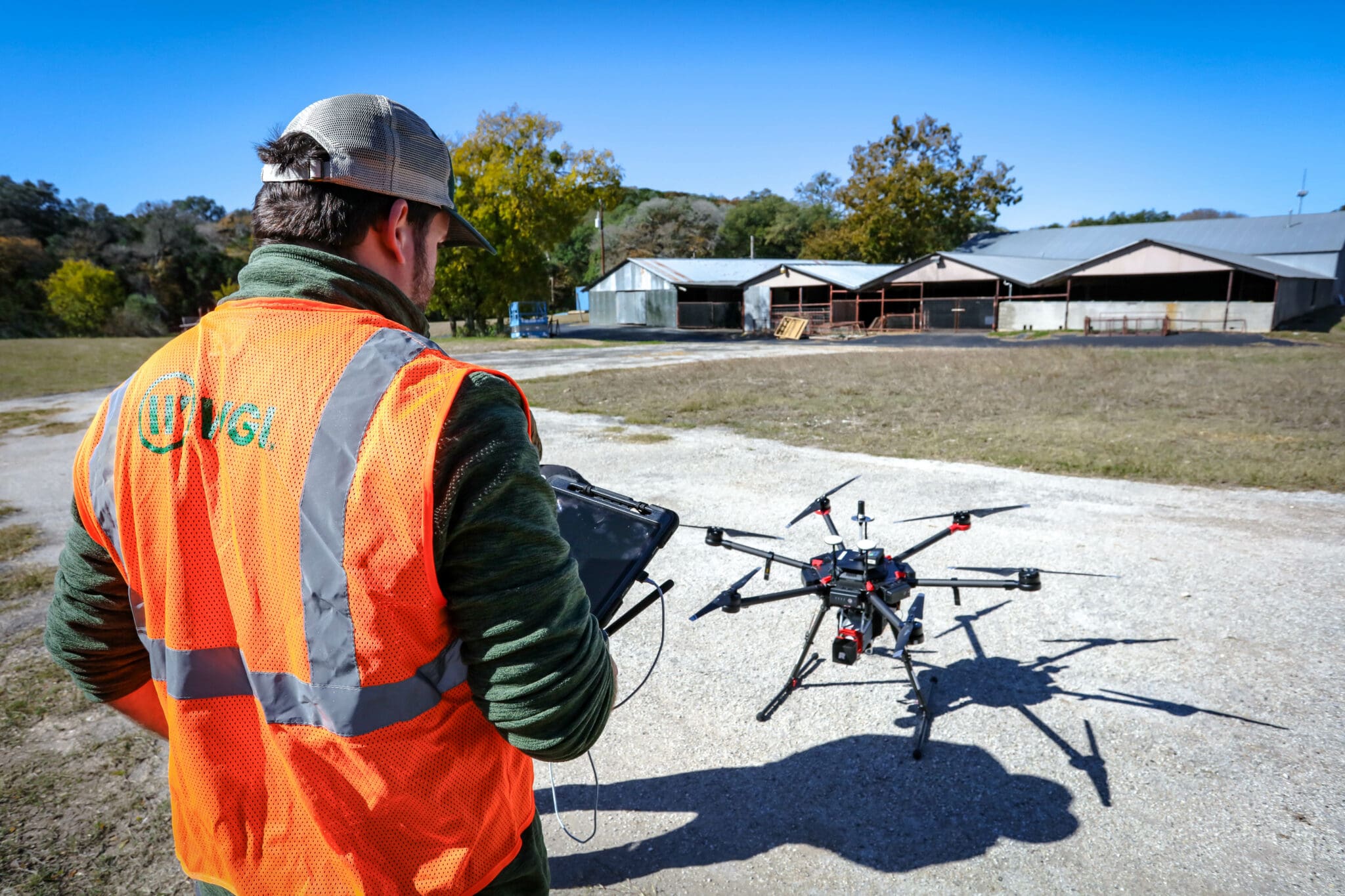
This technology-driven approach reduces field time, minimizes disruption, and delivers scalable datasets that support planning, design, utility coordination, and environmental analysis. Information is developed with downstream use in mind, ensuring data can be readily integrated into engineering and decision-making workflows.
Geospatial and Surveying Services Now Available Statewide
WGI now offers a full range of Land Surveying and Geospatial services across North Carolina, including:
- Boundary and right-of-way surveys
- Topographic and corridor surveys for transportation and infrastructure projects
- Control and geodetic surveys
- Utility-focused surveying and geospatial coordination (SUE)
- LiDAR, photogrammetry, and remote sensing data collection
- Hydrographic surveying for waterway and infrastructure projects
Services are delivered with a focus on accuracy, coordination, and early risk reduction, supported by local teams and backed by WGI’s nationwide technical resources.
Expanding Capability to Meet North Carolina’s Needs
The addition of licensed Land Surveying and Geospatial services strengthens WGI’s ability to support North Carolina clients with deeper technical integration, clearer insight into existing conditions, and more predictable project outcomes. It builds on the firm’s established transportation engineering presence while responding to the growing complexity of infrastructure and utility systems statewide.
As North Carolina continues to invest in transportation, utilities, and resilient infrastructure, WGI is positioned to support that progress with experienced local teams, advanced geospatial intelligence, and a long-term commitment to the region.
Contact Us
Whether your project involves complex corridors, utility coordination, waterways, or constrained environments, our local teams and nationwide technical experts are ready to help deliver accurate data and integrated solutions.
Connect with our team to learn how WGI can support your next project in North Carolina!