Note: this is the third post in a multi-part series focused on single-family housing developments. Read more posts in the series:
Part 1: Planning and Feasibility Steps
Part 2: Zoning, Density, and Layout
Part 3: Site Investigation Report
Part 4: Coordination, Design, and Permitting
Part 5: Grading and Drainage Design
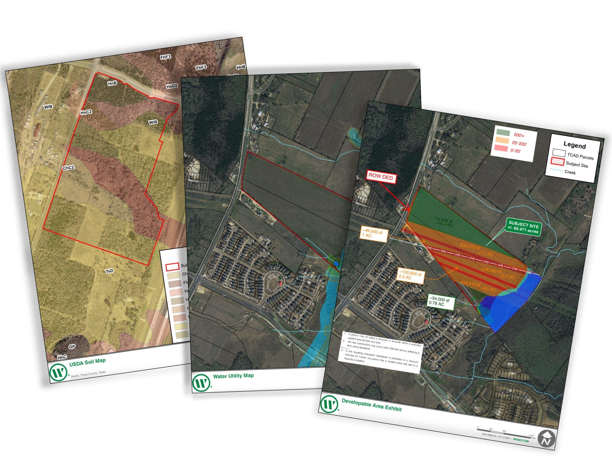
When looking to develop a property, knowing its potential — and pitfalls — is a very necessary action toward preserving capital. The first step in any development should be a Site Investigation Report (SIR). This report provides a developer the needed information to analyze the property’s value and determine margins based on the lot type and its density potential.
What’s in a Site Investigation Report
The SIR dives into detailed information regarding the site’s planning, surveying, and engineering associated items to provide a full picture of the parcel. This process involves gathering information found at the city level to determine zoning, water, and sewer service availability. County data sources are also used to pull available boundary information and determine if there are any issues with easements or other encumbrances associated with the property.
How Zoning Codes Come Into Play
From a planning standpoint, the zoning code is referenced to determine the lot size, width, and area minimums. This step also can inform a developer if any additional steps are necessary to rezone, and the likelihood of increasing the property’s value with additional up-front time. Often a city’s attitude about develop change due to council or outside forces and these circumstances can either hurt or help a potential development.
Hard Costs vs. Soft Costs
The SIR will identify the site’s issues with water and sewer availability, road access, site topography, drainage, soils and other items needed to understand a site. All these items are required to define the projected costs associated with the project. In addition to the site’s hard costs, SIR reports define the soft costs associated with soils exploration, planning, surveying, engineering, and fees that the city will charge a developer for review. The reports also include a breakdown of the area fees that a city typically charges, per lot or by acre, to offset the site’s development and its added burden on the city’s systems.
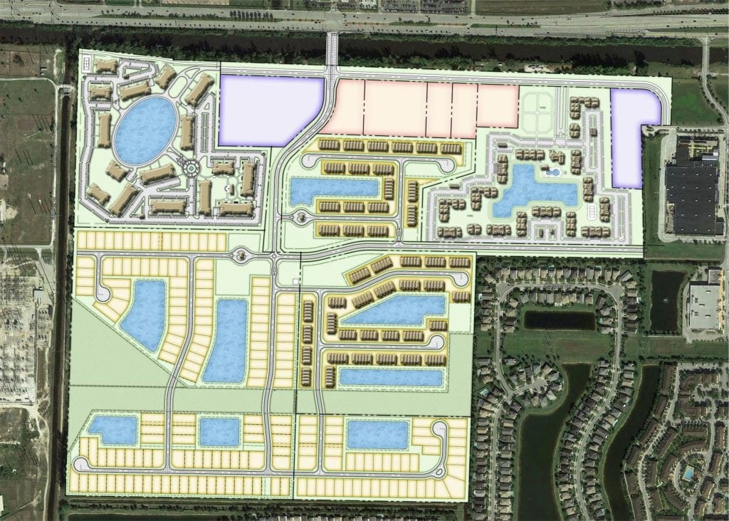
Conceptual Drawings
At this stage, we can also provide developers with a conceptual color drawing depicting how the site may be built by either using current zoning codes, or different zoning criteria. This method provides us with a starting point for discussion with city staff, while providing the developer relevant information for discussion with the owner or potential buyers of the finished lots. This conceptual drawing will typically change multiple times until all parties in the review process are satisfied.
“Will Serve” Letters
We also, as part of the due diligence associated with drafting the report, typically acquire “will serve” letters from the services providers. It offers the potential buyer yet another level of assurance that the site can be serviced with sewer and water.
Soil Exploration
The soils of Texas sites do not change drastically from place to place, but there are still unknowns associated with rock depths, water depths, and other pitfalls that must be explored. At this point in the process, we typically recommend the developer move forward with a site soil exploration that we help coordinate. A needed design tool, it can determine upfront if the site is viable for development.
Historic and Environmental Considerations
Another item we encourage is the review of the site’s historic and environmental conditions. It is vital to discover issues that will put constraints on the project and limit the site’s full potential, or deem the project unfeasible due to vulnerable plants, wetlands, or animals located there.
Narrowing Down the Timeline
In meeting with city staff, we determine the timelines needed for planning, zoning, surveying, and engineering to achieve vested rights for the project’s density. Also, a timeline is provided for full engineering approval and permitting, allowing the project to start construction. This timeline is typically used by developers when defining the terms of a Letter of Intent and with the final purchase of the property.
Limit Your Exposure To Risk
We want your development to succeed and a site investigation report is a great way to limit your exposure to risk. An SIR helps developers determine the viability of a project and gauge if the risks result in the necessary profit margins.
Development is a gamble – Let our team of professionals help you hedge your bets and decide whether it’s time to fold or go all in on that property you’ve been eyeing. Contact us today to schedule a conversation about your next project.