Innovation From Within: WGI’s Associates Pitch Ideas for the Future
WGI associates participated in an internal contest to pitch innovative ideas to improve the company, their work product, and the built environment.
Learn from award-winning professionals — explore our whitepapers, blogs, and the latest industry updates.
Join our dynamic organization of engineers, land surveyors, landscape architects, environmental scientists, and architects!
Talk to a market leader today! We’ll answer any questions you have about our professional services.

Broadband providers and Outside Plant Engineering (OSP) firms turn to WGI for fielding support to meet the demanding pace of broadband rollout across America. WGI understands the cost and schedule challenges for owners, engineers, and constructors of new broadband networks. WGI leverages its unique technologies to perform broadband-related field data collection — for as little as a hundred to thousands of miles of network areas at a time — producing cost-effective, rapid, and accurate 2D and 3D mapping for design of fiber and small-cell networks. Our mapping and inventories also help small-cell providers with precision when adding density of antennas by location. The information and data we provide meet the needs for make-ready engineering, pole-loading calculations, maintenance of traffic (MOT) permits, and planimetric base mapping. We also deploy vehicle-based ground-penetrating radar systems operated at traffic speed for detecting subsurface utilities potentially impacted by directional boring. All this information and data is optionally provided to planners and engineers for 3D design via our client-accessible geographic information system (GIS) platform.
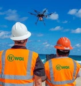
From the skies, WGI leverages advanced imaging instrumentation from unmanned rotary and fixed-wing airborne platforms to capture and digitize all visible features across all scales of telecom infrastructure networks. WGI’s distribution of industry leading airborne lidar and imagery equipment allows rapid and efficient deployment of sensor assets throughout the United States. The aerial sensor fleet is backed up by a team of project-design professionals specializing in selecting the right combination of instrumentation for each unique telecom asset network. WGI’s three fixed-wing lidar and imagery systems are ideal for the efficient mapping of large-scale or remote distribution networks by collecting hundreds of linear miles in a single day, while capturing backlots and aerial-perspective information with a reduced ground effort. For large-scale projects where high-resolution geospatial data is required to precisely locate service lines and pole attachments, WGI is the first adopter of a dual-laser lidar and imagery sensor. It’s capable of semi-oblique point cloud capture at unprecedented resolutions in the large-scale sensor class. WGI supports smaller-scale mapping, design, and asset management projects as well. A fleet of small and heavy-lift UASs, including DOD NDAA-compliant, U.S.-manufactured platforms, offer high-resolution lidar and inspection-ready oblique imagery. (Thermal for issues – more for electric) WGI’s geospatial data, derived from lidar and imagery, is engineering ready for the inspection and digitization of telecom assets and the surrounding environment.
WGI’s services and products assist our clients in meeting their deadlines, while they continue to ramp up fiber and small-cell networks for new construction or new attachments. Presently a large portion of construction activity is based on the government’s historic federal funding, helping providers deploy high-speed internet to underserved areas and rural communities. Parallel funding is provided for local governments to accurately measure where high-speed service reached Americans — and where it has not. There is significant emphasis placed on expediting the provision of needed broadband service to rural communities. Concurrently, network and broadband providers are performing system upgrades in many areas due to increased competition.
For electric utilities or other pole owners, existing tenant attachers, and potential attachers, WGI’s services improve and speed the process of preparing poles for new attachments or make-ready. Our products fulfill needs for consistent data and information. This efficiency, in the rollout process for all pole owners and attachers, is because the information is an unambiguous digital twin. New attachers can determine if there is a need to rearrange any, or all, wireline attachments in the communications space and determine if any existing violations require remediation.
Pole attachers can effectively prepare their design, process permits, and construction. Owners know exactly the nature of in situ, without conducting their own windshield reviews of field conditions. Owners will have better insights if proposed attachers plan to conform to internal design, construction, and maintenance standards.
WGI’s helps its customers business activities for connecting homes and businesses with superfast fiber-optic cables or small cells. For contractors doing design and construction work, we provide the most efficient solutions supporting a competitive price for design and construction. If your project area exceeds 100 contiguous miles of fiber or city-wide small-cell deployments, WGI is your best choice for mapping and inventories.
WGI’s approach offers distinct advantages over other fielding methods. We eliminate the need for a large field workforce. There is a reduced need to set up temporary work zones or disrupt traffic flow for any fielding, minimizing safety risks for all. For poles, our services and products are superior for planning modification or replacement of a utility pole, or adding lines or equipment on the utility pole, and determining if poles can accommodate additional facilities.
Our imagery and GIS viewer consist of a comprehensive 360° and 3D view of the environment for remote desktop engineering. With a 3D view, engineers have better identification and assessment of possible safety hazards. This includes identifying overhead power lines, structures, or other obstructions posing risks during make-ready and construction. For planning, design, and implementation of small-cell networks WGI’s data products are extraordinarily useful. Products are used to develop network signal propagation models, simulate signal coverage, and analyze any potential interference sources.
Whether you are planning aerial or underground fiber routes or small cell network design, WGI has the technology and the experience to bring the field to your desk.
For more information about this study or to have a conversation with one of our experts, please contact us today.

WGI is a national design and professional services firm leading in technology-based solutions for the construction of public infrastructure and real estate development. At WGI, we’re providing Tomorrow’s Infrastructure Solutions Today.

WGI associates participated in an internal contest to pitch innovative ideas to improve the company, their work product, and the built environment.

WGI stayed in growth mode throughout the pandemic as it moved to expand its geographic footprint by furthering early steps at organic expansion.

Melissa’s addition to the team solidifies WGI’s leadership in helping communities harness the benefits of much-needed infrastructure projects throughout the nation.

WGI continues its investments in the latest cutting-edge technologies with the addition of the RIEGL VMX-2HA to the Geospatial Team’s Mobile lidar collection.

In the WGI Geospatial Division, we are innovators. While anyone can purchase the latest technology such as UAS and lidar systems, we pride ourselves on the unique ways we leverage technology to provide better deliverables for our clients. Here’s what we’re working on…

ENR editors have recognized WGI as the 2021 Southeast Design Firm of the Year!
You’ve been searching for a place like WGI. We look forward to meeting you soon.
Sign up to receive emails to hear our latest news and achievements in our monthly newsletter.
Enter your zip code, and we’ll personalize your experience with local projects, office locations, team members, and more.
WGI supports its associates with meaningful opportunities for growth, strong benefits and perks, while we work collaboratively with clients and co-consultants to shape and improve communities.


WGI is a dynamic organization with opportunities nationwide for engineers, land surveyors, landscape architects, environmental scientists, and architects.