
These higher rainfall values will help local authorities with the planning and designing of infrastructure to reduce the threat of flooding within the City. The higher rainfall values will greatly affect existing and new developments adjacent to the floodplain and the design of drainage systems for new developments.
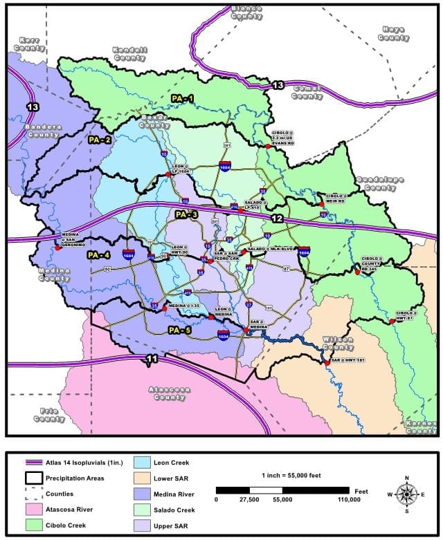
The implemented NOAA Atlas 14 rainfall data divides the City of San Antonio into five precipitation regions. This provides a more realistic rainfall distribution to the different areas of San Antonio. Generally, the northern regions of San Antonio and Bexar County will experience a greater increase in rainfall intensities as opposed to the southern precipitation regions.
The San Antonio River Authority (SARA) is working alongside the Federal Emergency Management Agency (FEMA) to update the current floodplain maps to account for the increase in rainfall values. This means that properties adjacent to existing floodplain could potentially have even greater portions of floodplain adjacent or within the property, which will in turn impact developable land and even land value.
Design of proposed developments within the City of San Antonio will need to incorporate drainage systems with higher capacities to account for the higher rainfall intensities adopted from NOAA Atlas 14. The increase in rainfall depth will not only impact design for new developments but potentially existing infrastructure as well.
The City of Antonio typically requires a drainage study during a subdivision plat, a master development plan, or during permitting. As such, properties with previously approved drainage studies and drainage infrastructure that will go in for platting or permitting will require an updated study using the NOAA Atlas 14 rainfall intensities. The updated study will need to verify that any increase in stormwater runoff generated by the site is contained within the existing drainage systems or drainage easements to a point 2000-ft downstream of the development.
Check out our Houston County Detention/Drainage and Floodplain Updates Blog Post.
Check out our National Oceanic and Atmospheric Administration Atlas 14 Revision Blog Post
Other Helpful Links:
https://www.sanantonio.gov/TCI/Services/Storm-Water-Plan-Review