
Podcast
WGI Unleashed Episode 89: Lyndsey Duty, Environmental Scientist
On the latest episode of the WGI Unleashed podcast, we sit down with Lyndsey Duty, one of WGI’s Environmental Scientists based out of our Tampa, FL office!
As the Commonwealth of Virginia strives to create vibrant, sustainable towns and cities, it faces a dynamic landscape of technological advancements. Emerging technologies promise efficiency, connectivity, and improved quality of life, yet policy can hinder or enable their seamless integration into urban planning and development. Urban planners, policymakers, developers, and residents grapple with balancing innovation with privacy, security, and equitable access.
In this edition of our Policy Puzzle series, we delve into a few innovative tools, their land-use planning applications, and the Commonwealth-specific policy measures that dictate their use.
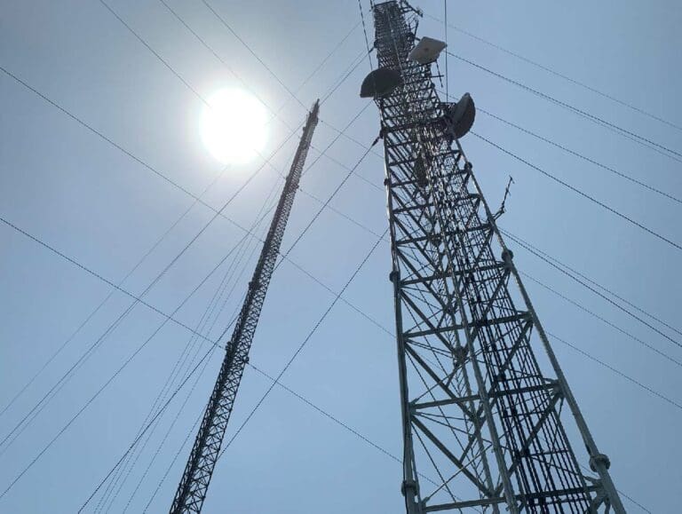
Drone usage can enhance the efficiency, accuracy, and cost-effectiveness of urban planning, particularly when paired with LiDAR (Light Detection and Ranging). Here’s how they contribute.
Drone policy in Virginia is vague. Per section §15.2-926.3 of the Virginia Code, localities cannot regulate the use of privately owned, unmanned aircraft systems (UAS) through ordinances or regulations. However, HB 2350 (2017) made it a Class 1 misdemeanor to use a UAS to trespass upon the property of another for peeping or spying.
HB 2125 (2015) requires law enforcement agencies to obtain a warrant before using a drone for any purpose except in limited circumstances. Yet, the unclear wording of the law seems to allow drone usage for public planning purposes by local governments, institutions, and private organizations.
Internet of Things (IoT) plays a pivotal role in shaping smart cities by connecting previously unconnected elements (e.g., street lights, meters, utilities) with data, devices, and people. IoT empowers urban planners to create safer, more sustainable, and efficient communities by using real-time data from IoT devices to inform decision-making.
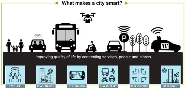
With the vast amounts of indiscriminate data collected by IoT devices, privacy is increasingly of concern. Virginia is one of four US states with a comprehensive data protection law for its residents. The Virginia Consumer Data Protection Act (VCDPA) took effect on January 1, 2023, requiring organizations to gain permission from consumers to use their data. However, it is unclear how smart infrastructure data collected by governments apply to the VCDPA.
Artificial Intelligence (AI) plays a pivotal role in modern urban planning, revolutionizing how cities are designed, managed, and optimized. AI empowers planners to create smarter, more sustainable cities by leveraging data collected through drones, LiDAR, and IoT devices. The following are a few applications of AI in planning:
Numerous policies and directives have also emerged recently related to the use of AI in Virginia.
Planners and the development community should stay tuned to the Commonwealth’s future regulatory moves and their implications for the public sector.
For more information on the complexities of recent and potential state-level urban and community planning policy in the Commonwealth or to receive expert support in planning your next project, be sure to Contact Our Team today!
WGI is a national design and professional services firm leading in technology-based solutions for the construction of public infrastructure and real estate development. At WGI, we’re providing Tomorrow’s Infrastructure Solutions Today.
On the latest episode of the WGI Unleashed podcast, we sit down with Lyndsey Duty, one of WGI’s Environmental Scientists based out of our Tampa, FL office!

WGI’s San Antonio team laced up their running shoes and braved the rain to take on the iconic Rock and Roll 5K – Discover how they turned challenges into triumphs in this memorable event recap!

With a legacy of supporting, empowering, & inspiring women in transportation, the WTS Central Florida’s Annual Awards & Scholarship Banquet was nothing short of a night to remember.

Discover how Austin is transforming urban development with proposed zoning changes, inclusive housing initiatives, and creative space preservation—all while embracing growth and sustainability.

Texas Medical Center made $78M from parking last year. Why haven’t its busiest garages been upgraded in years?

Discover how WGI helped bring Lively Lane to life—a vibrant community in San Marcos that blends sustainable design, live/work townhomes, and natural beauty to create the perfect balance of urban convenience and serenity.
