
Video: Introduce a Girl to Engineering Day – Girl Day 2020
With more than 1,400 volunteers from UT Austin, nonprofit organizations, and AEC firms, Girl Day has become the largest event of its kind in the United States!
Learn from award-winning professionals — explore our whitepapers, blogs, and the latest industry updates.
Join our dynamic organization of engineers, land surveyors, landscape architects, environmental scientists, and architects!
Talk to a market leader today! We’ll answer any questions you have about our professional services.

The following table prescribes the land uses permitted under certain conditions, including noise reduction measures.
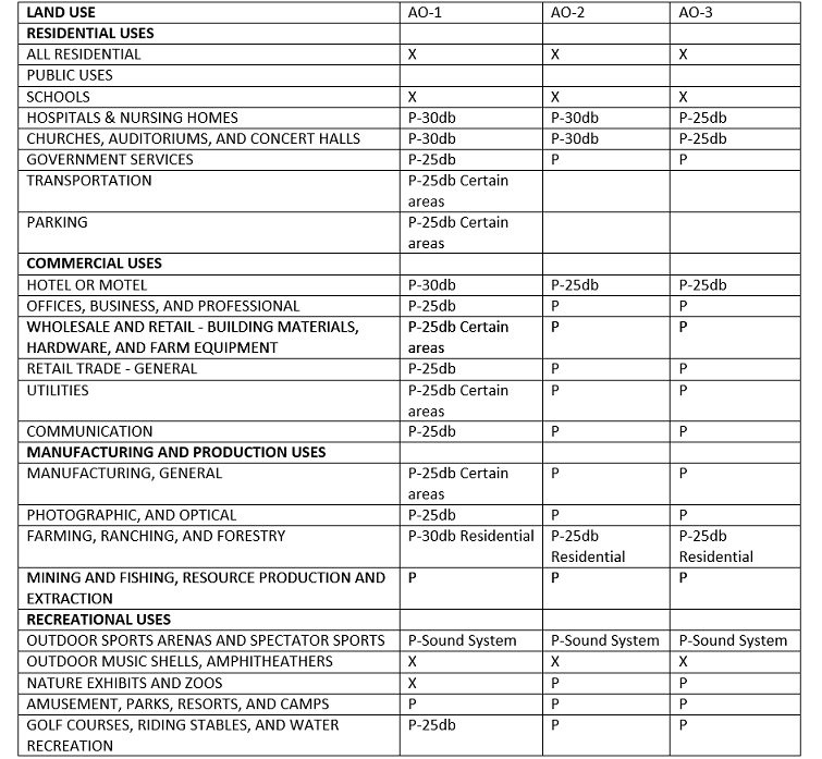
In the Airport Overlay Table:
Residential and school uses in airport overlay zone three, AO-3, are permitted only on property that is included in a final plat that was recorded on August 20, 2001, is located in a municipal utility district on December 31, 2001, or located in a neighborhood plan combining district on December 31, 2001.
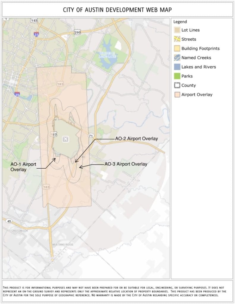
In addition to land use restrictions, the following airport hazards are described and prohibited: any structure or object of natural growth: exceeds the height limits of Section 25-13-22; interferes with visual, radar, radio, or other systems for tracking, acquiring data relating to, monitoring, or controlling aircraft; interferes with a pilot’s ability to distinguish between airport lights and others lights, results in glare in the eyes of a pilot, or impairs visibility in the vicinity of the airport; creates a wildlife hazard, as defined by the Code of Federal Regulations Title 14, Part 139; or otherwise endangers or interferes with the landing, taking off, or maneuvering of an aircraft.
Please see Chapter 25-13 – Airport Hazard and Compatible Land Use Regulations in the City of Austin Code of Ordinances for more information.

WGI is a national design and professional services firm leading in technology-based solutions for the construction of public infrastructure and real estate development. At WGI, we’re providing Tomorrow’s Infrastructure Solutions Today.

With more than 1,400 volunteers from UT Austin, nonprofit organizations, and AEC firms, Girl Day has become the largest event of its kind in the United States!

WGI’s Lisa Nisenson was featured on the American Planning Association’s podcast to discuss rapidly changing e-commerce trends and technologies, and the long-term implications of COVID-19 on the way planners are thinking about the future.

WGI’s experts from multiple divisions share their thoughts and predictions in terms of what we can expect to see in our industry in 2022 and beyond.
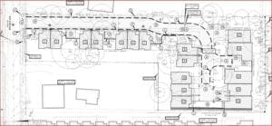
Learn more about detached condos – traditional homes that sell as a fee-simple condominium. WGI is the local expert for this project type and we are ready to get started on your next project!

By Matthew Prendergast, KXAN Click here to see the original story A 51-story condominium tower is being planned for construction in the Rainey Street district

WGI is the engineering and design consultant for the 115-acre Northline project in Leander, TX.
You’ve been searching for a place like WGI. We look forward to meeting you soon.
Sign up to receive emails to hear our latest news and achievements in our monthly newsletter.
Enter your zip code, and we’ll personalize your experience with local projects, office locations, team members, and more.
WGI supports its associates with meaningful opportunities for growth, strong benefits and perks, while we work collaboratively with clients and co-consultants to shape and improve communities.


WGI is a dynamic organization with opportunities nationwide for engineers, land surveyors, landscape architects, environmental scientists, and architects.