As demand for high-quality spatial data continues to surge, the AEC industry is undergoing a transformation in how information is collected, managed, and applied across the project lifecycle. What was once a supporting function is now central to decision-making, with geospatial data playing a critical role in everything from design and asset management to simulation and long-term planning.
At the same time, advances in lidar, UAV technology, and data processing, combined with the emergence of AI, are rapidly expanding both the scale and the value of what can be delivered. The challenge is no longer just capturing data, but making it accessible, usable, and impactful across increasingly complex programs.
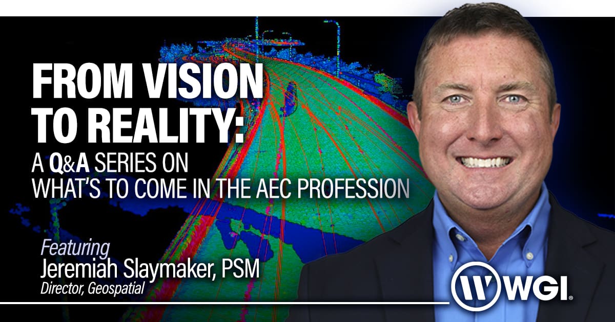
In this edition of From Vision to Reality, we sit down with Jeremiah Slaymaker, PSM, Director of Geospatial at WGI, to discuss how the geospatial profession is evolving, the growing importance of data-driven decision-making, and what it takes to operate at scale in today’s environment.
Jeremiah shares his perspective on emerging opportunities like statewide lidar programs, the realities of managing massive datasets, and how WGI is leveraging innovation and multidisciplinary collaboration to deliver smarter, faster, and more integrated solutions.
1. What is your outlook on the current state of the AEC profession? How do you see the industry evolving over the next 12–24 months, and what role will WGI play in shaping that future?
I tell students all the time, “It’s a great time to be a surveyor.” And I really believe that. The AEC industry is hungry for spatial data right now, and that demand is only growing.
What’s changing isn’t just how we collect data; it’s what we do with it afterward. Over the next 12–24 months, you’re going to see a big shift in how data is processed, stored, and reused across multiple applications. AI is starting to play a role here too, especially in making post-processing more efficient.
At WGI, we’ve invested heavily in mobile lidar. We’re running more scanners across the Southeast than anyone, and we’re continuing to look at how new tools and technologies can help us get more value out of that detail. At the end of the day, it’s not just about collecting data anymore, it’s about making it useful.
2. What changes are you seeing across the AEC profession, and how do they present new challenges or opportunities?
This is a fun question because there’s a lot going on right now. I’ve always said technology has probably had the biggest impact on the geospatial profession, but honestly, you could say the same about a lot of industries these days.
The pace of innovation isn’t slowing down, it’s speeding up. And as that happens, everything around it has to evolve too. Policies, procedures, even the way we think about professional licensing. Those conversations are ongoing and aren’t going away anytime soon.
Then you layer in market dynamics, and things get even more interesting. Client expectations are changing, timelines are tighter, and the need for integrated, data-driven solutions is growing. It’s a very dynamic environment, and the firms that do well are the ones that can adapt quickly.
3. What unique opportunities does WGI face as we move through the remainder of the year and into 2026?
One of the opportunities we’re really excited about is FDOT’s push to establish a statewide lidar program. It’s a big deal because it’s all about creating a consistent, high-quality dataset across the entire state.
Instead of every district doing things a little differently, the goal is to standardize how data is collected and used whether it’s for design, asset management, or even emergency response. That kind of consistency opens the door for a lot of long-term value.
WGI is in a great position to support this. We’ve got a strong relationship with FDOT, and we’ve already collected a ton of data across Florida, especially along major corridors. Between that and our continued investment in aerial lidar, we’re excited to be part of something that’s going to have a statewide impact.
4. What challenges does WGI anticipate looking ahead to 2026, and how is the firm preparing to address them?
If you go back 10 years, a “big” project for us might have been a 15-mile survey along I-95. Today, we’re not just talking about projects. We’re talking about programs that can cover thousands of miles.
That creates a whole new set of challenges. First, how do you safely and efficiently collect that much data? But just as important, what do you do with it once you have it?
Storage, management, accessibility…those are the conversations we’re having now. And there’s no one-size-fits-all solution. We’re looking at everything, from expanding infrastructure to cloud-based options, to make sure the data isn’t just collected but actually usable.
As we head toward 2026, that’s really the balancing act, handling massive datasets while still making them practical and valuable for our clients.
5. How does collaboration across WGI’s multidisciplinary teams enhance the firm’s ability to address industry challenges?
This is one of my favorite topics. Honestly, collaboration is a big reason I’ve spent my entire career in multidisciplinary firms, and a big part of why I’ve been with WGI as long as I have.
What makes WGI unique is that our geospatial team supports both internal teams (engineers, architects, planners) and a wide range of external clients. That gives us a really well-rounded perspective on how to approach problems.
A good example is our work with Duke Energy. They’ve got a lot of vendors, but we’re one of only a few that can bring the full package: SUE, aerial lidar, bathymetric, and traditional field crews. That allows us to respond quickly, especially when something urgent comes up, and do it safely.
At the end of the day, it’s about having the right people and the right tools, and knowing how to bring them together.
6. How is WGI leveraging innovation to maintain its leadership position in the AEC profession?
For us, innovation really comes down to how we think about data. Not just collecting it, but how it can be used down the road.
A great example is SunTrax. We originally got involved to help set up a UAV calibration site, which was pretty straightforward like control networks, aerial targets, that kind of thing. But as the project evolved, so did the opportunity.
We ended up capturing a full digital dataset of the facility, such as lidar, orthophotography, 3D modeling, the whole package. Now, that same data is being used to develop a digital twin, which could support things like flight simulations and advanced air mobility.
That’s the exciting part, seeing how something that started with one purpose can grow into something much bigger. And that’s where we’re really focused, staying ahead of those trends and finding new ways to get more value out of the data.
7. What lessons from recent projects are shaping your approach as we look toward 2026?
One of the bigger milestones for us recently has been expanding into North Carolina. It took some time to get licensed and prequalified, but it’s opened up a lot of new opportunities.
We’re already working closely with our teams in Raleigh and Charlotte and starting to look at opportunities with NCDOT and Duke Energy in that region. It’s exciting, but it also comes with responsibility. We’ve got to make sure we’re putting the right people and resources in place to support that growth.
If there’s one takeaway, it’s that growth doesn’t just happen; you’ve got to be intentional about it. And as we look ahead, that’s exactly what we’re focused on.
Join the Conversation
The role of geospatial data in the AEC industry is expanding rapidly, shifting from a foundational input to a strategic asset that informs decisions across the entire project lifecycle. As datasets grow larger and more complex, the ability to efficiently manage, process, and apply that information becomes a defining capability.
Jeremiah’s insights highlight an important shift: success is no longer measured by how much data is collected, but by how effectively it is used. From statewide LiDAR initiatives to digital twin applications, the value of geospatial work is increasingly tied to integration, accessibility, and long-term usability.
At the same time, scaling these capabilities requires intentional investment—in technology, infrastructure, and the people who bring it all together. Balancing rapid growth with thoughtful execution will be critical as programs expand and expectations continue to rise.
As we look toward 2026 and beyond, firms that can turn complex data into clear, actionable insight will play a central role in shaping the future of the built environment.
Stay tuned for more perspectives from the leaders driving WGI’s innovation and growth in upcoming editions of From Vision to Reality.