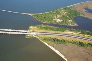
Project Spotlight: Design Build SR-8 (I-10) Multilane Highway
The widening of the SR-8 (I-10) multilane highway from the Escambia Bay Bridge to East of SR 281 (Avalon Boulevard) in Santa Rosa County, was completed in August 2019.
Learn from award-winning professionals — explore our whitepapers, blogs, and the latest industry updates.
Join our dynamic organization of engineers, land surveyors, landscape architects, environmental scientists, and architects!
Talk to a market leader today! We’ll answer any questions you have about our professional services.
If you haven’t paid attention to autonomous-vehicle technology’s rapid evolution, you are not alone. Over the past year, the COVID-19 pandemic dramatically affected transit volumes and safety.
The same pandemic that hit “pause” on both transit and the economy hit “fast-forward” on autonomous vehicle development and testing. The empty streets arising from COVID lockdowns and stay-at-home orders proved the perfect testing grounds for autonomous vehicles. Developers could test them on urban streets with minimal risk to pedestrians and other drivers. One robot taxi service, Waymo One, completed more than 100,000 trips last year, and its fully driverless vehicles clocked 70,000 miles on U.S. roads.
For urban planners and city administrators alike, this is both exciting and terrifying at the same time. It means that cities need to revamp their urban and transportation plans to accommodate vehicle automation, and do it quickly. A handful of larger cities are already integrating autonomous transportation into the downtown plans, but smaller and mid-sized cities have made less overall progress. Many haven’t even started.
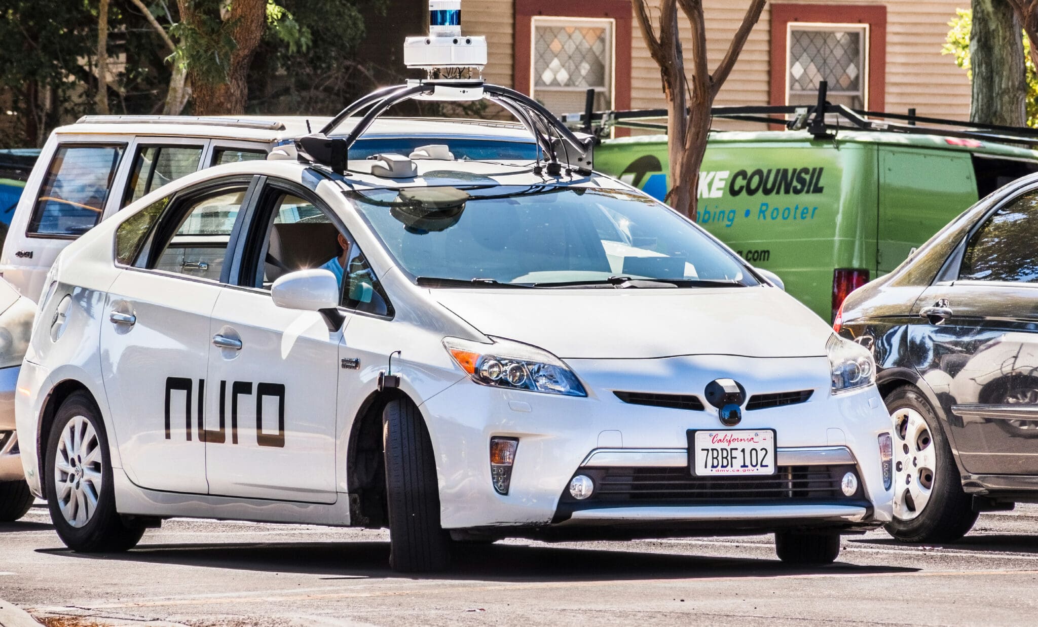
The first step is understanding the state of the autonomous vehicle industry right now. While the development of privately owned automated vehicles is slower than expected, we are seeing traction with automated shuttles and delivery vehicles. Delivery robots, like those manufactured by Nuro, are also showing great promise. Well-known brands like Domino’s, Kroger, Walmart, Chipotle, and CVS are already using Nuro delivery robots to safely transport their products throughout the U.S.
These small electric vehicles are emission-free and, because of their diminutive size, improve safety on neighborhood streets. Neighborhood streets currently clogged with Amazon, FedEx, and UPS trucks will benefit from these smaller, safer, and cleaner delivery robots.
Likewise, autonomous-shuttle technology also improved, and we are starting to see self-driving, emission-free buses conveying people throughout downtown areas and across business, hospital, and university campuses.
These autonomous buses and delivery robots are particularly well suited for master-planned communities that are privately owned, offer off-site parking, and aren’t nearby to entertainment and tourist areas. They offer simple routes for low-speed circulators.
But many communities present more complicated landscapes. Most city grids are not developed in a simple pattern; rather, they evolved over time as communities expanded and development altered the landscape. Roads may wind their way around buildings, parks, downtown landmarks — sometimes without rhyme or reason. The geometric grids of Washington DC, Chicago, Manhattan, Detroit, Salt Lake City, and other master-planned cities are the exception, not the rule. While creatively or organically (as in Boston) laid out roads add character, they cause significant challenges to autonomous vehicles.
Every community is unique. There are no cookie-cutter solutions to accommodating autonomous vehicles. Every city’s plan should address that community’s unique needs. At the same time, it is paramount to develop standards dictating how automated vehicles both react to and communicate with surrounding vehicles, pedestrians, and infrastructure. These will all influence what future infrastructure looks like, how communities are designed, and most importantly, managed.
So, where can you start? Safety is the primary consideration when introducing autonomous vehicles, and it’s necessary to balance the requirements — providing a vibrant pedestrian experience, maintaining traffic flow, and transit operations — while integrating the needs of autonomous vehicles.
The move to large-scale vehicle automation (including fully driverless vehicles) is expected to occur over the long term. For the foreseeable future, there will be a mix of vehicles that contain varying levels of automation. Some cities implemented separate lanes for automated vehicles to further safety, particularly for low-speed automated shuttle services, as exemplified by Atlanta’s North Avenue project.
Some states are considering exclusive automated truck platoon lanes as well, for long-distance freight services. However, not every community has the necessary street space to provide separate self-driving lanes. This is particularly true of smaller and mid-sized cities where city streets and sidewalks may not be wide enough for reconfiguration and development of discrete autonomous vehicle lanes. In these cities, mixed-flow strategies can be pursued, in which traditional and self-driving vehicles would have to safely and efficiently coexist.
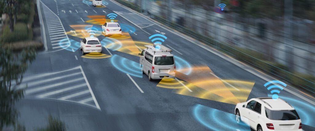
There are a number of common strategies for accomplishing this. Municipal planners and their design and planning consultants can limit unprotected left turns whenever possible. If traditional traffic and autonomous vehicles aren’t turning towards each other, the risk of collision can be significantly reduced. By limiting automated vehicle traffic to making right turns, planners can make merging in and out of traffic much easier and safer. Information management is also a key consideration in cities with mixed-flow traffic. Automated vehicles can help manage the flow by communicating their locations and trajectories with traffic-management technology. For instance, self-driving buses could constantly communicate with each other and with traffic-management technology to inform of their location, when they will arrive at intersections, current schedule on-time status, and other potential points of conflict with other vehicles.
In turn, traffic signals can use this information to optimize traffic flow to prioritize movement of transit vehicles, better manage high-pedestrian locations, and provide vehicle-collision warnings, red-light running alerts to oncoming vehicles, and warn of potential vehicle, bicycle, and pedestrian conflicts.
WGI can help cities determine whether discrete self-driving lanes or mixed-flow strategies will best meet their unique needs. Our planners, traffic operations engineers, and autonomous vehicle experts help create plans that will effectively manage autonomous vehicles, traffic flow from traditional cars and trucks, and pedestrian flow alike.
Data management is essential to real-time traffic management utilizing vehicle data. For example, smart-work zones can collect data from vehicles in real-time, also providing advance lane-closure information and continuous updates either directly to vehicles through wireless or cellular-based vehicle-to-everything (CV2X) communications or via cloud-based connections to traveler information apps such as Waze, 511, and other systems.
Traditionally, smart-work zones were designed to safely route traffic through work zones to keep construction workers safe. In the context of autonomous vehicles, smart-work zones use wireless V2X infrastructure to continuously communicate with self-driving vehicles. The data that’s transmitted from the vehicles to a local or regional control center is analyzed, and the system uses that data to manage traffic operations tools like dynamic message signs and traffic signals. The data can also be used to reroute traffic to ease congestion, avoid accident scenes or construction sites, or accommodate special events. This same system will lay the groundwork for a much larger communications system for vehicles and infrastructure after the work zone is complete.
These data-management tools will also be essential for managing the curb. When automated vehicles and the systems that manage them are connected using CV2X, it’s easier to manage the curb and schedule curbside areas for different uses. For example, it can schedule pick-up/drop-off uses during commuting hours and then switch utilization to deliveries during the mid-day hours. This can dramatically improve the performance of downtown streets.
As wireless broadband technology advances (5G and beyond) are widely available to support CV2X, the smart-city technologies on which autonomous vehicles rely will be even more efficient and effective. The challenge then will be selecting and installing the broadband infrastructure needed to effectively and efficiently operate autonomous-vehicle networks. WGI can help cities select the right infrastructure or design a private wireless network to provide the most reliable coverage.
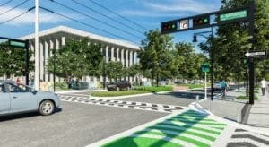
But these high-tech tools aren’t the only considerations; traditional traffic elements such as crosswalks, road lines, and pavement markings are just as important. For the sake of pedestrian safety and traffic flow, it’s essential for autonomous vehicles to recognize these planning elements. If a self-driving car doesn’t recognize a crosswalk, pedestrians using that crosswalk could be at risk. Likewise, if it doesn’t recognize road markings it may have difficulty staying in the proper lane. Or if robotic delivery vehicles have trouble recognizing drop-off/pick-up areas they may have trouble completing their deliveries.
Ultimately, these markings will need to be standardized. Original Equipment Manufacturers (OEMs) designing and building the various autonomous vehicles and robots will need to work with cities, states, and the federal government to create a standard set of markings that can be recognized by vehicles. And of course, the OEMs must also create artificial intelligence tools to help autonomous vehicles recognize pedestrians, bicyclists, stop signs, and other traffic signs to assure safe introduction to communities. Standardization of CV2X interfaces between vehicles and infrastructure, mobile phones, bicycles, and other mobility appliances will enable faster adoption and deployment of these technology tools across the entire transportation market, meaning custom or proprietary solutions for individual cities or communities should not be necessary.
As important as it is for cities to begin planning for the introduction of self-driving vehicles, implementing these plans won’t be inexpensive. In addition to the construction costs associated with renovating downtowns to accommodate these vehicles, autonomous buses and shuttles are costly, and the technology needed to manage city-wide networks is, too.
The good news is that federal agencies and state governments are committed to making the transition work, and there are grants available to underwrite them. Cities may also be eligible for private grants and low-interest loans. WGI’s planning experts are well-versed on the available funding options, as well as how to obtain grants to help with the cost of implementing autonomous vehicle plans. We can help create a funding strategy that will assist you in attaining the capital your city needs to implement your plan.
There are also permitting and zoning considerations to address. In addition to expanded vehicle charging, architects may be able to design “roadways” that enter buildings to pick up and drop off people and packages since there are no emissions. This is a brave new world for cities, and permitting and zoning regulations vary from city to city, and from state to state. We can help your permitting and zoning leaders create regulations that will allow you to implement safe and effective autonomous-vehicle programs, promote safety for pedestrians and drivers, and support economic development.
Self-driving vehicles will bring numerous benefits to cities of all sizes. They help promote greener cities by reducing carbon emissions caused by traditional vehicles, they create safer streets for both drivers and pedestrians, and they promote mobility and improve curb management. And the autonomous vehicle future is closer than you think. The introduction of self-driving buses and shuttles, as well as robotic delivery vehicles, is already happening. Taxis and automobiles will come in later stages but would pose the same congestion and parking challenges that currently exist.
Now is the time for cities to start planning for the autonomous vehicle future. Contact the experts at WGI today and let’s discuss how we can help with all aspects of the planning, from zoning and permitting, to urban and transportation planning, to choosing the right technology, to developing and implementing financing plans.

WGI is a national design and professional services firm leading in technology-based solutions for the construction of public infrastructure and real estate development. At WGI, we’re providing Tomorrow’s Infrastructure Solutions Today.

The widening of the SR-8 (I-10) multilane highway from the Escambia Bay Bridge to East of SR 281 (Avalon Boulevard) in Santa Rosa County, was completed in August 2019.
Discover the 3D design software breakthroughs that are enabling designers to accomplish things that CAD users could only dream about.

WGI showed up and showed out at this year’s 2021 Mercedes Benz Corporate run!
WGI was ranked in the top 200 for the tenth consecutive year by Engineering News-Record (ENR) on their Top 500 Design Firms List for 2024.

WGI’s Traci Scheppske is part of Leadership Broward’s Class XXXVIII – Broward County’s premier leadership development training organization.

The Airport Overlay has special requirements. Make sure you’re familiar with them before you get started on your next development project.
You’ve been searching for a place like WGI. We look forward to meeting you soon.
Sign up to receive emails to hear our latest news and achievements in our monthly newsletter.
Enter your zip code, and we’ll personalize your experience with local projects, office locations, team members, and more.
WGI supports its associates with meaningful opportunities for growth, strong benefits and perks, while we work collaboratively with clients and co-consultants to shape and improve communities.


WGI is a dynamic organization with opportunities nationwide for engineers, land surveyors, landscape architects, environmental scientists, and architects.