A New Look for the New Year
We’re refreshing our brand to reflect the energy, inspiration, and excitement that we feel when we come to work every day.
Learn from award-winning professionals — explore our whitepapers, blogs, and the latest industry updates.
Join our dynamic organization of engineers, land surveyors, landscape architects, environmental scientists, and architects!
Talk to a market leader today! We’ll answer any questions you have about our professional services.

Note: this is the first post in a multi-part series focused on single-family housing developments. Read more posts in the series:
Part 1: Planning and Feasibility Steps
Part 2: Zoning, Density, and Layout
Part 3: Site Investigation Report
Part 4: Coordination, Design, and Permitting
Part 5: Grading and Drainage Design
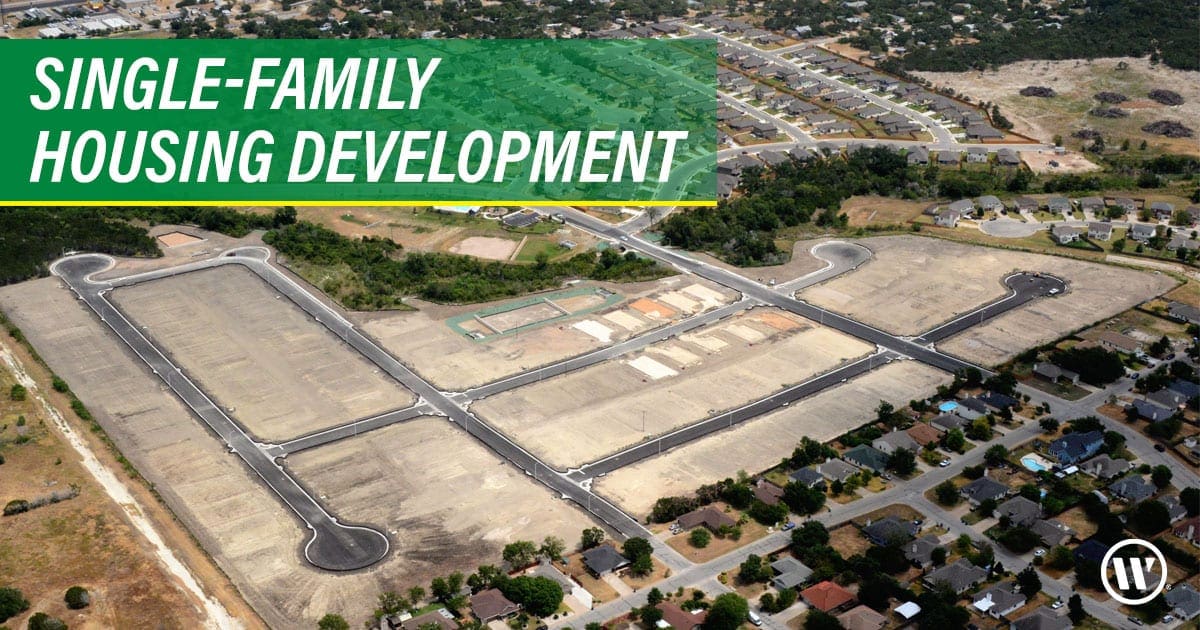
We know the State of Texas is an awesome place to live, and now – more than ever — the word is out. Texas makes up almost 9% of the total U.S. population but what’s more exciting is it’s around 32% of the total growth, and Texas adds more population than any state and at a faster rate.
This drives a housing market that Texas cities are prepared for with well-organized growth plans, and smart ways of handling that growth.
Taking a dive into how a city manages growth, Georgetown is a perfect example of anticipating, organizing, and executing. Georgetown is fully staffed with a team of planners, has an easy-to-use website and information for developers, planners, and engineers to access how they see growth occurring in their city. Like many Texas municipalities, it spent considerable time and resources to accommodate current and future growth.
Georgetown’s mission, on its website, states: “The Georgetown Planning Department is committed to actively preserving the community’s heritage and shaping its future by implementing the City’s adopted vision and promoting a high-quality built environment.” Just from this statement, a developer should expect that open space, amenities such as trails, and preservation of natural areas are a priority. These outdoor features reduce density, and in the long run make for a more balanced neighborhood that experience shows will sell faster and create higher resale values.
Taking a deeper dive into the city’s online information, the site has many Graphical Information System Maps – usually referred to as GIS Maps. The one map initially reviewed when looking for new properties to develop is the current zoning map. It depicts the city’s various zoning districts, identifying if a property under consideration has the correct zoning or if it would require additional steps in the process to develop, such as annexation, re-zoning, or creation of a planned unit development (PUD). Most cities in Texas adopted a long-term planning approach of defining an Extra-Territorial Jurisdiction (ETJ). This is a systemic planning tool used by cities to plan for long-term water and sewer service districts, helping define future zoning and development opportunities. These areas usually take more steps to develop, but for the right property it can be worth the extra effort.
Analyzing the zoning code is the next step in deciding if the subject property is right for development. This code is usually many chapters long, but drilling into the zoning code and referencing single family, the key items to locate are the review of lot width, lot area, building setbacks, and road requirements. From this, the developer’s planner/engineer can determine the possible densities a property may potentially yield to define the overall land value.
Next in determining if the property is feasible to develop is reviewing it for engineering issues like the availably of water and sewer service, and a high-level analysis of the need for storm water treatment, rate, and flood routing. Road connectivity is also typically reviewed at this high level, determining the need for collector-type roads requiring a larger corridor that tends to reduce the property’s overall density. Utility corridors are also reviewed to determine how lot layout might be affected and what density impacts they may have on a site. Like Georgetown’s website, most of this information is generally available on other cities’ websites, too.
Once the Letter of Intent, or agreement to sell/purchase is signed, moving forward requires a more detailed engineering review, and meetings with city staff and decisionmakers if the property requires higher-level attention for approval. This stage is typically referred to as a Site Investigation Report. This report dives deeper into the engineering, property boundary, soils, and environmental issues associated with the property. At this time, a site visit is usually completed to fill in the gaps of the available online information. The property boundary is also reviewed for deviations from available GIS data. The property’s easements and encumbrances are also part of this review. A more detailed report can also include estimated costs of development, including fees, area charges, and cost of construction. A schedule is typically provided for use in determining the dates and times associated with payments to the property’s seller.
The steps above only get you to a decision. There are many additional steps in the development process that only a very few engineering companies can provide to a developer. Development is not for everyone and requires substantial capital to undergo the entire process. WGI’s development experience is absolutely necessary for preservation of capital and assuring success.

WGI is a national design and professional services firm leading in technology-based solutions for the construction of public infrastructure and real estate development. At WGI, we’re providing Tomorrow’s Infrastructure Solutions Today.

We’re refreshing our brand to reflect the energy, inspiration, and excitement that we feel when we come to work every day.

Do you have questions about permitting TXDOT driveways? WGI can handle it for you.

A Site Investigation Report (SIR) is a vital first step in determining whether to roll the dice on an investment property or leave the table.

WGI’s team of professional landscape architects recently had the privilege of bringing the vision of a multi-use oasis to life for a single-family rental community in New Braunfels, Texas

At WGI, we’ll help your community develop integrated micromobility plans and policies to capture benefits, limit risks and expand choices. From pilot project design to overall mobility planning, we can help you test, scale and incorporate innovative transportation into your community plans.

While traditional Transit Oriented Developments (TODs) have been used to create more efficient transportation networks in urban areas, they don’t always take into account the needs of existing residents or businesses. That’s why it’s time to say hello to Equitable Transit Oriented Development (ETODs) & their focus on the ‘people’ aspect of development.
You’ve been searching for a place like WGI. We look forward to meeting you soon.
Sign up to receive emails to hear our latest news and achievements in our monthly newsletter.
Enter your zip code, and we’ll personalize your experience with local projects, office locations, team members, and more.
WGI supports its associates with meaningful opportunities for growth, strong benefits and perks, while we work collaboratively with clients and co-consultants to shape and improve communities.


WGI is a dynamic organization with opportunities nationwide for engineers, land surveyors, landscape architects, environmental scientists, and architects.