Download a PDF Copy of this Paper
Better and Faster Survey Data Through Technology: Get Geospatial Already.
Over the last decade or so, Land Surveying has advanced at light speed. Although some circumstances still call for a surveyor holding a pole to collect data, those days are certainly numbered.
Today’s cutting-edge technologies are far more accurate, more complete, and measurably faster. Just as significantly, they enable surveyors to safely deliver detailed data in less time and usually at lesser expense.
Since time is always money during development projects, utilizing these technologies can result in double savings for project owners — save first on the mapping, save again on faster delivery.
Land Surveying is now part of a more comprehensive service within the AEC profession generally known as Geospatial, which relies on technologies such as remote sensing and reality capture systems to ensure the greatest efficiencies. The geospatial processing software used to store, calibrate, analyze, and extract the data is equally advanced.
To be successful — and provide clients the best service — design firms need all these resources at their fingertips. Otherwise, projects can take longer to complete, cost substantially more, and unnecessarily jeopardize worker safety. Using state-of-the-art geospatial technologies injected new life into a once-static field that was dependent on total stations and GPS receivers.
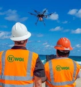
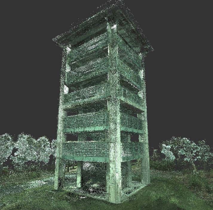
 Through the use of LiDAR (Light Detection and Ranging), companies like WGI collect millions of 3D data points in real-time to complete accurate, high-quality digital terrain models of the physical environment. The LiDAR collection method depends entirely on the project’s need or site.
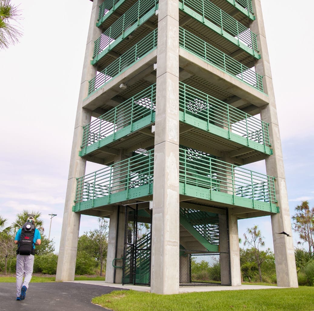
Terrestrial Mobile LiDAR provides street-view imagery by collecting data at highway speeds. Aerial LiDAR is used to map vast areas of the earth from GPS-monitored aircraft. While Backpack and Static LiDAR have other applications, in this context, it is determining the precise geospatial location of objects and their features in order to create a densified point cloud and, ultimately, design-quality surveys.
At WGI, Terrestrial Mobile LiDAR is used extensively for Department of Transportation roadway projects because it allows our professionals to collect detailed survey-grade data from a vehicle traveling along the highway at the posted speed limit. The LiDAR unit is easily mounted atop any vehicle, allowing it to scan vertically and horizontally with a level of detail that conventional Land Surveying can’t match.
Consider the time savings, which can be especially beneficial in schedule-critical assignments. Terrestrial Mobile LiDAR simultaneously collects “street-view” imagery that can be used to examine and map pavement conditions, breaklines, or catalogue the locations of features for GIS-based asset management programs.
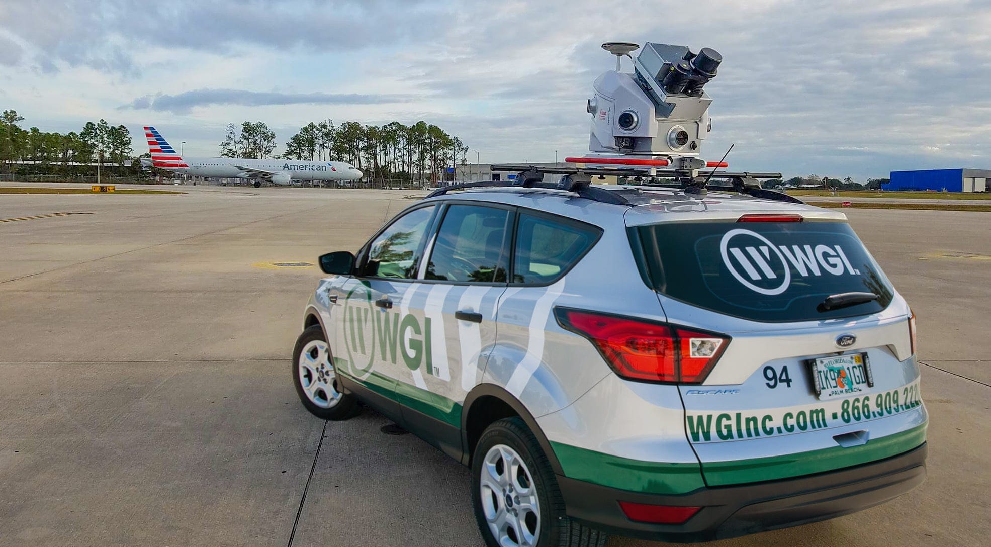
Land Surveying near airports and other restricted-airspace aviation areas presents different challenges for data collection. The mapping must be collected in the shortest time possible because airports do not shut down nor can air traffic be diverted simply to perform a survey.
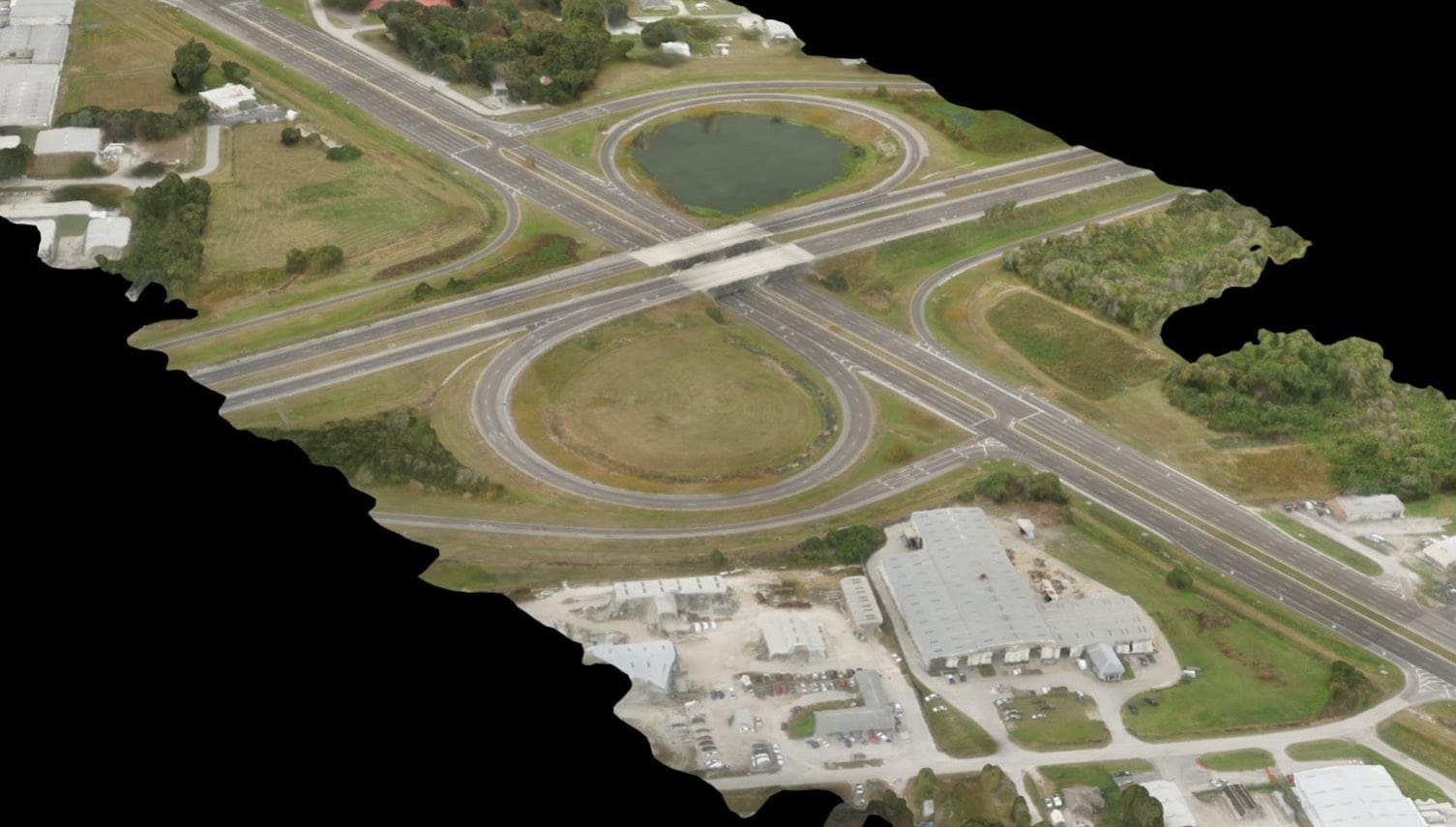
As an example, it may take 160 weeks for one field crew to survey a 100-mile long, 250-foot wide highway corridor using traditional surveying methods, followed by 42 weeks to process the data to the point of a suitable existing-conditions survey design file. Using Mobile LiDAR, the data collection for the same 100-mile corridor takes one to two days, and the data processing can take one technician 60 weeks to produce the same survey design file.
Point Cloud extraction is typically broken into segments, allowing multiple technicians to work on the same project without conflict. The net result is a time savings of approximately 183 weeks.
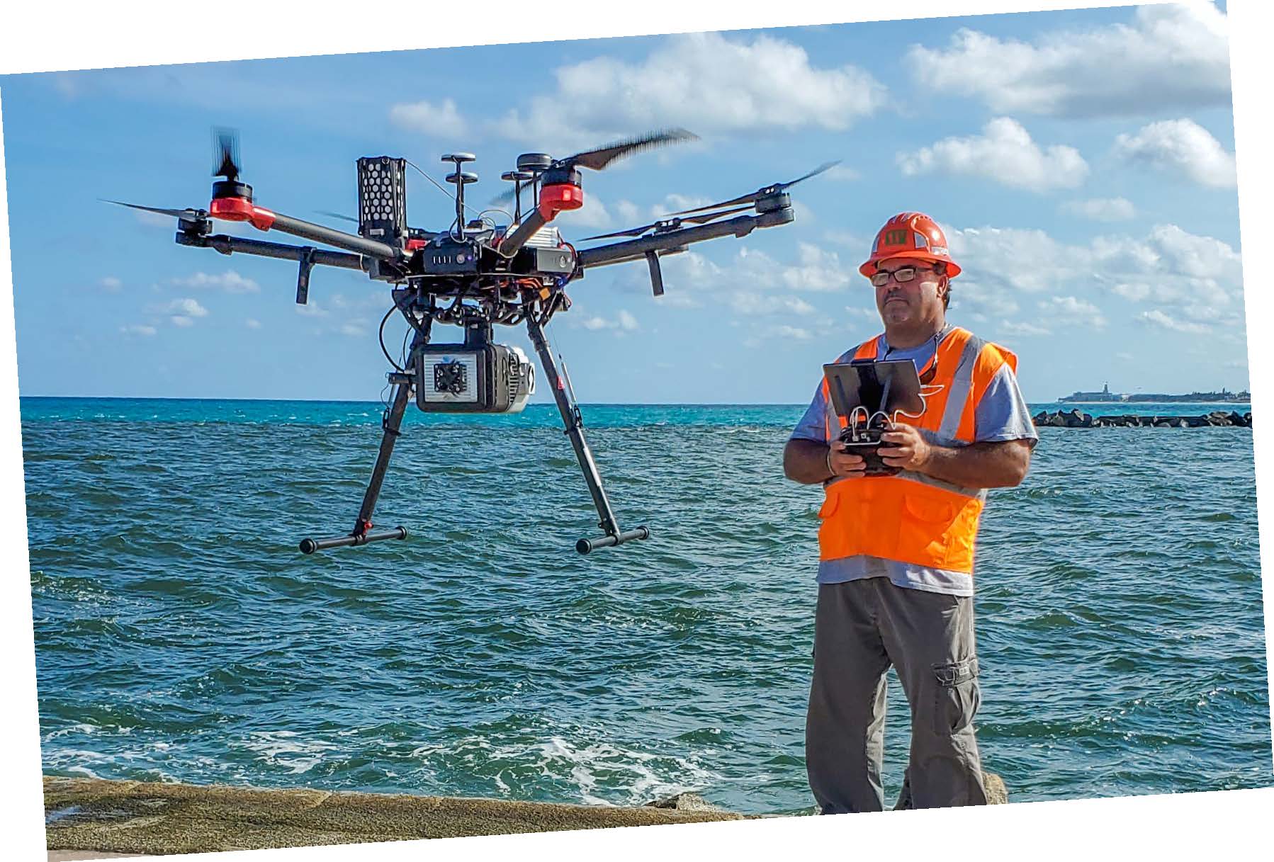
 Similarly, LiDAR can be used on unmanned aerial vehicles (UAV) to collect a larger data set. WGI utilizes gas-powered Harris-brand aerial drones. This advanced drone flies for up to two hours collecting data over an area as large as 500 acres without refueling. Even with heavily wooded tracts, Aerial LiDAR can penetrate this canopy, making it ideal for bare-earth models.
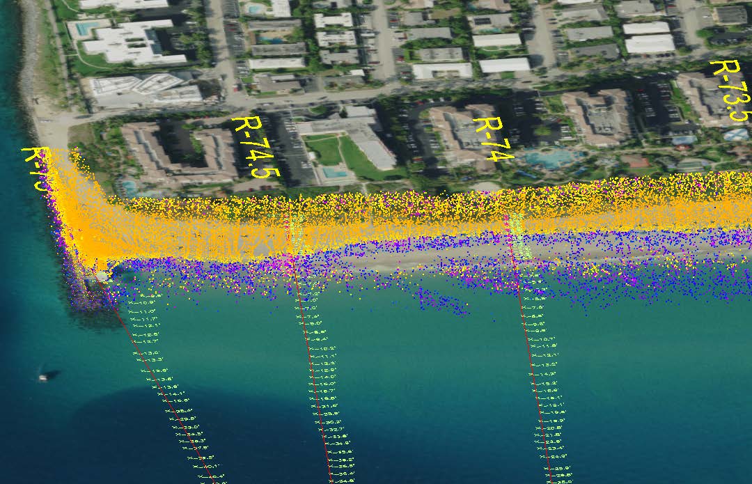
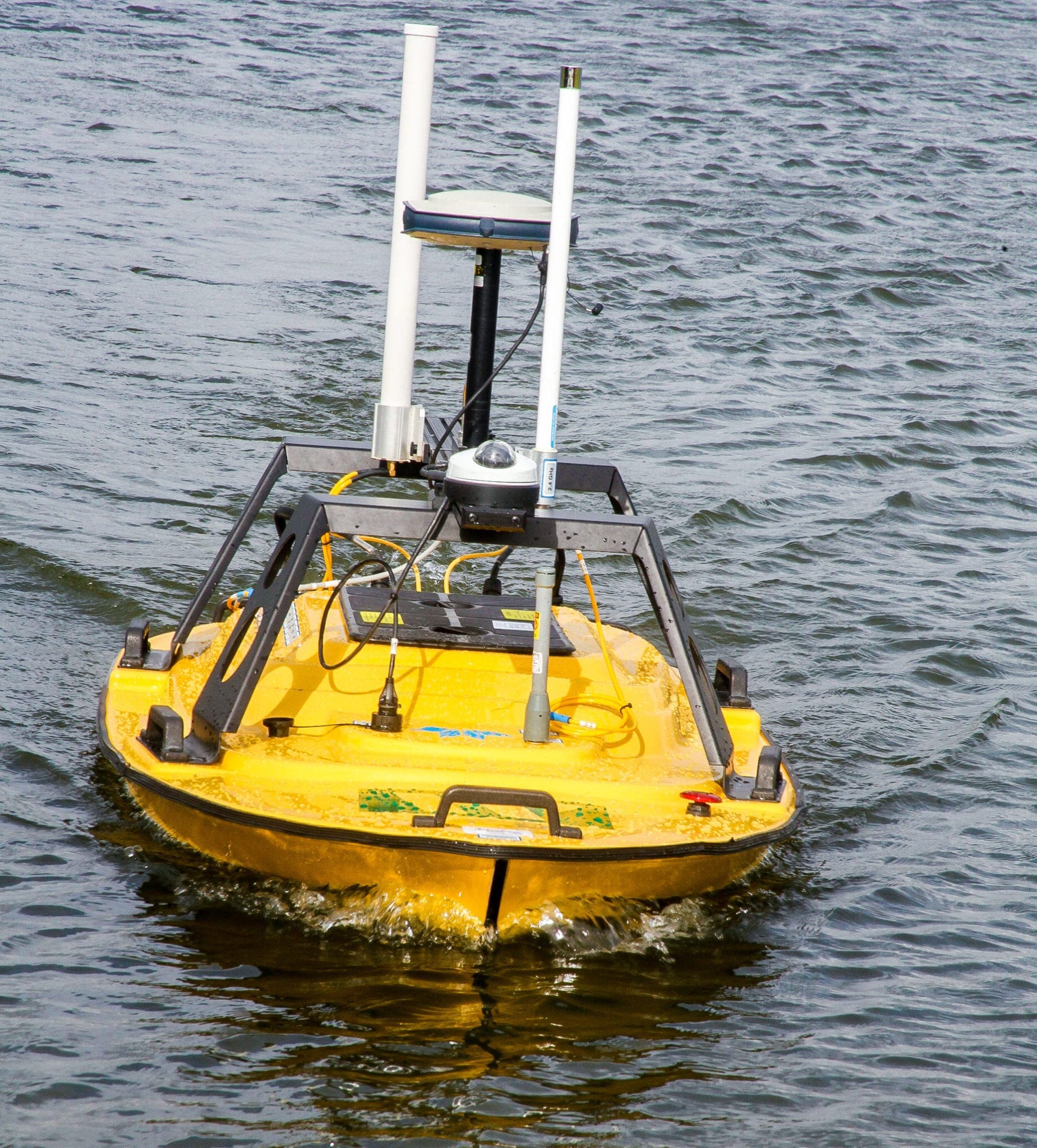
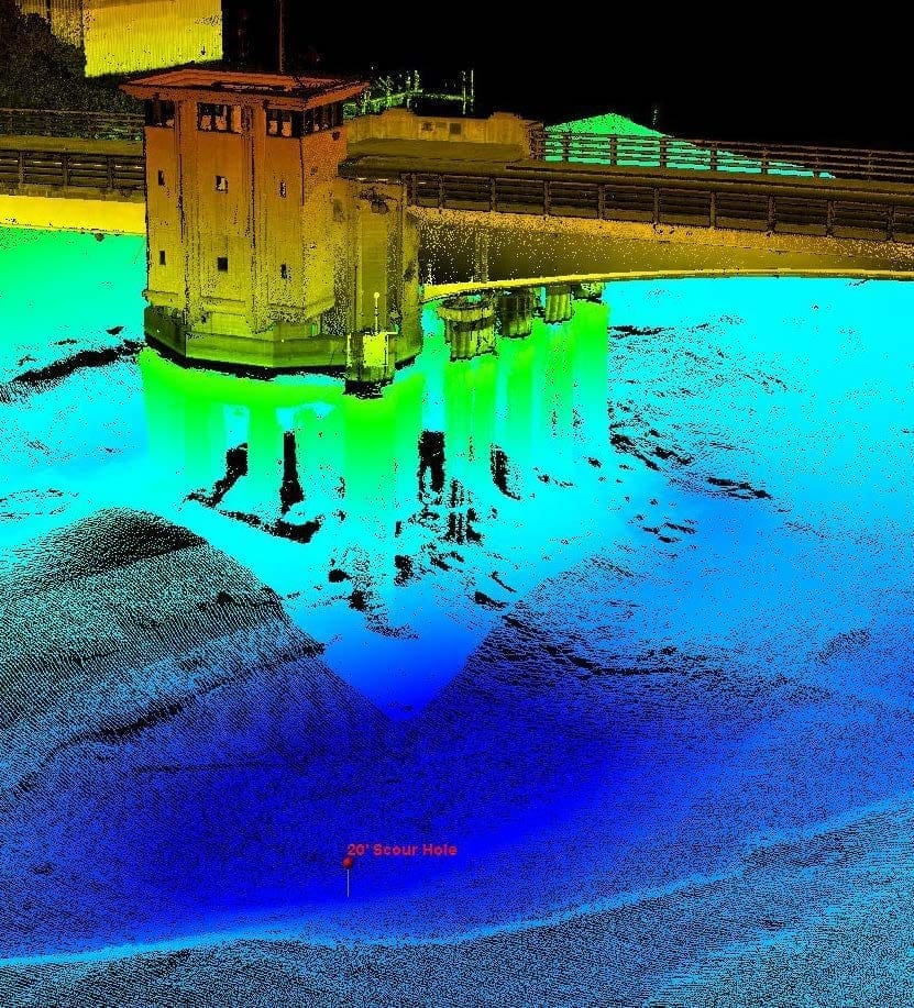
Aerial LiDAR is a growing trend for coastal region data collection. Using specific sensors, we can clearly map upland, shoreline, and under the water’s surface. In areas that are deemed uninhabitable, UAV mapping now makes surveying a possibility where it would have been extremely difficult or impossible in the past.
A combination of Terrestrial Mobile LiDAR and aerial data acquisition can quickly and accurately gather information to create a complete picture of a project. Data collection from the air and ground is useful to get a full capture of a site when line-of-sight is required.
For example, it may take 20 weeks to survey a 1,000-acre tract for a future planned community using traditional surveying methods, followed by two to four weeks to clean up the data into a suitable existing-conditions base file. Using Aerial LiDAR, the same 1,000-acre tract’s data can be collected in a single day once site control has been set, with data clean up taking the same timeframe as the conventional method. The net result is a time savings of 20 weeks.
Download a PDF Copy of this Paper
Better and Faster Survey Data Through Technology: Get Geospatial Already.