Download this article as a PDF
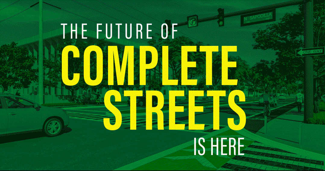
When first introduced in 2003, the Complete Streets concept was hailed as a breakthrough in urban planning. It was a groundbreaking step, providing more transportation choices in urban settings for a nation whose history was steeped in the romance of the automobile and car-centric planning.
No longer would we be tied to our cars. By providing safer bicycle lanes, creative traffic-calming strategies, and more convenient (and ADA-compliant) sidewalks, cities began the process of making their communities more transportation-diverse.
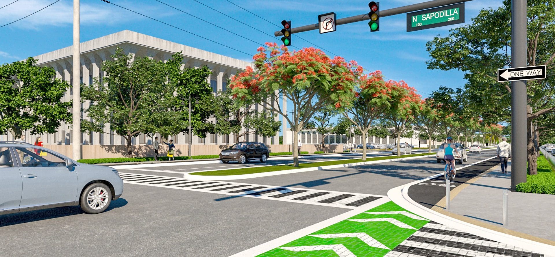
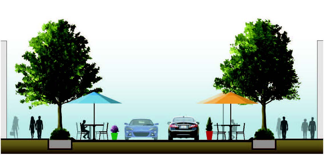
The Complete Streets revolution was transformative. Urban roadways became safer to drive. Sidewalks became more active. The increase in pedestrian traffic led to more socialization; people interacted more with each other as they strolled along city sidewalks or sat at restaurant’s outdoor tables. It also became more accessible for people with disabilities to get to and from their cars, and along sidewalks. As downtowns de-emphasized the vehicle, many communities found the quality of life significantly improved.
So did local economies. Increased pedestrian traffic and less congested roadways were good for local businesses, particularly restaurants and retail establishments benefitting from improved foot traffic. Complete Streets is the last generation’s urban-planning success story.
YET WHERE DO WE GO FROM HERE?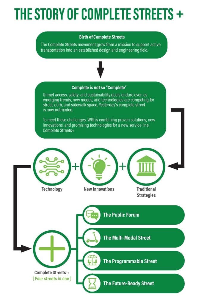
Today, cities across the United States find themselves amid a mobility movement. Like Complete Streets, mobility focuses on minimizing roadway congestion and making it easier for people to move freely in an urban environment. Similarly, Transportation Management (TM) strategies encourage carpooling and public transportation to reduce single-occupant vehicle trips. And just as the original Complete Streets approaches promoted bicycle use, mobility planning promotes other types of less-intrusive transportation, like scooters. We now even have a term for these smaller-scale transportation methods: micromobility.
Complete Streets and mobility aren’t mutually exclusive. They share many attributes, and the two approaches complement each other. Both include many Smart Growth and land-use policies, including location-efficient development, strategic parking management, car-free planning, traffic calming, and transport-planning reforms to promote curb management.
Another area of commonality for Complete Streets and mobility is curb management. In fact, with the influx of Transportation Network Companies like Uber and Lyft and the impending self-driving vehicle age, curb management is, and will continue to be, an essential urban-planning element for Complete Streets communities. It is essential for communities to provide adequate space for drop-offs and pick-ups and traditional deliveries to residents and businesses — all without creating roadway congestion or hazards for pedestrians or people using micromobility transportation. This is already a primary challenge for urban planners and becomes increasingly more critical as self-driving vehicles begin to proliferate.
And speaking of technology, mobile technology is playing an important role in shaping how we manage Complete Streets and mobility. Since the iPhone launched in 2007, smartphones are ubiquitous. It’s estimated that more than 5 billion people—about 2/3 of the world’s population—own at least one mobile phone. Of cell phone users in the United States, 77% own smartphones. We use our smartphones every day, all day long — to shop; to get directions; to keep up with the news; to communicate with family, colleagues, and friends; and complete a dozen other tasks requiring connectivity.
Since connectivity is such an essential part of our day-to-day lives, it makes sense that it would play a vital role in transportation. In fact, mobile technology can connect people to all elements of the parking and mobility experience. It gives people control over their route and transportation via GPS and mapping apps; in cities that introduced parking-guidance networks and other smart-city technology, it can help them find parking quickly and easily; and once the driver arrives at his or her destination, it provides the most convenient payment option. These considerations must be factored into Complete Streets planning.
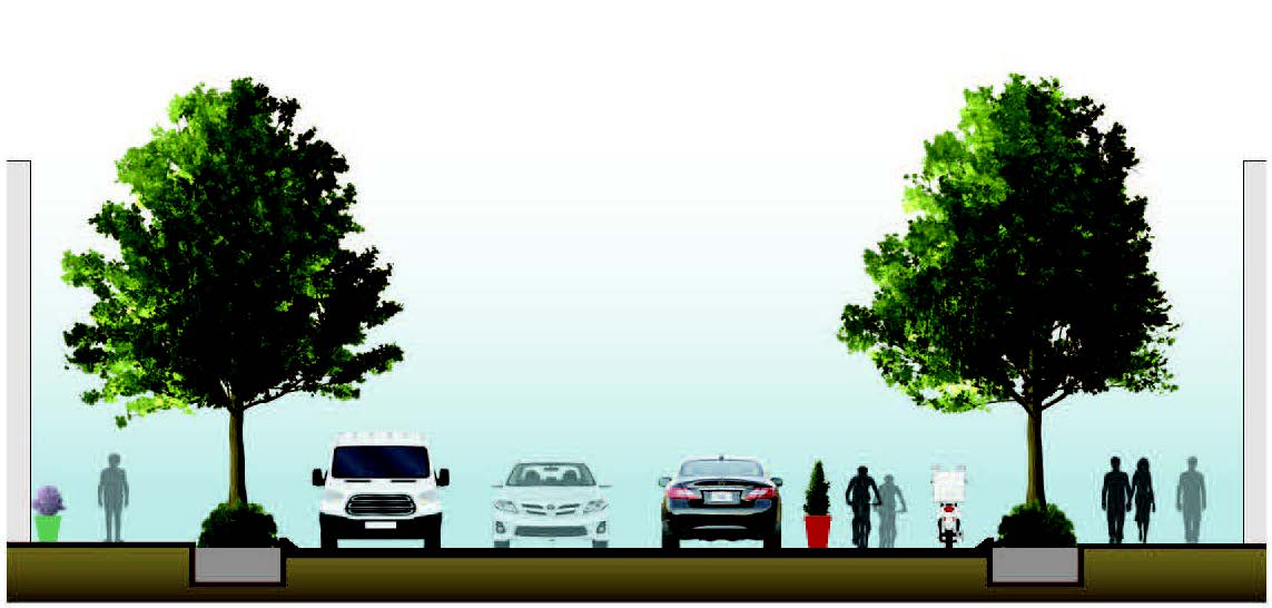
COMPLETE STREETS + ELEMENTS
- Flexible Areas
- Green Infrastructure
- Buried Utilities
- EV Infrastructure
- Electrified Fleet
- Smart Streetlights
- Placemaking and Art
- Flush Curbs
DAY IN THE LIFE OF A PROGRAMMABLE STREET
All lanes are open to traveling vehicles and transit during the peak hours of morning and evening rush hour.
After morning rush hour subsides, one lane is reserved for loading while another becomes a bike lane used by cyclists, electric scooters, and delivery bikes.
COMPLETE STREETS +
So, what will the future of Complete Streets look like? Let’s call it Complete Streets +. With Complete Streets +, Complete Streets elements are essential components of every downtown planning project. Planners will look at the community as a whole and see which elements would greatly benefit individual areas. Our understanding of Complete Streets matured over the past two decades. Communities don’t need to include every single Complete Streets element on every street corner.
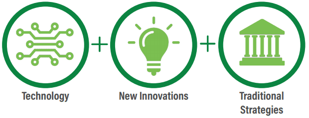
Technology will also play an increasingly important role in the future of Complete Streets. In fact, WGI developed a new planning concept called Programmable Streets™. Through Programmable Streets™, our urban planning and transportation planning professionals incorporate technology in the physical and social programming of the street. It can include a wide range of technologies. For instance, programmable signs can guide drivers to parking resources and inform them of special events and other timely information about downtown areas. Or audible crossing equipment designed to make it safer for people, particularly people with disabilities, to cross city streets. Or digital sensors alerting drivers to changing certain streets’ functionality, like temporary conversion to pedestrian zones.
The possibilities are unlimited, and planners need to design flexibility into Complete Streets programming to accommodate the inevitable introduction of new and useful technologies.
Another common theme of Complete Street + is the need to balance pick-up and drop-off areas without clogging streets with even more traffic. Well-designed drop-off areas that fit seamlessly into traffic patterns are essential. Transportation planners can help get cars off the street quickly and make it convenient for drivers to get in and out of downtown areas, significantly benefitting pick-up/drop-off areas. After all, the less traffic on city streets, the easier it is for cars to get around safely.
Another future element of Complete Streets + to plan for now is the inevitable arrival of the self-driving vehicle (SDV) era. Accommodating these vehicles require cities to create more dedicated lanes for them. However, this must be done without paving more real estate. There are two primary ways to accomplish this. First, underutilized dedicated bus lanes repurposed to dedicated SDV lanes with just a bit of restriping and new signage. If that’s not possible, on-street parking spaces can be converted to SDV lanes. However, this approach requires developing new parking structures or lots elsewhere to replace the lost spaces.
It’s also important to remember that these Complete Streets + approaches aren’t just for urban downtown cores. They are equally useful for suburban areas, too. An effective Complete Streets + plan offers something for everyone, including people using transit, pedestrians, drivers, micromobility users, and ridesharing.
Contact our team of experts today and let’s discuss how Complete Streets + can benefit your community.
Download this article as a PDF