
Today’s Technology: UAV LiDAR Snoopy
WGI is adding new versatility to our LiDAR capabilities with the introduction of LiDAR USA’s “Snoopy” system.
Learn from award-winning professionals — explore our whitepapers, blogs, and the latest industry updates.
Join our dynamic organization of engineers, land surveyors, landscape architects, environmental scientists, and architects!
Talk to a market leader today! We’ll answer any questions you have about our professional services.
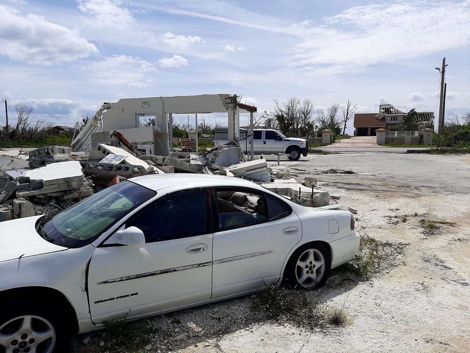
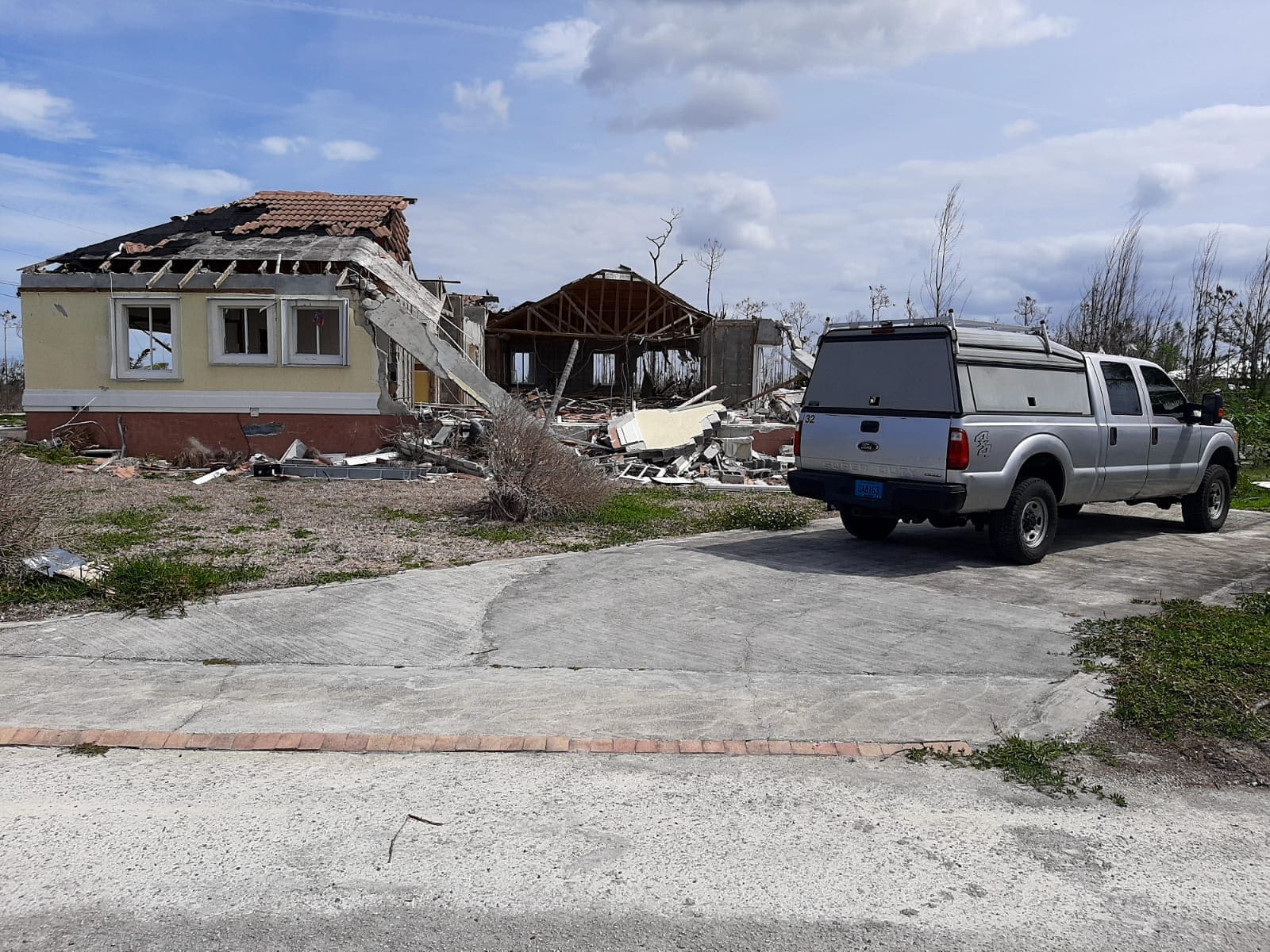
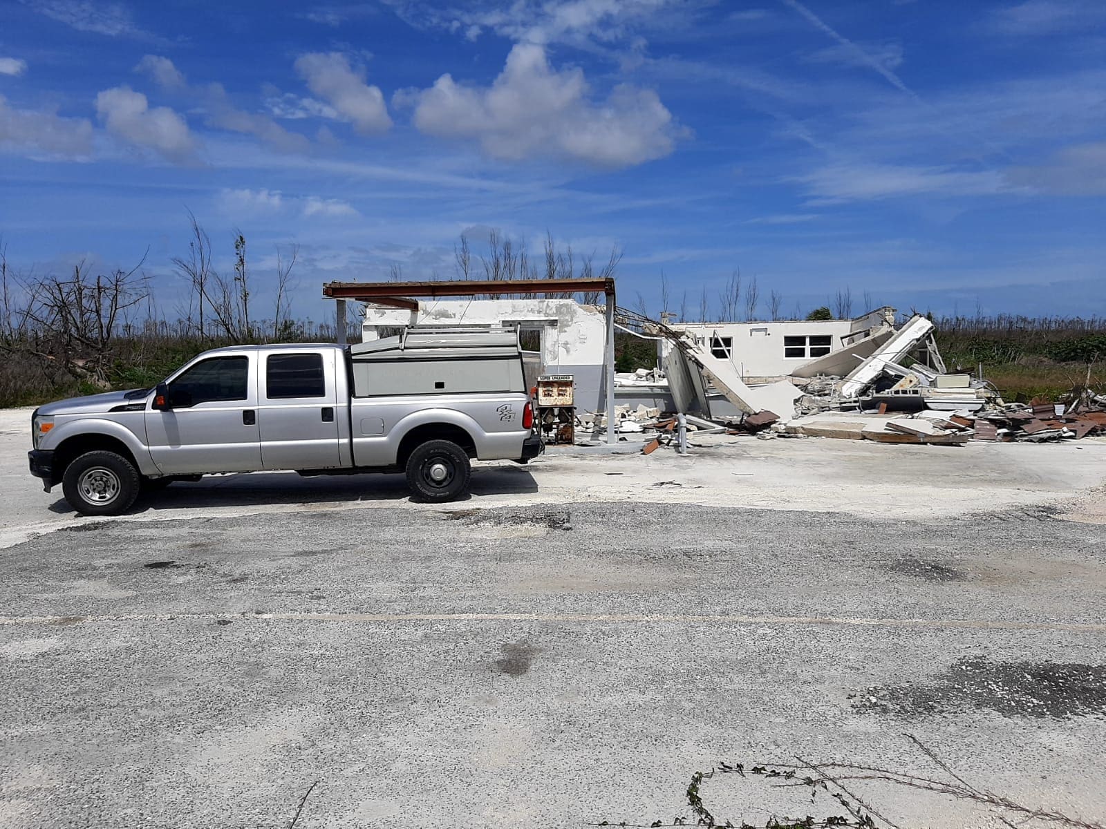
The destruction of Hurricane Dorian made a huge impact on the residents of the Bahamas, specifically in Alcoa. Many residents have started on the long road to rebuilding their homes and businesses that were destroyed.
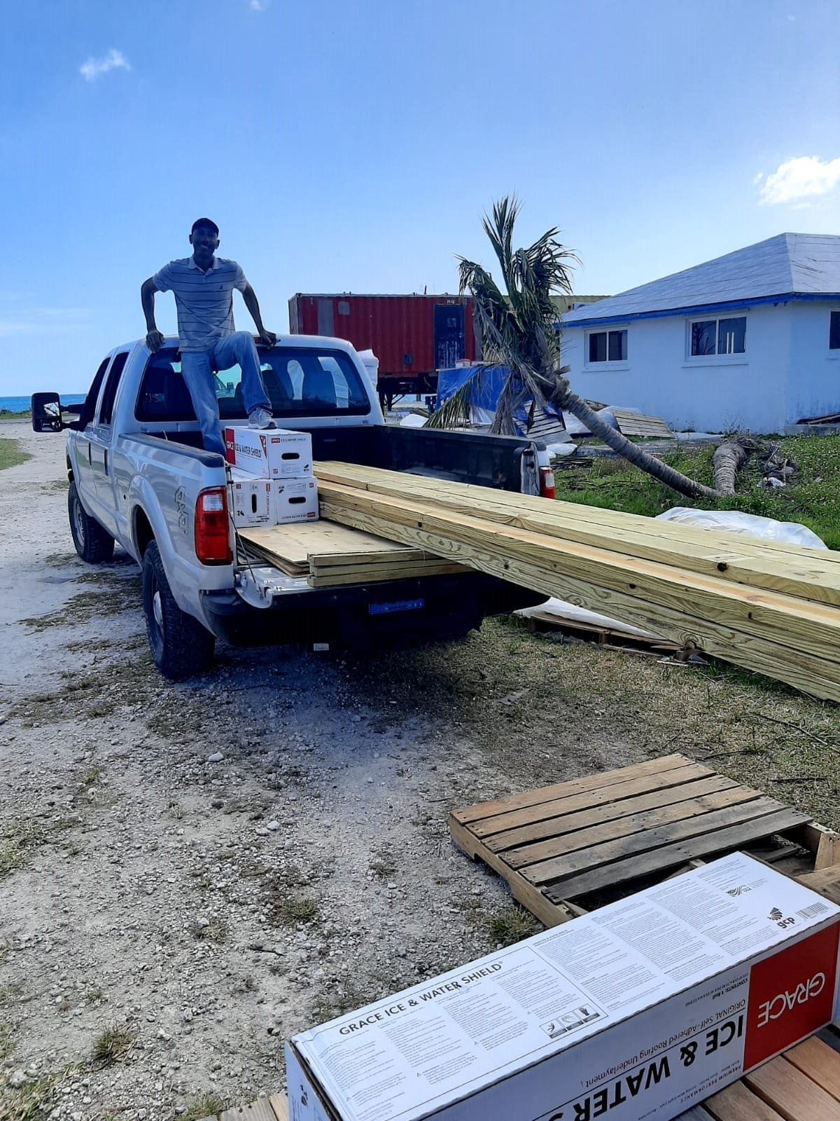
WGI recently teamed up with Acts 2 Worship Church to help provide relief for one family in particular that lost a total of four homes during the storm.
WGI’s CEO, David Wantman decided to donate one of our geospatial trucks to help the Bridgewater Family get a jump start on rebuilding their homes and their lives.
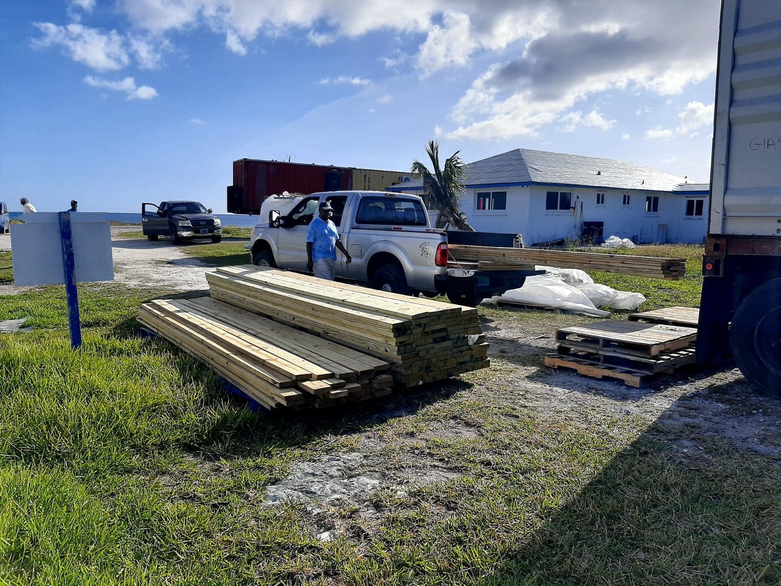
The new truck will allow them to speed up their rebuilding efforts and quickly transfer the supplies needed for reconstruction. Many families affected by Hurricane Dorian are still in need and could use all of the support that anyone can offer.
WGI is a national design and professional services firm leading in technology-based solutions for the construction of public infrastructure and real estate development. At WGI, we’re providing Tomorrow’s Infrastructure Solutions Today.
WGI is adding new versatility to our LiDAR capabilities with the introduction of LiDAR USA’s “Snoopy” system.
WGI places top five for the fourth consecutive year on the South Florida Business Journal Top 25 Engineering Firms List.
Welcome back to WGI Unleashed! In this episode, we have a conversation with Matt Floyd, a Project Surveyor with our Geospatial Team in West Palm Beach, Florida.
WGI’s geospatial team recently utilized vehicle-mounted mobile LiDAR, boat-based LiDAR, and sonar to collect data for the partial rehabilitation of a bridge.
Melissa’s addition to the team solidifies WGI’s leadership in helping communities harness the benefits of much-needed infrastructure projects throughout the nation.
This addition to the Geospatial Team’s Mobile LiDAR collection provides 72 MP of high-resolution imagery & allows us to offer a more robust dataset.
You’ve been searching for a place like WGI. We look forward to meeting you soon.
Sign up to receive emails to hear our latest news and achievements in our monthly newsletter.
Enter your zip code, and we’ll personalize your experience with local projects, office locations, team members, and more.
WGI supports its associates with meaningful opportunities for growth, strong benefits and perks, while we work collaboratively with clients and co-consultants to shape and improve communities.
WGI is a dynamic organization with opportunities nationwide for engineers, land surveyors, landscape architects, environmental scientists, and architects.