

Blog
World Landscape Architecture Month
This month we recognize our landscape architects by highlighting their contributions to WGI, our communities, and to making our world a better, more beautiful place!
This month we recognize our landscape architects by highlighting their contributions to WGI, our communities, and to making our world a better, more beautiful place!

Before embarking on a development project in San Antonio, Texas, here are ten factors to consider to make sure your development project is a success.
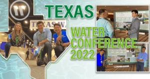
WGI associates got their feet wet in San Antonio, TX where they attended Texas Water 2022, the largest regional water conference in the U.S—widely recognized as the premier water and wastewater conference in the Southwest.

WGI has extensive experience in mobile lidar hardware and software solutions.
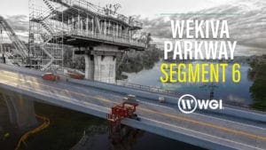
WGI’s Senior Vice President of Transportation, Nancy Clements, was on-site at the Wekiva Parkway Segment 6 Project to discuss the environmentally sensitive Wekiva River and all the unique features of the project.

The acquisition supports our commitment to sustainability and resiliency, and it builds upon our core capabilities in civil engineering, water resources, drainage engineering, and environmental engineering.

As you prepare your real property for development, it’s essential to understand and face the zoning, political, and unique site challenges — and create a comprehensive strategy for overcoming them.

For this milestone episode of WGI Unleashed, we get to know Amanda Montgomery, Environmental Scientist for our Environmental Team based in our Fort Lauderdale, FL office.
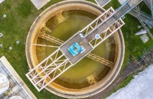
Avoid treatment operation disruptions & learn the critical elements to increase the longevity & sustainability of your treatment structures.

This addition to the Geospatial Team’s Mobile lidar collection provides 72 MP of high-resolution imagery & allows us to offer a more robust dataset.
