Learn from award-winning professionals — explore our whitepapers, blogs, and the latest industry updates.
Join our dynamic organization of engineers, land surveyors, landscape architects, environmental scientists, and architects!
Talk to a market leader today! We’ll answer any questions you have about our professional services.
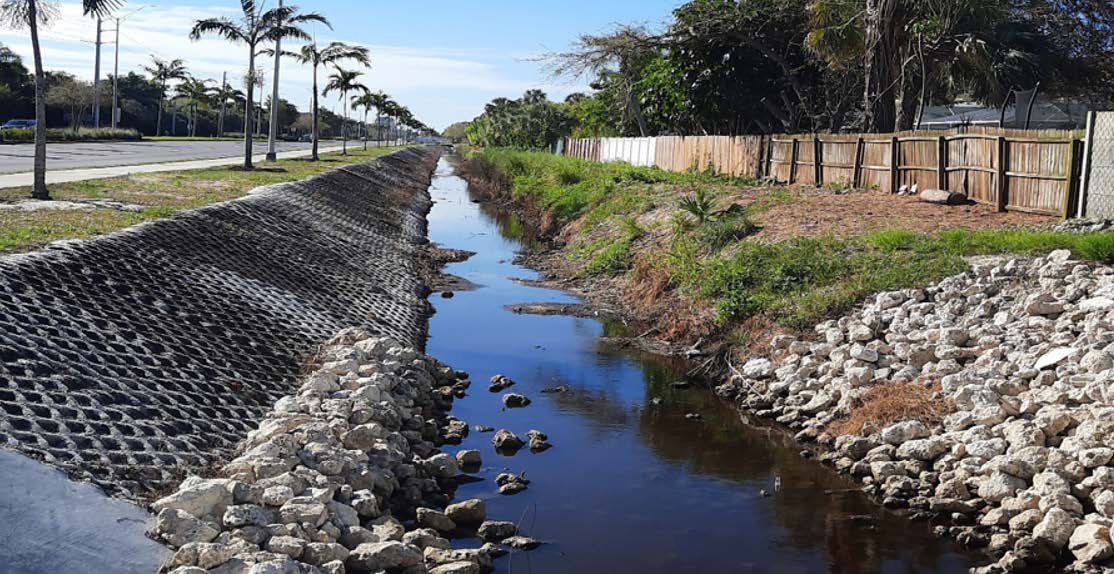
This design project refined the hydraulic model and design improvements (widening and deepening) for the Goodlette-Frank Road ditch to support FEMA flood hazard mitigation funding. The design will optimize the drainage capacity of the ditch by widening it and deepening it. The enhanced capacity of the ditch will benefit the neighborhood areas to the west by lowering flood water levels. The project used mobile and backpack LiDAR for the ditch design survey, ground penetrating radar (GPR), and multiple pipe and cable locating technologies to define the underground utilities during the SUE phase. Mobile LiDAR was also used to collect street, driveway, and structure elevations within portions of neighborhoods west of the Goodlette-Frank Road ditch to provide base flood elevation data.
Sign up to receive emails to hear our latest news and achievements in our monthly newsletter.
Enter your zip code, and we’ll personalize your experience with local projects, office locations, team members, and more.
WGI supports its associates with meaningful opportunities for growth, strong benefits and perks, while we work collaboratively with clients and co-consultants to shape and improve communities.
WGI is a dynamic organization with opportunities nationwide for engineers, land surveyors, landscape architects, environmental scientists, and architects.