Learn from award-winning professionals — explore our whitepapers, blogs, and the latest industry updates.
Join our dynamic organization of engineers, land surveyors, landscape architects, environmental scientists, and architects!
Talk to a market leader today! We’ll answer any questions you have about our professional services.
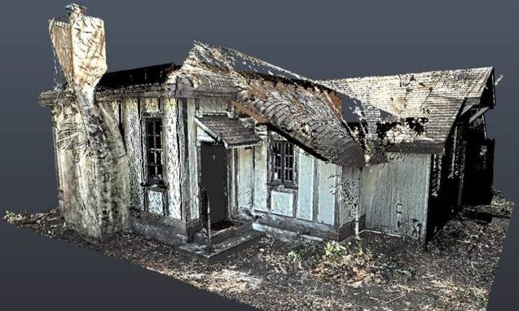
The Marjory Stoneman Douglas Historical House is located in south Coconut Grove, Florida. The home is where nationally recognized journalist, author, environmentalist, conservationist, and activist Marjory Stoneman Douglas lived and worked from 1926 until she passed away in 1988, at the age of 108. Built of wood frame construction, faced with half-timbered stucco and brick, the one-bedroom, 900 sf, single-story home survived multiple hurricanes, but has since become inhabitable due to termite and mold infestations. The home was purchased by the state of Florida in 1991, designated a National Historic Landmark in 2015, and was listed on The Florida Trust for Historic Preservation’s “11 to Save” list as one of the 2018 top eleven historic/threatened properties to save.
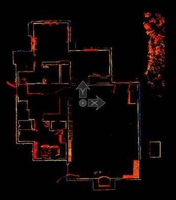
In 2020, the Florida Department of Environmental Protection (FDEP) contracted with WGI to design improvements to the home and property. As part of the design, WGI provided full Geospatial services to provide accurate as-built conditions. Field crews met staff on site for interior access and performed High Definition Laser Scanning to collect as-built data on existing features for the interior and exterior of the structure. WGI mapped the structure at centimeter accuracy with Leica P-50 and BLK-360 scanners. These static scanners collect millions of data points, collectively known as point clouds, which were used to extract features for accurate modeling of the house. Such accuracies are required due to the variety of surfaces on the house and the non-typical sizes encountered on the frame. WGI delivered an accurately detailed 2D AutoCAD ReCAP file and 3D REVIT model to the architect for future reference.
Additionally, WGI performed Boundary and Topographic Surveys of the subject property, allowing design and approval of future plans and permitting (inconsistencies in property lines are common in historical areas, such as this property.) WGI held the vesting deed where contradicting calls for adjoiner deeds and plats were discovered.
Sign up to receive emails to hear our latest news and achievements in our monthly newsletter.
Enter your zip code, and we’ll personalize your experience with local projects, office locations, team members, and more.
WGI supports its associates with meaningful opportunities for growth, strong benefits and perks, while we work collaboratively with clients and co-consultants to shape and improve communities.
WGI is a dynamic organization with opportunities nationwide for engineers, land surveyors, landscape architects, environmental scientists, and architects.