WGI Icon_Green (1)
WGI Projects
Project Experience

Learn more about successful projects from some of our clients.

Plan Your Next Project!

Kick-start your next project with this quick step-by-step intake form.
About
WGI

WGI is a national design firm creatively transforming infrastructure and real estate through tech-driven services.

Our
Locations

You’ve seen our award-winning team, proven expertise, and industry authority. Now let’s make your next project a success.

Meet Our
Leadership Team

Our Executive Leadership Team and Practice Area Leaders bring decades of experience and client successes to your next project.

Our Practice Area Leadership

Our nationwide team of engineers, surveyors, planners, and architects offers
market-leading experience.

Firm Registrations

WGI holds nationwide registrations to perform engineering, surveying, architecture, and environmental science services.
WGI
Insights Blog

Our blog covers client interests like infrastructure, real estate, regulations, and smart, connected communities.

Whitepapers & Publications

Our whitepapers highlight our design experts' innovative insights and best practices for the AEC industry.

News &
Press Releases

Dedicated to your success, we invite you to subscribe to our newsletter for the latest news, case studies, and insights.

WGI
Media Room

Our passionate design professionals frequently share their expertise at webinars and virtual events.

Pearce Services - Midwest

Client:
Pearce Services
Market:
Technology, Telecommunication
Location:
Indiana, Michigan, and Ohio

Project Details

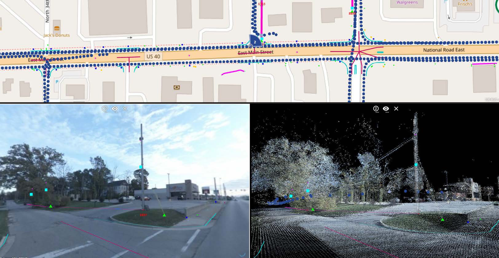
WGI is currently performing Phase 2 of a multi-phase project using our advanced mobile LiDAR capabilities to develop GIS datasets in support of telecommunication fiber design across multiple wires centers throughout Midwest states that include Indiana, Michigan, and Ohio. The mobile LiDAR point cloud data is acquired along potential fiber routes and GIS data in support of both buried and aerial fiber routing is extracted.

Aerial features include pole location and attachment heights of cables and components. Underground features include edge of pavement, sidewalk location as well as the location of visible manholes, valves, and pedestals. Some routes require both aerial and underground extraction.

To date this project included the following parameters:

• Total mobile LiDAR acquisition route: 1200 miles
• Total miles of feature extraction: 1252 miles
• Miles of extracted aerial features: 490 miles
• Miles of extracted underground features: 762 miles

Deliverables included: RGB colorized point cloud in LAS 1.2 format and captured imagery, ESRI File Geodatabase (GDB) format of all extracted features in support of schematic base map development. Full use of the Orbit software application for one year was included for the client. Access to Orbit for additional years can be provided at a nominal cost per terabyte of data to be processed and reviewed.

Contact Our Team About Your Next Project.

At WGI, we creatively transform how our world is envisioned, designed, and experienced. Our expert team of professional engineers is ready to help.