Learn from award-winning professionals — explore our whitepapers, blogs, and the latest industry updates.
Join our dynamic organization of engineers, land surveyors, landscape architects, environmental scientists, and architects!
Talk to a market leader today! We’ll answer any questions you have about our professional services.
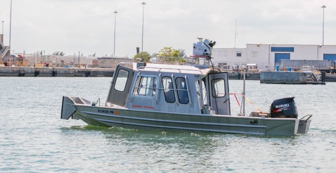
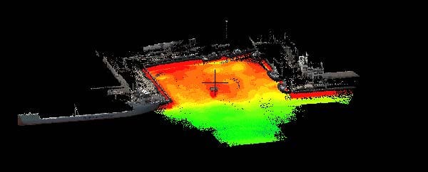
WGI’s Geospatial Division was tasked with providing a topographic and hydrographic survey of Berth 28 at Port Everglades for the Topo/Hydro Support Contract with the Jacksonville District of the Army Corps of Engineers. In addition to GPS and conventional surveying methods, WGI utilized state-of-the-art technology, including mobile LiDAR and multibeam sonar mounted to a survey vessel to simultaneously locate areas of interest both above and below the water surface. The use of these technologies, coupled together, allowed for rapid collection of data, significantly increased detail, and eliminated the logistical challenges associated with putting personnel within the restricted areas of the Port.Â
Sign up to receive emails to hear our latest news and achievements in our monthly newsletter.
Enter your zip code, and we’ll personalize your experience with local projects, office locations, team members, and more.
WGI supports its associates with meaningful opportunities for growth, strong benefits and perks, while we work collaboratively with clients and co-consultants to shape and improve communities.
WGI is a dynamic organization with opportunities nationwide for engineers, land surveyors, landscape architects, environmental scientists, and architects.