Learn from award-winning professionals — explore our whitepapers, blogs, and the latest industry updates.
Join our dynamic organization of engineers, land surveyors, landscape architects, environmental scientists, and architects!
Talk to a market leader today! We’ll answer any questions you have about our professional services.
Under a continuing services contract with the Miami-Dade Water and Sewer Department (WASD), WGI has completed 30 task work orders (TWO) to date. We have provided land surveying and subsurface utility engineering (SUE) services for water and sanitary sewer systems, sanitary sewage collection and transmission systems, water and sanitary sewage pumping facilities, water and sanitary sewage treatment plants, and other similar facilities during the design, construction, and post-construction phases. WGI’s land surveying services include performing as-built/record, boundary, right-of-way, and topographic surveys. Underground utility location services include performing SUE per the American Society of Civil Engineers ASCE 38-22 standards for QLA through QLD. WGI used geophysical sensing equipment for identifying, designating, locating, and mapping existing and abandoned utility infrastructure, i.e., magnetic, sonic, acoustic, ground penetrating radar (GPR), radio frequency detection, and vacuum excavation equipment.
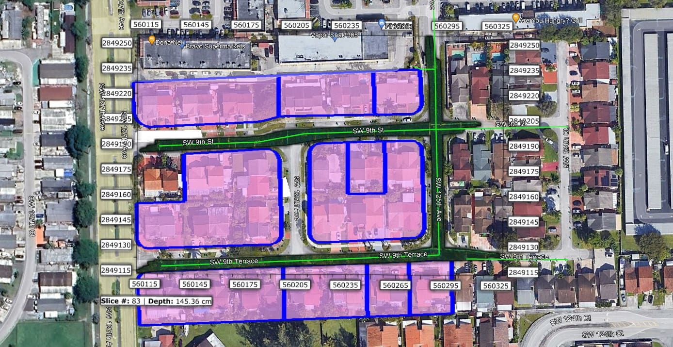
For this particular task work order, WGI performed ASCE 38-22 Quality Level B investigation with the Impulse Radar Raptor 3D high-speed multi-channel GPR (3DHSMC). Forty-two parcels were targeted for lateral sanitary sewer connection confirmation. One of the challenges of collecting subsurface utility data in roadways is doing it safely and efficiently. This rear-mounted 3D high-speed multi-channel GPR is used to collect GPR data within the roadways at posted speed limits, validating the horizontal position and depth accuracy of the subsurface utility targets where present. This GPR uses an inertial measurement unit (IMU) and GNSS to align and position each sensor passing over the road surface areas. We quickly collect georeferenced 3DHSMC GPR data for underground laterals, eliminating the need for conventional “pushcart” GPR methods within the roadway. Therefore, minimizing the impact on the public on heavily traveled roads, daytime businesses, and tourist activities, with emphasis on safety.
Sign up to receive emails to hear our latest news and achievements in our monthly newsletter.
Enter your zip code, and we’ll personalize your experience with local projects, office locations, team members, and more.
WGI supports its associates with meaningful opportunities for growth, strong benefits and perks, while we work collaboratively with clients and co-consultants to shape and improve communities.
WGI is a dynamic organization with opportunities nationwide for engineers, land surveyors, landscape architects, environmental scientists, and architects.