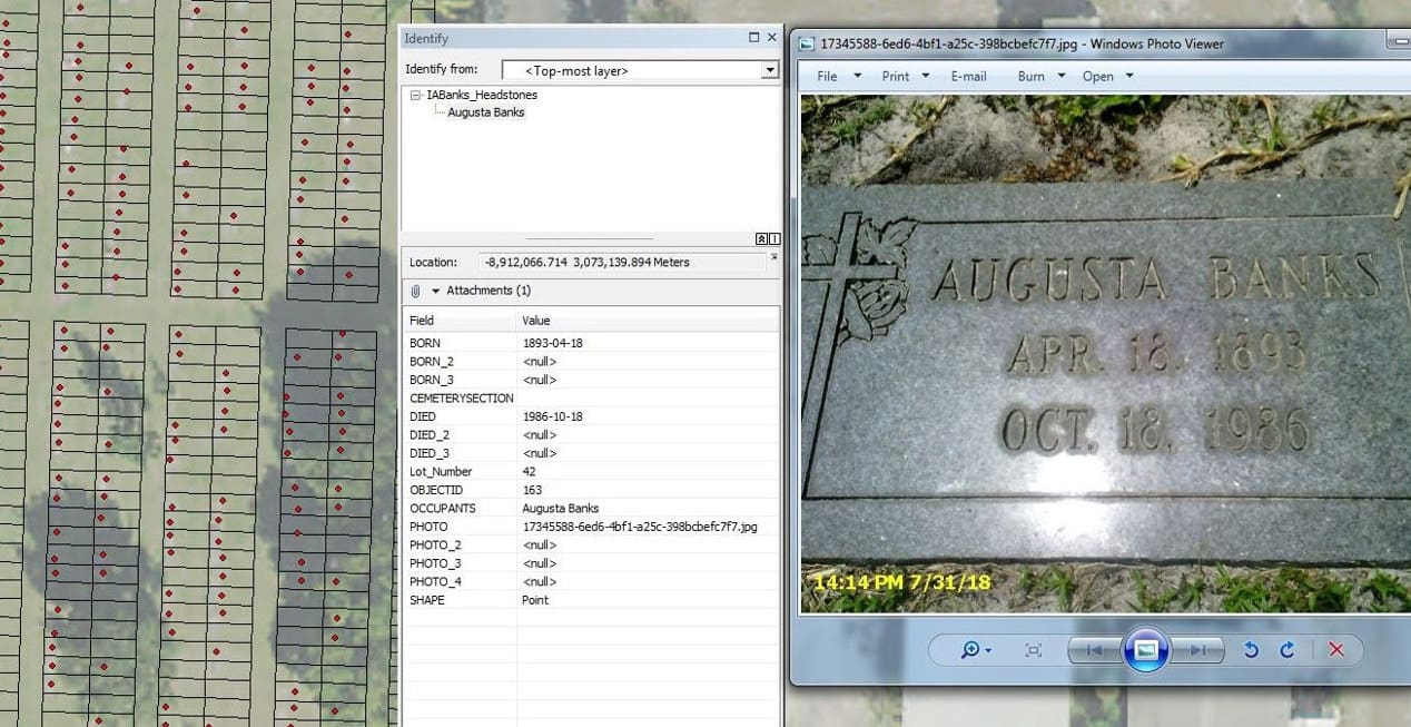
The City of Lake Worth contracted with WGI to obtain documentation from the City’s outdated book system of selling and recording burial lots for the two city owned cemeteries. WGI coordinated with the multiple city departments to research and document existing ownership or burial lots and those that were presold. WGI prepared boundary surveys and a geodatabase of the recorded platted lines for the City of Lake Worth’s cemeteries, Pinecrest Cemetery, and the I.A. Banks Cemetery. Pinecrest Cemetery has over 7,500 existing burial lots, while I.A. Banks Cemetery has just over 250 burial lots.
WGI collected all burial markers in the scoped cemeteries using Trimble GeoXT units equipped with Terraflex, a cloud-based solution, which enabled field personnel to collect data with sub-meter accuracy in real-time. The GIS team developed a schema to collect attributes for burial markers and surveyed plots represented as point and polygon features, respectively. In addition, the photos attachments associated with each plot were collected and delivered. WGI provided a geodatabase with all data collected for City of Lake Worth’s cemeteries, Pinecrest Cemetery, and the I.A. Banks Cemetery as well as presented the findings to City staff.
.png?width=185&height=175&name=WGI%20Icon_Green%20(1).png)


















 PORT ST. LUCIE