Learn from award-winning professionals — explore our whitepapers, blogs, and the latest industry updates.
Join our dynamic organization of engineers, land surveyors, landscape architects, environmental scientists, and architects!
Talk to a market leader today! We’ll answer any questions you have about our professional services.
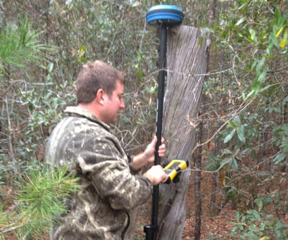
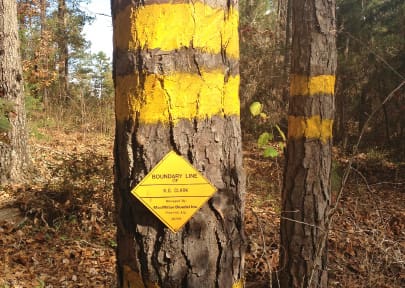
WGI performed installation boundary surveys and parcel acquisition surveys on approximately 8,084 acres of the Naval Air Station Meridian site, located in East Central Mississippi. Inaccuracies in existing information prompted the Navy to request cadastral surveying support to modernize numerous aspects of their geospatial data. In order to update boundary surveys and Real Estate Summary Maps (RESM) for many of their installations, WGI conducted deed research and performed surveys to establish the accurate legal boundaries per the recorded legal descriptions, identified Navy-owned acreage for each site, and provided corresponding accurate AutoCAD and Geographic Information System (GIS) mapping data. WGI acquired and reviewed descriptions of all Navy-owned parcels adjacent to the exterior boundary for each site and boundary survey monuments located at each site. Source documents included RESMs, legal documents, deeds, plats, and other maps. Thick underbrush and widespread tree canopies covered much of the boundary, requiring conventional survey equipment (i.e. total stations, machetes, and axes), while open area data was collected via global positioning system (GPS). Concurrent with the fieldwork, WGI surveyors transferred collected data to various WGI offices where experienced technicians manipulated the data for the highest quality deliverable. After a thorough Quality Assurance/Quality Control (QA/QC) review, WGI successfully delivered an accurate geo-rectified shape file for the Navy’s use in their GIS database.
Sign up to receive emails to hear our latest news and achievements in our monthly newsletter.
Enter your zip code, and we’ll personalize your experience with local projects, office locations, team members, and more.
WGI supports its associates with meaningful opportunities for growth, strong benefits and perks, while we work collaboratively with clients and co-consultants to shape and improve communities.
WGI is a dynamic organization with opportunities nationwide for engineers, land surveyors, landscape architects, environmental scientists, and architects.